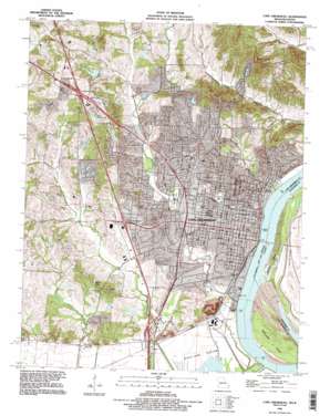
Cape Girardeau Topo Map Missouri
To zoom in, hover over the map of Cape Girardeau
USGS Topo Quad 37089c5 - 1:24,000 scale
| Topo Map Name: | Cape Girardeau |
| USGS Topo Quad ID: | 37089c5 |
| Print Size: | ca. 21 1/4" wide x 27" high |
| Southeast Coordinates: | 37.25° N latitude / 89.5° W longitude |
| Map Center Coordinates: | 37.3125° N latitude / 89.5625° W longitude |
| U.S. States: | MO, IL |
| Filename: | o37089c5.jpg |
| Download Map JPG Image: | Cape Girardeau topo map 1:24,000 scale |
| Map Type: | Topographic |
| Topo Series: | 7.5´ |
| Map Scale: | 1:24,000 |
| Source of Map Images: | United States Geological Survey (USGS) |
| Alternate Map Versions: |
Cape Girardeau MO 1967, updated 1968 Download PDF Buy paper map Cape Girardeau MO 1967, updated 1978 Download PDF Buy paper map Cape Girardeau MO 1993, updated 1995 Download PDF Buy paper map Cape Girardeau MO 1993, updated 1995 Download PDF Buy paper map Cape Girardeau MO 2012 Download PDF Buy paper map Cape Girardeau MO 2015 Download PDF Buy paper map |
1:24,000 Topo Quads surrounding Cape Girardeau
> Back to 37089a1 at 1:100,000 scale
> Back to 37088a1 at 1:250,000 scale
> Back to U.S. Topo Maps home
Cape Girardeau topo map: Gazetteer
Cape Girardeau: Airports
Saint Francis Hospital Heliport elevation 145m 475′Southeast Missouri Hospital Heliport elevation 137m 449′
Cape Girardeau: Bends
Big Bend elevation 99m 324′Cape Girardeau: Dams
Brown Lake Dam elevation 152m 498′Garms Lake Dam elevation 158m 518′
Juden Dam elevation 111m 364′
Lake Hollenbeck Dam elevation 143m 469′
Lake Tanglewood North Dam elevation 146m 479′
Lake Tanglewood South Dam elevation 138m 452′
Little Bear Lake Dam elevation 156m 511′
Little Ponderosa Lake Dam elevation 137m 449′
North Twin Lakes Dam elevation 136m 446′
Cape Girardeau: Flats
Black Land Bottom elevation 102m 334′Cape Girardeau: Islands
Giboney Island elevation 102m 334′Marquette Island elevation 102m 334′
Cape Girardeau: Mines
Marquette Cement Quarry and Plant elevation 116m 380′Cape Girardeau: Parks
Arena Park elevation 113m 370′Capaha Park elevation 124m 406′
Houck Stadium elevation 139m 456′
Indian Park elevation 112m 367′
Klaus Park elevation 177m 580′
Missouri Park elevation 119m 390′
Mount Tabor Park elevation 124m 406′
Cape Girardeau: Populated Places
Cape Girardeau elevation 108m 354′Decatur elevation 109m 357′
Elmwood (historical) elevation 104m 341′
Cape Girardeau: Reservoirs
Brown Lake elevation 152m 498′Garms Lake elevation 158m 518′
Lake Hollenbeck elevation 143m 469′
Lake Tanglewood North elevation 146m 479′
Lake Tanglewood South elevation 138m 452′
Little Ponderosa Lake elevation 137m 449′
North Twin Lake elevation 136m 446′
Cape Girardeau: Streams
Cape La Croix Creek elevation 99m 324′Ranney Creek elevation 101m 331′
Sloan Creek elevation 100m 328′
Upper Whitewater Creek elevation 99m 324′
Cape Girardeau: Summits
Mount Tabor elevation 142m 465′Cape Girardeau: Swamps
Big Swamp elevation 101m 331′Cape Girardeau digital topo map on disk
Buy this Cape Girardeau topo map showing relief, roads, GPS coordinates and other geographical features, as a high-resolution digital map file on DVD:


