Ware Topo Map Illinois
To zoom in, hover over the map of Ware
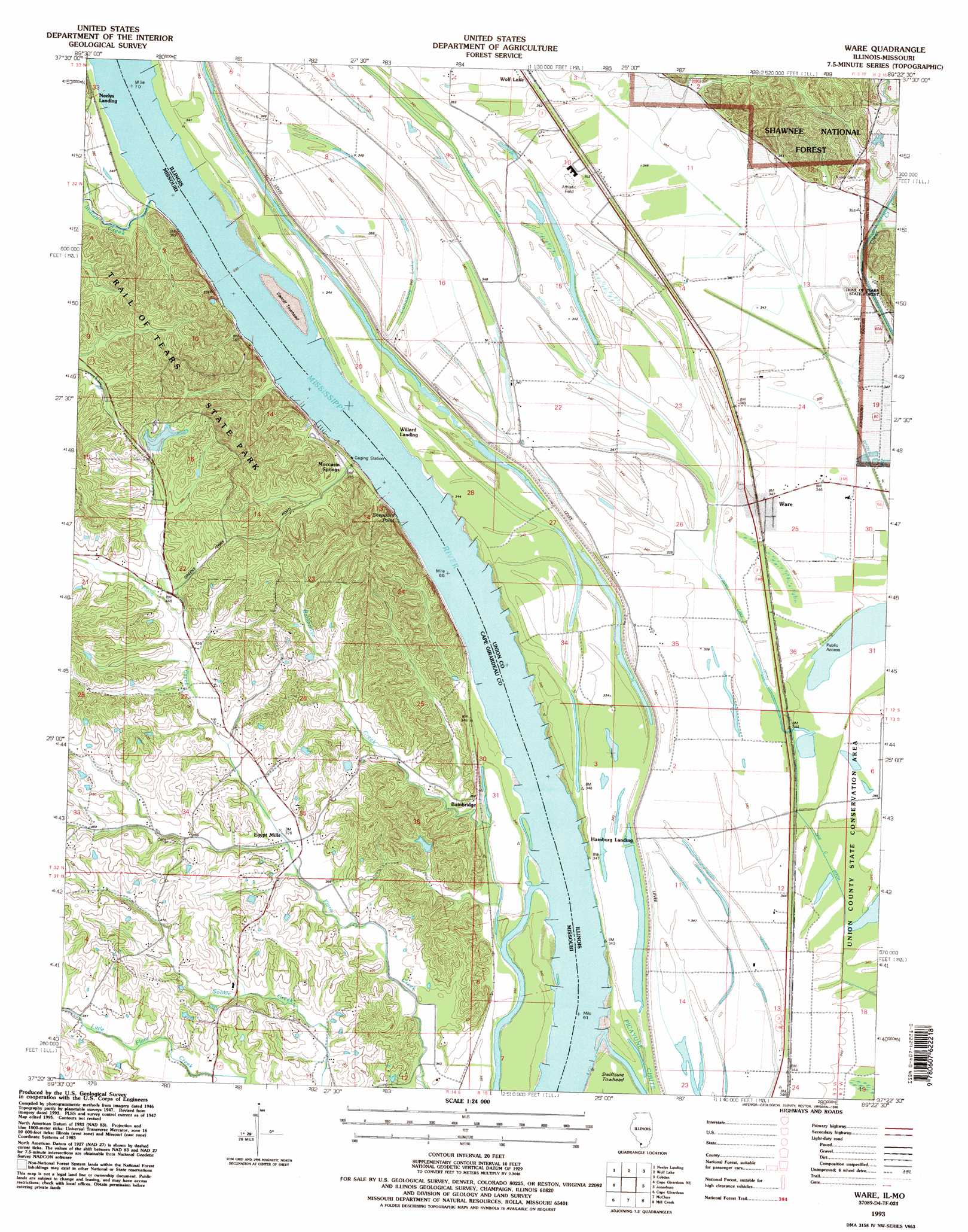
USGS Topo Quad 37089d4 - 1:24,000 scale
| Topo Map Name: | Ware |
| USGS Topo Quad ID: | 37089d4 |
| Print Size: | ca. 21 1/4" wide x 27" high |
| Southeast Coordinates: | 37.375° N latitude / 89.375° W longitude |
| Map Center Coordinates: | 37.4375° N latitude / 89.4375° W longitude |
| U.S. States: | IL, MO |
| Filename: | o37089d4.jpg |
| Download Map JPG Image: | Ware topo map 1:24,000 scale |
| Map Type: | Topographic |
| Topo Series: | 7.5´ |
| Map Scale: | 1:24,000 |
| Source of Map Images: | United States Geological Survey (USGS) |
| Alternate Map Versions: |
Ware IL 1947, updated 1969 Download PDF Buy paper map Ware IL 1947, updated 1990 Download PDF Buy paper map Ware IL 1948 Download PDF Buy paper map Ware IL 1993, updated 1996 Download PDF Buy paper map Ware IL 2012 Download PDF Buy paper map Ware IL 2015 Download PDF Buy paper map |
| FStopo: | US Forest Service topo Ware is available: Download FStopo PDF Download FStopo TIF |
1:24,000 Topo Quads surrounding Ware
Crosstown |
Altenburg |
Gorham |
Pomona |
Carbondale |
Oak Ridge |
Neelys Landing |
Wolf Lake |
Cobden |
Makanda |
Jackson |
Cape Girardeau Ne |
Ware |
Jonesboro |
Anna |
Gordonville |
Cape Girardeau |
Mcclure |
Mill Creek |
Dongola |
Chaffee |
Scott City |
Thebes |
Tamms |
Pulaski |
> Back to 37089a1 at 1:100,000 scale
> Back to 37088a1 at 1:250,000 scale
> Back to U.S. Topo Maps home
Ware topo map: Gazetteer
Ware: Canals
Line C Ditch elevation 101m 331′Number 7 Ditch elevation 106m 347′
Ware: Dams
Lake Boutin Dam elevation 155m 508′Ware: Islands
Vancill Towhead elevation 103m 337′Ware: Lakes
Conaway Lake elevation 105m 344′Ware: Parks
Trail of Tears State Park elevation 147m 482′Union County State Conservation Area elevation 104m 341′
Ware: Populated Places
Bainbridge elevation 108m 354′Egypt Mills elevation 113m 370′
Hamburg Landing elevation 108m 354′
Moccasin Springs elevation 109m 357′
Ware elevation 105m 344′
Ware: Reservoirs
Lake Boutin elevation 155m 508′Ware: Streams
Bainbridge Creek elevation 101m 331′Indian Creek elevation 103m 337′
Turkey Creek elevation 103m 337′
Ware: Summits
Sheppard Point elevation 149m 488′Ware digital topo map on disk
Buy this Ware topo map showing relief, roads, GPS coordinates and other geographical features, as a high-resolution digital map file on DVD: