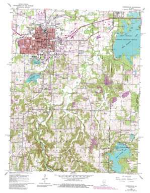
Carbondale Topo Map Illinois
To zoom in, hover over the map of Carbondale
USGS Topo Quad 37089f2 - 1:24,000 scale
| Topo Map Name: | Carbondale |
| USGS Topo Quad ID: | 37089f2 |
| Print Size: | ca. 21 1/4" wide x 27" high |
| Southeast Coordinates: | 37.625° N latitude / 89.125° W longitude |
| Map Center Coordinates: | 37.6875° N latitude / 89.1875° W longitude |
| U.S. State: | IL |
| Filename: | o37089f2.jpg |
| Download Map JPG Image: | Carbondale topo map 1:24,000 scale |
| Map Type: | Topographic |
| Topo Series: | 7.5´ |
| Map Scale: | 1:24,000 |
| Source of Map Images: | United States Geological Survey (USGS) |
| Alternate Map Versions: |
Carbondale IL 1966, updated 1967 Download PDF Buy paper map Carbondale IL 1966, updated 1978 Download PDF Buy paper map Carbondale IL 1966, updated 1990 Download PDF Buy paper map Carbondale IL 1996, updated 1998 Download PDF Buy paper map Carbondale IL 2012 Download PDF Buy paper map Carbondale IL 2015 Download PDF Buy paper map |
| FStopo: | US Forest Service topo Carbondale is available: Download FStopo PDF Download FStopo TIF |
1:24,000 Topo Quads surrounding Carbondale
> Back to 37089e1 at 1:100,000 scale
> Back to 37088a1 at 1:250,000 scale
> Back to U.S. Topo Maps home
Carbondale topo map: Gazetteer
Carbondale: Airports
Memorial Hospital of Carbondale Heliport elevation 135m 442′Carbondale: Bays
Duck Neck elevation 123m 403′Carbondale: Capes
Hogan Point elevation 123m 403′Long View Park elevation 123m 403′
Carbondale: Dams
Campus Lake Dam elevation 133m 436′Carbondale Reservoir Dam elevation 129m 423′
Crab Orchard Dam elevation 123m 403′
Little Grassy Dam elevation 152m 498′
Sycamore Creek Dam elevation 163m 534′
Carbondale: Islands
Pine Island elevation 127m 416′Carbondale: Parks
Attucks Park elevation 118m 387′Doug Lee Park elevation 130m 426′
Evergreen Park elevation 133m 436′
Lenus Turley Park elevation 123m 403′
Oakdale Park elevation 127m 416′
Oakland Field elevation 126m 413′
Parrish Park elevation 123m 403′
Renfro Park elevation 121m 396′
Tatum Heights Park elevation 119m 390′
West Walnut Street Historic District elevation 133m 436′
Carbondale: Populated Places
Boskydell elevation 127m 416′Carbondale elevation 126m 413′
Crab Orchard Estates elevation 138m 452′
Evergreen Terrace elevation 137m 449′
Southern Hills elevation 134m 439′
Carbondale: Post Offices
Carbondale Post Office elevation 132m 433′Carbondale: Reservoirs
Campus Lake elevation 133m 436′Carbondale Reservoir elevation 129m 423′
Crab Orchard Lake elevation 123m 403′
Little Grassy Lake elevation 152m 498′
Spring Arbor Lake elevation 163m 534′
Carbondale: Streams
Drury Creek elevation 114m 374′Indian Creek elevation 120m 393′
Piles Fork elevation 111m 364′
Prairie Creek (historical) elevation 123m 403′
Sycamore Creek elevation 113m 370′
Carbondale digital topo map on disk
Buy this Carbondale topo map showing relief, roads, GPS coordinates and other geographical features, as a high-resolution digital map file on DVD:


