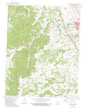
Perryville West Topo Map Missouri
To zoom in, hover over the map of Perryville West
USGS Topo Quad 37089f8 - 1:24,000 scale
| Topo Map Name: | Perryville West |
| USGS Topo Quad ID: | 37089f8 |
| Print Size: | ca. 21 1/4" wide x 27" high |
| Southeast Coordinates: | 37.625° N latitude / 89.875° W longitude |
| Map Center Coordinates: | 37.6875° N latitude / 89.9375° W longitude |
| U.S. State: | MO |
| Filename: | o37089f8.jpg |
| Download Map JPG Image: | Perryville West topo map 1:24,000 scale |
| Map Type: | Topographic |
| Topo Series: | 7.5´ |
| Map Scale: | 1:24,000 |
| Source of Map Images: | United States Geological Survey (USGS) |
| Alternate Map Versions: |
Perryville West MO 1980, updated 1980 Download PDF Buy paper map Perryville West MO 1980, updated 1980 Download PDF Buy paper map Perryville West MO 2012 Download PDF Buy paper map Perryville West MO 2015 Download PDF Buy paper map |
1:24,000 Topo Quads surrounding Perryville West
> Back to 37089e1 at 1:100,000 scale
> Back to 37088a1 at 1:250,000 scale
> Back to U.S. Topo Maps home
Perryville West topo map: Gazetteer
Perryville West: Dams
Colonial Acres Lake Dam elevation 182m 597′Eddleman Lake Dam elevation 148m 485′
Hickory Hollow Lake Dam elevation 191m 626′
Lake Kah-Tan-Da Dam elevation 203m 666′
Legion Lake Dam elevation 147m 482′
Mach Lake Dam elevation 176m 577′
Marys Lake Dam elevation 170m 557′
Ollie Moore Lower Lake Dam elevation 186m 610′
Perco Lake North Dam elevation 180m 590′
Perco Lake South Dam elevation 185m 606′
Perry County Community Lake Dam elevation 157m 515′
Perryville West: Lakes
Silver Lake elevation 165m 541′Perryville West: Parks
County Lake State Wildlife Management Area elevation 158m 518′Perryville West: Populated Places
Friendly Valley elevation 175m 574′Highland elevation 203m 666′
Silver Lake elevation 173m 567′
Perryville West: Ranges
Mine Hills elevation 187m 613′Perryville West: Reservoirs
Colonial Acres Lake elevation 182m 597′Lake Kah-Tan-Da elevation 203m 666′
Legion Lake Reservoir (historical) elevation 147m 482′
Number 19 Reservoir elevation 176m 577′
Perco Lakes elevation 180m 590′
Perry County Community Lake elevation 157m 515′
Saint Marys Lake elevation 170m 557′
Seminary Lake elevation 171m 561′
Perryville West: Ridges
Barbier Ridge elevation 209m 685′Pecaut Ridge elevation 208m 682′
Perryville West: Springs
Park Spring elevation 152m 498′Perryville West: Streams
Hunt Branch elevation 139m 456′Nations Creek elevation 157m 515′
Sandy Branch elevation 156m 511′
Tyler Branch elevation 155m 508′
Perryville West: Valleys
Cody Hollow elevation 142m 465′Happy Hollow elevation 150m 492′
Kuhlman Hollow elevation 155m 508′
Mine Hollow elevation 142m 465′
Papaw Hollow elevation 173m 567′
Pecaut Hollow elevation 143m 469′
Vacant Hollow elevation 156m 511′
Perryville West digital topo map on disk
Buy this Perryville West topo map showing relief, roads, GPS coordinates and other geographical features, as a high-resolution digital map file on DVD:


