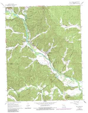
Mill Spring Topo Map Missouri
To zoom in, hover over the map of Mill Spring
USGS Topo Quad 37090a6 - 1:24,000 scale
| Topo Map Name: | Mill Spring |
| USGS Topo Quad ID: | 37090a6 |
| Print Size: | ca. 21 1/4" wide x 27" high |
| Southeast Coordinates: | 37° N latitude / 90.625° W longitude |
| Map Center Coordinates: | 37.0625° N latitude / 90.6875° W longitude |
| U.S. State: | MO |
| Filename: | o37090a6.jpg |
| Download Map JPG Image: | Mill Spring topo map 1:24,000 scale |
| Map Type: | Topographic |
| Topo Series: | 7.5´ |
| Map Scale: | 1:24,000 |
| Source of Map Images: | United States Geological Survey (USGS) |
| Alternate Map Versions: |
Mill Spring MO 1968, updated 1969 Download PDF Buy paper map Mill Spring MO 1968, updated 1985 Download PDF Buy paper map Mill Spring MO 2012 Download PDF Buy paper map Mill Spring MO 2015 Download PDF Buy paper map |
| FStopo: | US Forest Service topo Mill Spring is available: Download FStopo PDF Download FStopo TIF |
1:24,000 Topo Quads surrounding Mill Spring
> Back to 37090a1 at 1:100,000 scale
> Back to 37090a1 at 1:250,000 scale
> Back to U.S. Topo Maps home
Mill Spring topo map: Gazetteer
Mill Spring: Basins
The Gulf elevation 147m 482′Mill Spring: Lakes
Carter Lake elevation 143m 469′Twin Ponds elevation 230m 754′
Mill Spring: Mines
Gravel Pit elevation 128m 419′Mill Spring: Populated Places
Gaylor elevation 135m 442′Leeper elevation 149m 488′
Mill Spring elevation 133m 436′
Mill Spring: Ridges
Benning Ridge elevation 203m 666′Hassell Ridge elevation 221m 725′
Mill Spring: Springs
Bunyard Spring elevation 127m 416′Mill Spring elevation 141m 462′
Mill Spring: Streams
Big Brushy Creek elevation 126m 413′Brewer Bay elevation 137m 449′
Cedar Bay elevation 131m 429′
Dry Creek elevation 137m 449′
Little Brushy Creek elevation 128m 419′
McKenzie Creek elevation 131m 429′
Middle Brushy Creek elevation 138m 452′
Mill Creek elevation 125m 410′
Mill Spring Creek elevation 125m 410′
Wingo Slough elevation 125m 410′
Mill Spring: Summits
Bunkers Knob elevation 228m 748′Carson Hill elevation 232m 761′
Mill Spring: Valleys
Bear Mountain Hollow elevation 154m 505′Benning Hollow elevation 151m 495′
Evans Hollow elevation 138m 452′
Ging Hollow elevation 145m 475′
Greenwood Valley elevation 132m 433′
Hay Hollow elevation 144m 472′
Horseshoe Valley elevation 159m 521′
Johnson Hollow elevation 129m 423′
Kelley Valley elevation 138m 452′
Kelow Valley elevation 132m 433′
Kenny Hollow elevation 132m 433′
Lambert Hollow elevation 195m 639′
Mill Field Hollow elevation 199m 652′
Miller Hollow elevation 133m 436′
Mining Town Hollow elevation 148m 485′
Newtown Hollow elevation 139m 456′
Nipper Hollow elevation 134m 439′
Stillhouse Hollow elevation 140m 459′
Mill Spring digital topo map on disk
Buy this Mill Spring topo map showing relief, roads, GPS coordinates and other geographical features, as a high-resolution digital map file on DVD:


