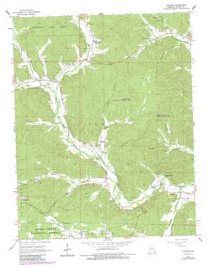
Lowndes Topo Map Missouri
To zoom in, hover over the map of Lowndes
USGS Topo Quad 37090b3 - 1:24,000 scale
| Topo Map Name: | Lowndes |
| USGS Topo Quad ID: | 37090b3 |
| Print Size: | ca. 21 1/4" wide x 27" high |
| Southeast Coordinates: | 37.125° N latitude / 90.25° W longitude |
| Map Center Coordinates: | 37.1875° N latitude / 90.3125° W longitude |
| U.S. State: | MO |
| Filename: | o37090b3.jpg |
| Download Map JPG Image: | Lowndes topo map 1:24,000 scale |
| Map Type: | Topographic |
| Topo Series: | 7.5´ |
| Map Scale: | 1:24,000 |
| Source of Map Images: | United States Geological Survey (USGS) |
| Alternate Map Versions: |
Lowndes MO 1965, updated 1967 Download PDF Buy paper map Lowndes MO 1965, updated 1977 Download PDF Buy paper map Lowndes MO 1965, updated 1985 Download PDF Buy paper map Lowndes MO 2011 Download PDF Buy paper map Lowndes MO 2015 Download PDF Buy paper map |
| FStopo: | US Forest Service topo Lowndes is available: Download FStopo PDF Download FStopo TIF |
1:24,000 Topo Quads surrounding Lowndes
> Back to 37090a1 at 1:100,000 scale
> Back to 37090a1 at 1:250,000 scale
> Back to U.S. Topo Maps home
Lowndes topo map: Gazetteer
Lowndes: Dams
Anderson Lake Dam elevation 164m 538′Williams Lake Section 31 Dam elevation 205m 672′
Lowndes: Forests
Coldwater State Forest elevation 216m 708′Lowndes: Parks
Hiram State Wildlife Management Area elevation 182m 597′Lowndes: Populated Places
Burbank elevation 212m 695′Clubb elevation 168m 551′
Hiram elevation 154m 505′
Lowndes elevation 135m 442′
Lowndes: Reservoirs
Anderson Lake elevation 164m 538′Williams Lake Section 31 elevation 205m 672′
Lowndes: Springs
Faulkner Spring elevation 134m 439′Hughs Spring elevation 132m 433′
Lowndes: Streams
Barnes Creek elevation 127m 416′Gizzard Creek elevation 152m 498′
Goose Creek elevation 140m 459′
McCabe Creek elevation 145m 475′
West Fork Bear Creek elevation 158m 518′
Lowndes: Valleys
Andy Jack Hollow elevation 152m 498′Byron Hollow elevation 157m 515′
Greenville Hollow elevation 149m 488′
McCarn Hollow elevation 151m 495′
Perkins Hollow elevation 177m 580′
Polecat Hollow elevation 137m 449′
Sugarcamp Hollow elevation 143m 469′
Thirtyone Hollow elevation 158m 518′
Lowndes digital topo map on disk
Buy this Lowndes topo map showing relief, roads, GPS coordinates and other geographical features, as a high-resolution digital map file on DVD:


