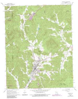
Piedmont Topo Map Missouri
To zoom in, hover over the map of Piedmont
USGS Topo Quad 37090b6 - 1:24,000 scale
| Topo Map Name: | Piedmont |
| USGS Topo Quad ID: | 37090b6 |
| Print Size: | ca. 21 1/4" wide x 27" high |
| Southeast Coordinates: | 37.125° N latitude / 90.625° W longitude |
| Map Center Coordinates: | 37.1875° N latitude / 90.6875° W longitude |
| U.S. State: | MO |
| Filename: | o37090b6.jpg |
| Download Map JPG Image: | Piedmont topo map 1:24,000 scale |
| Map Type: | Topographic |
| Topo Series: | 7.5´ |
| Map Scale: | 1:24,000 |
| Source of Map Images: | United States Geological Survey (USGS) |
| Alternate Map Versions: |
Piedmont MO 1968, updated 1969 Download PDF Buy paper map Piedmont MO 1968, updated 1985 Download PDF Buy paper map Piedmont MO 2011 Download PDF Buy paper map Piedmont MO 2015 Download PDF Buy paper map |
| FStopo: | US Forest Service topo Piedmont is available: Download FStopo PDF Download FStopo TIF |
1:24,000 Topo Quads surrounding Piedmont
> Back to 37090a1 at 1:100,000 scale
> Back to 37090a1 at 1:250,000 scale
> Back to U.S. Topo Maps home
Piedmont topo map: Gazetteer
Piedmont: Airports
Piedmont Municipal Airport elevation 141m 462′Piedmont: Dams
Lake Jeano Dam elevation 223m 731′Rothwell Ranch Lake Dam elevation 303m 994′
Piedmont: Forests
Riverside State Forest elevation 216m 708′Piedmont: Gaps
Lon Sanders Canyon elevation 184m 603′Piedmont: Populated Places
Beckville elevation 152m 498′Gads Hill elevation 257m 843′
Piedmont elevation 151m 495′
Platow elevation 196m 643′
Virginia Settlement elevation 173m 567′
Piedmont: Ranges
Finleys Mountains elevation 202m 662′Piedmont: Reservoirs
Dover Lake elevation 223m 731′Rothwell Ranch Lake elevation 303m 994′
Piedmont: Springs
Peach Tree Spring elevation 212m 695′Piedmont: Streams
Beckville Branch elevation 312m 1023′Grassy Creek elevation 191m 626′
Greasy Creek elevation 185m 606′
Lick Branch elevation 144m 472′
Piedmont: Summits
Chlore Mountain elevation 300m 984′Clark Mountain elevation 439m 1440′
Finley Mountain elevation 386m 1266′
Gold Hill elevation 238m 780′
Grassy Mountain elevation 302m 990′
Iron Knob elevation 252m 826′
Piedmont digital topo map on disk
Buy this Piedmont topo map showing relief, roads, GPS coordinates and other geographical features, as a high-resolution digital map file on DVD:


