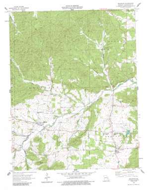
Belgrade Topo Map Missouri
To zoom in, hover over the map of Belgrade
USGS Topo Quad 37090g7 - 1:24,000 scale
| Topo Map Name: | Belgrade |
| USGS Topo Quad ID: | 37090g7 |
| Print Size: | ca. 21 1/4" wide x 27" high |
| Southeast Coordinates: | 37.75° N latitude / 90.75° W longitude |
| Map Center Coordinates: | 37.8125° N latitude / 90.8125° W longitude |
| U.S. State: | MO |
| Filename: | o37090g7.jpg |
| Download Map JPG Image: | Belgrade topo map 1:24,000 scale |
| Map Type: | Topographic |
| Topo Series: | 7.5´ |
| Map Scale: | 1:24,000 |
| Source of Map Images: | United States Geological Survey (USGS) |
| Alternate Map Versions: |
Belgrade MO 1958, updated 1959 Download PDF Buy paper map Belgrade MO 1958, updated 1977 Download PDF Buy paper map Belgrade MO 1958, updated 1986 Download PDF Buy paper map Belgrade MO 2011 Download PDF Buy paper map Belgrade MO 2015 Download PDF Buy paper map |
| FStopo: | US Forest Service topo Belgrade is available: Download FStopo PDF Download FStopo TIF |
1:24,000 Topo Quads surrounding Belgrade
> Back to 37090e1 at 1:100,000 scale
> Back to 37090a1 at 1:250,000 scale
> Back to U.S. Topo Maps home
Belgrade topo map: Gazetteer
Belgrade: Areas
Deslodge Land elevation 327m 1072′Belgrade: Bridges
Hunters Mill Bridge elevation 247m 810′Belgrade: Dams
Belgrade Dam elevation 305m 1000′Bressie Lake Dam elevation 298m 977′
Lake Loomis Dam elevation 298m 977′
Number 267 Dam elevation 280m 918′
Podorski Lake Dam elevation 292m 958′
Rieffer Lake Dam elevation 282m 925′
Spring Glen Lake Dam elevation 257m 843′
Belgrade: Mines
Dry Bone Shaft elevation 310m 1017′Farquaher Lead Diggings elevation 294m 964′
Jumbo Shaft elevation 308m 1010′
Nicholson Iron Bank elevation 265m 869′
Belgrade: Populated Places
Belgrade elevation 271m 889′Caledonia elevation 279m 915′
Belgrade: Reservoirs
Spring Glen Lake elevation 257m 843′Belgrade: Streams
Brock Creek elevation 268m 879′Clear Creek elevation 253m 830′
Dent Branch elevation 269m 882′
Flat Creek elevation 253m 830′
Furnace Creek elevation 248m 813′
Janes Creek elevation 273m 895′
North Fork Clear Creek elevation 267m 875′
Reynolds Branch elevation 259m 849′
Belgrade: Summits
Aker Hill elevation 362m 1187′Kitchell Hill elevation 325m 1066′
Turner Hill elevation 361m 1184′
Belgrade digital topo map on disk
Buy this Belgrade topo map showing relief, roads, GPS coordinates and other geographical features, as a high-resolution digital map file on DVD:


