Exchange Topo Map Missouri
To zoom in, hover over the map of Exchange
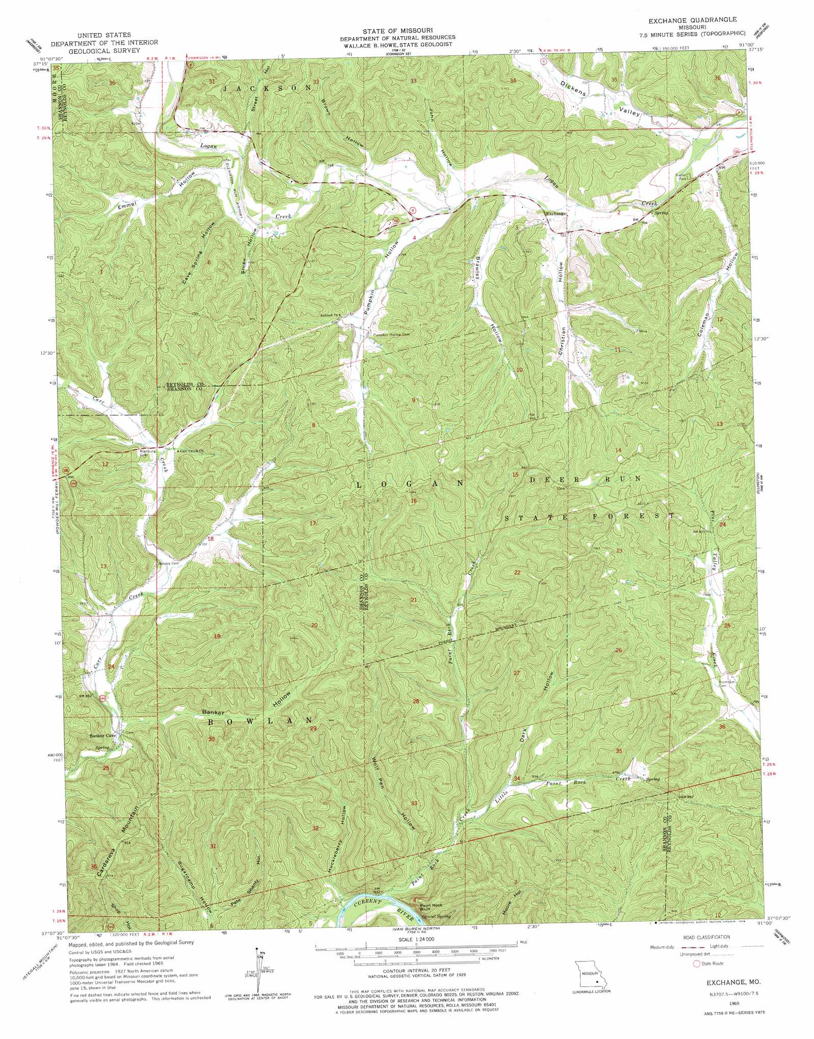
USGS Topo Quad 37091b1 - 1:24,000 scale
| Topo Map Name: | Exchange |
| USGS Topo Quad ID: | 37091b1 |
| Print Size: | ca. 21 1/4" wide x 27" high |
| Southeast Coordinates: | 37.125° N latitude / 91° W longitude |
| Map Center Coordinates: | 37.1875° N latitude / 91.0625° W longitude |
| U.S. State: | MO |
| Filename: | o37091b1.jpg |
| Download Map JPG Image: | Exchange topo map 1:24,000 scale |
| Map Type: | Topographic |
| Topo Series: | 7.5´ |
| Map Scale: | 1:24,000 |
| Source of Map Images: | United States Geological Survey (USGS) |
| Alternate Map Versions: |
Exchange MO 1965, updated 1966 Download PDF Buy paper map Exchange MO 2011 Download PDF Buy paper map Exchange MO 2015 Download PDF Buy paper map |
1:24,000 Topo Quads surrounding Exchange
Loggers Lake |
Bunker |
Corridon |
Centerville |
Lesterville |
The Sinks |
Midridge |
Corridon Se |
Redford |
Lesterville Se |
Eminence |
Powder Mill Ferry |
Exchange |
Ellington |
Clearwater Dam |
Winona |
Stegall Mountain |
Van Buren North |
Garwood |
Ellington Se |
Low Wassie |
Fremont |
Van Buren South |
Big Spring |
Hunter |
> Back to 37091a1 at 1:100,000 scale
> Back to 37090a1 at 1:250,000 scale
> Back to U.S. Topo Maps home
Exchange topo map: Gazetteer
Exchange: Cliffs
Paint Rock Bluff elevation 222m 728′Exchange: Forests
Deer Run State Forest elevation 293m 961′Exchange: Populated Places
Deslet elevation 196m 643′Exchange: Springs
Gravel Spring elevation 225m 738′Exchange: Streams
Little Paint Rock Creek elevation 168m 551′Paint Rock Creek elevation 175m 574′
Exchange: Summits
Cardareva Mountain elevation 314m 1030′Exchange: Valleys
Banker Hollow elevation 185m 606′Brawley Hollow elevation 222m 728′
Brown Hollow elevation 232m 761′
Cave Spring Hollow elevation 236m 774′
Christian Hollow elevation 218m 715′
Coleman Hollow elevation 209m 685′
Dark Hollow elevation 176m 577′
Dickens Valley elevation 211m 692′
Emmel Hollow elevation 237m 777′
Huckleberry Hollow elevation 156m 511′
John Hollow elevation 225m 738′
Pete Shanty Hollow elevation 173m 567′
Pumpkin Hollow elevation 224m 734′
Sloan Hollow elevation 232m 761′
Street Hollow elevation 242m 793′
Wolf Pen Hollow elevation 159m 521′
Exchange digital topo map on disk
Buy this Exchange topo map showing relief, roads, GPS coordinates and other geographical features, as a high-resolution digital map file on DVD: