Hartshorn Topo Map Missouri
To zoom in, hover over the map of Hartshorn
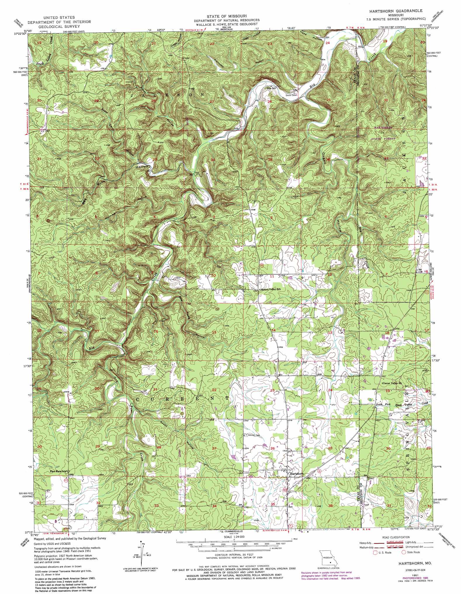
USGS Topo Quad 37091c6 - 1:24,000 scale
| Topo Map Name: | Hartshorn |
| USGS Topo Quad ID: | 37091c6 |
| Print Size: | ca. 21 1/4" wide x 27" high |
| Southeast Coordinates: | 37.25° N latitude / 91.625° W longitude |
| Map Center Coordinates: | 37.3125° N latitude / 91.6875° W longitude |
| U.S. State: | MO |
| Filename: | o37091c6.jpg |
| Download Map JPG Image: | Hartshorn topo map 1:24,000 scale |
| Map Type: | Topographic |
| Topo Series: | 7.5´ |
| Map Scale: | 1:24,000 |
| Source of Map Images: | United States Geological Survey (USGS) |
| Alternate Map Versions: |
Hartshorn MO 1951, updated 1952 Download PDF Buy paper map Hartshorn MO 1951, updated 1956 Download PDF Buy paper map Hartshorn MO 1951, updated 1977 Download PDF Buy paper map Hartshorn MO 1951, updated 1985 Download PDF Buy paper map Hartshorn MO 2012 Download PDF Buy paper map Hartshorn MO 2015 Download PDF Buy paper map |
1:24,000 Topo Quads surrounding Hartshorn
Beulah |
Maples |
Rhyse |
Darien |
Doss |
Prescott |
Licking |
Montauk |
Cedar Grove |
Gladden |
Houston |
Raymondville |
Hartshorn |
Lewis Hollow |
Round Spring |
Elk Creek |
Eunice |
Summersville |
Summersville Ne |
Alley Spring |
Willow Springs North |
Clear Springs |
Pine Crest |
Jam Up Cave |
Bartlett |
> Back to 37091a1 at 1:100,000 scale
> Back to 37090a1 at 1:250,000 scale
> Back to U.S. Topo Maps home
Hartshorn topo map: Gazetteer
Hartshorn: Plains
Salem Plateau elevation 347m 1138′Hartshorn: Populated Places
Hartshorn elevation 399m 1309′Nile elevation 287m 941′
Hartshorn: Streams
Dry Bone Creek elevation 301m 987′Hay Creek elevation 320m 1049′
Hartshorn: Valleys
Bee Rock Hollow elevation 283m 928′Cummins Hollow elevation 279m 915′
Dew Pond Hollow elevation 300m 984′
Dugan Hollow elevation 276m 905′
Huldy Hollow elevation 282m 925′
Rebel Cave Hollow elevation 308m 1010′
Rocky Hollow elevation 329m 1079′
Watered Hollow elevation 289m 948′
Hartshorn digital topo map on disk
Buy this Hartshorn topo map showing relief, roads, GPS coordinates and other geographical features, as a high-resolution digital map file on DVD: