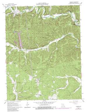
Corridon Topo Map Missouri
To zoom in, hover over the map of Corridon
USGS Topo Quad 37091d1 - 1:24,000 scale
| Topo Map Name: | Corridon |
| USGS Topo Quad ID: | 37091d1 |
| Print Size: | ca. 21 1/4" wide x 27" high |
| Southeast Coordinates: | 37.375° N latitude / 91° W longitude |
| Map Center Coordinates: | 37.4375° N latitude / 91.0625° W longitude |
| U.S. State: | MO |
| Filename: | o37091d1.jpg |
| Download Map JPG Image: | Corridon topo map 1:24,000 scale |
| Map Type: | Topographic |
| Topo Series: | 7.5´ |
| Map Scale: | 1:24,000 |
| Source of Map Images: | United States Geological Survey (USGS) |
| Alternate Map Versions: |
Corridon MO 1967, updated 1968 Download PDF Buy paper map Corridon MO 1967, updated 1980 Download PDF Buy paper map Corridon MO 1967, updated 1985 Download PDF Buy paper map Corridon MO 1999, updated 2002 Download PDF Buy paper map Corridon MO 2011 Download PDF Buy paper map Corridon MO 2015 Download PDF Buy paper map |
| FStopo: | US Forest Service topo Corridon is available: Download FStopo PDF Download FStopo TIF |
1:24,000 Topo Quads surrounding Corridon
> Back to 37091a1 at 1:100,000 scale
> Back to 37090a1 at 1:250,000 scale
> Back to U.S. Topo Maps home
Corridon topo map: Gazetteer
Corridon: Airports
Fletcher Landing Strip elevation 288m 944′West Fork Landing Strip elevation 316m 1036′
Corridon: Cliffs
Sutton Bluff elevation 359m 1177′Corridon: Dams
Fletcher Clarification Dam elevation 265m 869′Fletcher Mine Clarification Dam elevation 302m 990′
Fletcher Tailings Dam elevation 336m 1102′
Fletcher Tailings Pond Dam elevation 332m 1089′
Corridon: Lakes
Silver Lake elevation 257m 843′Corridon: Mines
Fletcher Mine elevation 359m 1177′Corridon: Populated Places
Bee Fork elevation 279m 915′Corridon elevation 371m 1217′
Ohlman elevation 375m 1230′
Reynolds elevation 383m 1256′
West Fork elevation 277m 908′
Corridon: Reservoirs
Fletcher Mine Clarification Basin elevation 302m 990′Number 46 Lake elevation 332m 1089′
Number 47 Lake elevation 336m 1102′
Corridon: Springs
Cooks Spring elevation 265m 869′Corridon: Streams
Brown Branch elevation 275m 902′Cooks Creek elevation 246m 807′
Kitchel Branch elevation 301m 987′
Mill Branch elevation 272m 892′
South Branch Bee Fork elevation 258m 846′
Toms Creek elevation 278m 912′
Willis Branch elevation 309m 1013′
Corridon: Valleys
Bailey Hollow elevation 261m 856′Camden Hollow elevation 266m 872′
Corridon Hollow elevation 308m 1010′
Fishtrap Hollow elevation 259m 849′
Grasshopper Hollow elevation 283m 928′
Jourdan Hollow elevation 281m 921′
North Hollow elevation 273m 895′
Radford Hollow elevation 253m 830′
Stable Hollow elevation 319m 1046′
Stillwell Hollow elevation 248m 813′
Sutterfield Hollow elevation 278m 912′
Vest Hollow elevation 294m 964′
West Fork Hollow elevation 285m 935′
Wet Hollow elevation 271m 889′
Corridon digital topo map on disk
Buy this Corridon topo map showing relief, roads, GPS coordinates and other geographical features, as a high-resolution digital map file on DVD:


