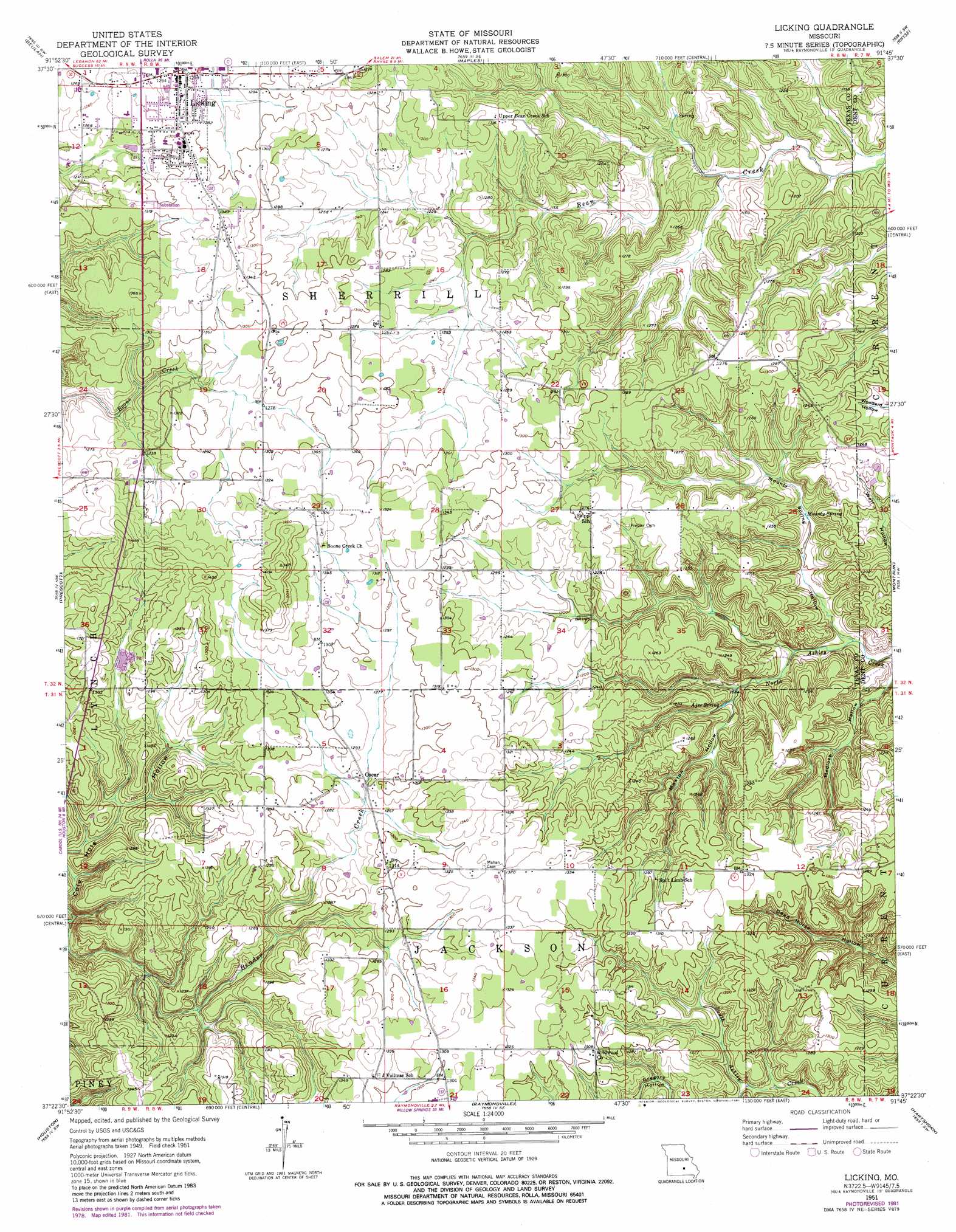
Licking Topo Map Missouri
To zoom in, hover over the map of Licking
USGS Topo Quad 37091d7 - 1:24,000 scale
| Topo Map Name: | Licking |
| USGS Topo Quad ID: | 37091d7 |
| Print Size: | ca. 21 1/4" wide x 27" high |
| Southeast Coordinates: | 37.375° N latitude / 91.75° W longitude |
| Map Center Coordinates: | 37.4375° N latitude / 91.8125° W longitude |
| U.S. State: | MO |
| Filename: | o37091d7.jpg |
| Download Map JPG Image: | Licking topo map 1:24,000 scale |
| Map Type: | Topographic |
| Topo Series: | 7.5´ |
| Map Scale: | 1:24,000 |
| Source of Map Images: | United States Geological Survey (USGS) |
| Alternate Map Versions: |
Licking MO 1951, updated 1952 Download PDF Buy paper map Licking MO 1951, updated 1969 Download PDF Buy paper map Licking MO 1951, updated 1981 Download PDF Buy paper map Licking MO 2011 Download PDF Buy paper map Licking MO 2015 Download PDF Buy paper map |
1:24,000 Topo Quads surrounding Licking
Big Piney |
Flat |
Edgar Springs |
Anutt |
Salem |
Slabtown Spring |
Beulah |
Maples |
Rhyse |
Darien |
Success |
Prescott |
Licking |
Montauk |
Cedar Grove |
Bucyrus |
Houston |
Raymondville |
Hartshorn |
Lewis Hollow |
Cabool Ne |
Elk Creek |
Eunice |
Summersville |
Summersville Ne |
> Back to 37091a1 at 1:100,000 scale
> Back to 37090a1 at 1:250,000 scale
> Back to U.S. Topo Maps home
Licking topo map: Gazetteer
Licking: Populated Places
Licking elevation 385m 1263′Mahan elevation 398m 1305′
Oscar elevation 387m 1269′
Licking: Springs
Ajee Spring elevation 334m 1095′Mounty Spring elevation 337m 1105′
Licking: Valleys
Cole Hole Hollow elevation 336m 1102′Gregory Hollow elevation 358m 1174′
Maxton Hollow elevation 332m 1089′
Mounty Spring Hollow elevation 320m 1049′
Licking digital topo map on disk
Buy this Licking topo map showing relief, roads, GPS coordinates and other geographical features, as a high-resolution digital map file on DVD: