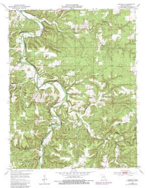
Prescott Topo Map Missouri
To zoom in, hover over the map of Prescott
USGS Topo Quad 37091d8 - 1:24,000 scale
| Topo Map Name: | Prescott |
| USGS Topo Quad ID: | 37091d8 |
| Print Size: | ca. 21 1/4" wide x 27" high |
| Southeast Coordinates: | 37.375° N latitude / 91.875° W longitude |
| Map Center Coordinates: | 37.4375° N latitude / 91.9375° W longitude |
| U.S. State: | MO |
| Filename: | o37091d8.jpg |
| Download Map JPG Image: | Prescott topo map 1:24,000 scale |
| Map Type: | Topographic |
| Topo Series: | 7.5´ |
| Map Scale: | 1:24,000 |
| Source of Map Images: | United States Geological Survey (USGS) |
| Alternate Map Versions: |
Prescott MO 1951, updated 1952 Download PDF Buy paper map Prescott MO 1951, updated 1965 Download PDF Buy paper map Prescott MO 1951, updated 1979 Download PDF Buy paper map Prescott MO 1951, updated 1981 Download PDF Buy paper map Prescott MO 2004, updated 2006 Download PDF Buy paper map Prescott MO 2011 Download PDF Buy paper map Prescott MO 2015 Download PDF Buy paper map |
| FStopo: | US Forest Service topo Prescott is available: Download FStopo PDF Download FStopo TIF |
1:24,000 Topo Quads surrounding Prescott
> Back to 37091a1 at 1:100,000 scale
> Back to 37090a1 at 1:250,000 scale
> Back to U.S. Topo Maps home
Prescott topo map: Gazetteer
Prescott: Airports
Piney Bend Airport elevation 294m 964′Prescott: Cliffs
Bell Bluff elevation 312m 1023′Narrow Gap Bluff elevation 304m 997′
Prescott: Populated Places
Prescott elevation 355m 1164′Raftville (historical) elevation 315m 1033′
Venable elevation 374m 1227′
Prescott: Ridges
Dzurk Ridge elevation 383m 1256′Elmo Ridge elevation 370m 1213′
Prescott: Springs
Boiling Spring elevation 286m 938′Burnett Spring elevation 281m 921′
Prescott: Streams
Arthur Creek elevation 288m 944′Bender Creek elevation 304m 997′
Boone Creek elevation 278m 912′
Brushy Creek elevation 307m 1007′
Burton Branch elevation 297m 974′
Mullin Branch elevation 295m 967′
Phillips Creek elevation 287m 941′
Prescott: Valleys
Bridges Hollow elevation 293m 961′Bryant Hollow elevation 323m 1059′
Jacktar Hollow elevation 287m 941′
North Jacktar Hollow elevation 292m 958′
Sand Hollow elevation 298m 977′
Schoolhouse Hollow elevation 300m 984′
South Jacktar Hollow elevation 292m 958′
Steam Mill Hollow elevation 287m 941′
Strawberry Hollow elevation 297m 974′
Prescott digital topo map on disk
Buy this Prescott topo map showing relief, roads, GPS coordinates and other geographical features, as a high-resolution digital map file on DVD:


