Rhyse Topo Map Missouri
To zoom in, hover over the map of Rhyse
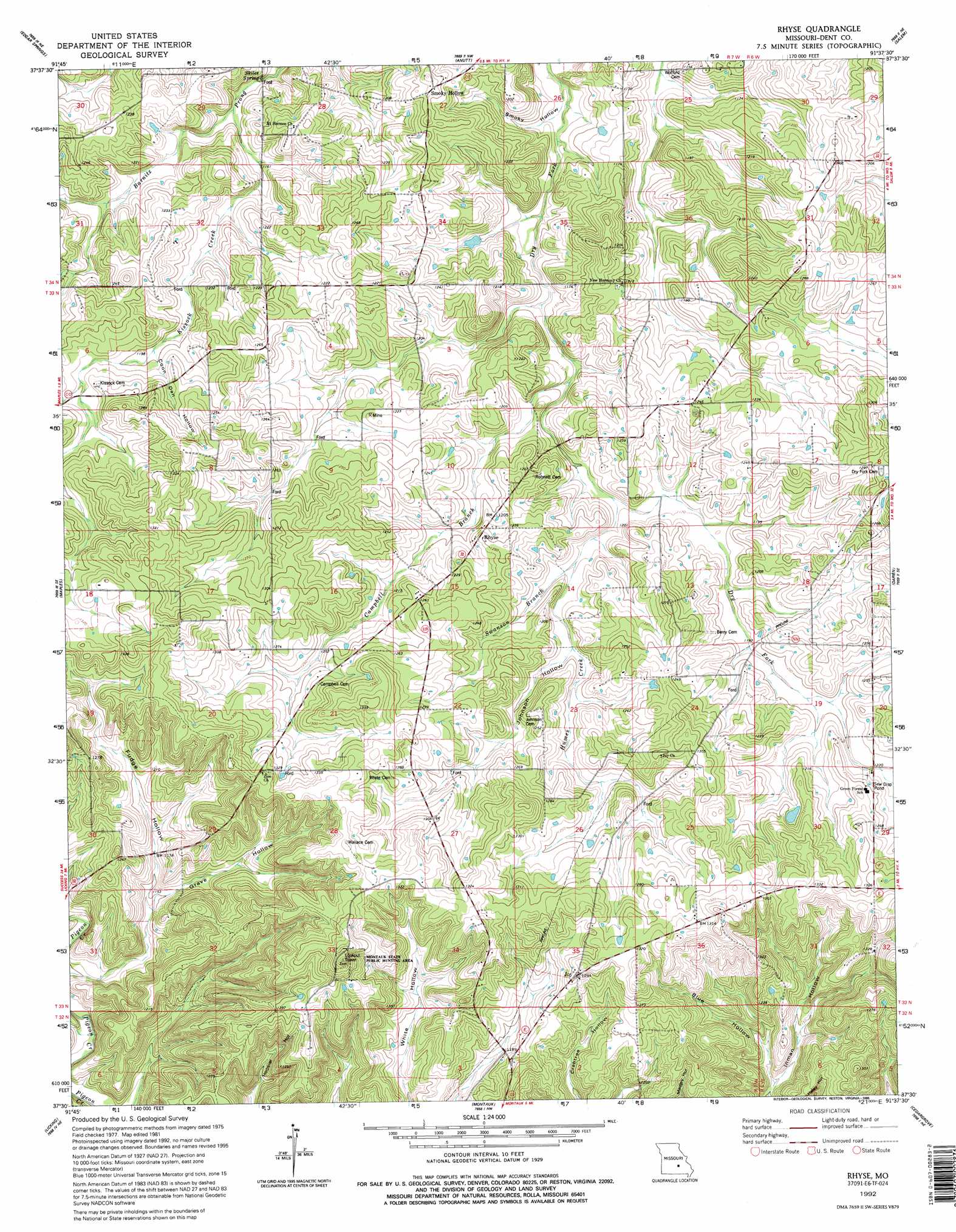
USGS Topo Quad 37091e6 - 1:24,000 scale
| Topo Map Name: | Rhyse |
| USGS Topo Quad ID: | 37091e6 |
| Print Size: | ca. 21 1/4" wide x 27" high |
| Southeast Coordinates: | 37.5° N latitude / 91.625° W longitude |
| Map Center Coordinates: | 37.5625° N latitude / 91.6875° W longitude |
| U.S. State: | MO |
| Filename: | o37091e6.jpg |
| Download Map JPG Image: | Rhyse topo map 1:24,000 scale |
| Map Type: | Topographic |
| Topo Series: | 7.5´ |
| Map Scale: | 1:24,000 |
| Source of Map Images: | United States Geological Survey (USGS) |
| Alternate Map Versions: |
Rhyse MO 1981, updated 1982 Download PDF Buy paper map Rhyse MO 1992, updated 1995 Download PDF Buy paper map Rhyse MO 2011 Download PDF Buy paper map Rhyse MO 2015 Download PDF Buy paper map |
1:24,000 Topo Quads surrounding Rhyse
Kaintuck Hollow |
Yancy Mills |
Lecoma |
Seaton |
Cook Station |
Flat |
Edgar Springs |
Anutt |
Salem |
Short Bend |
Beulah |
Maples |
Rhyse |
Darien |
Doss |
Prescott |
Licking |
Montauk |
Cedar Grove |
Gladden |
Houston |
Raymondville |
Hartshorn |
Lewis Hollow |
Round Spring |
> Back to 37091e1 at 1:100,000 scale
> Back to 37090a1 at 1:250,000 scale
> Back to U.S. Topo Maps home
Rhyse topo map: Gazetteer
Rhyse: Dams
Mund Dam elevation 355m 1164′Rhyse: Populated Places
Joy elevation 396m 1299′Ranger elevation 421m 1381′
Rhyse elevation 375m 1230′
Smoky Hollow elevation 385m 1263′
Rhyse: Springs
Skiles Spring elevation 348m 1141′Rhyse: Streams
Campbell Branch elevation 348m 1141′Humes Creek elevation 353m 1158′
Kissock Creek elevation 347m 1138′
Swanson Branch elevation 357m 1171′
Rhyse: Valleys
Blue Hollow elevation 338m 1108′Coon Den Hollow elevation 365m 1197′
Fudge Hollow elevation 408m 1338′
Grave Hollow elevation 347m 1138′
Johnson Hollow elevation 360m 1181′
Smoky Hollow elevation 342m 1122′
Rhyse digital topo map on disk
Buy this Rhyse topo map showing relief, roads, GPS coordinates and other geographical features, as a high-resolution digital map file on DVD: