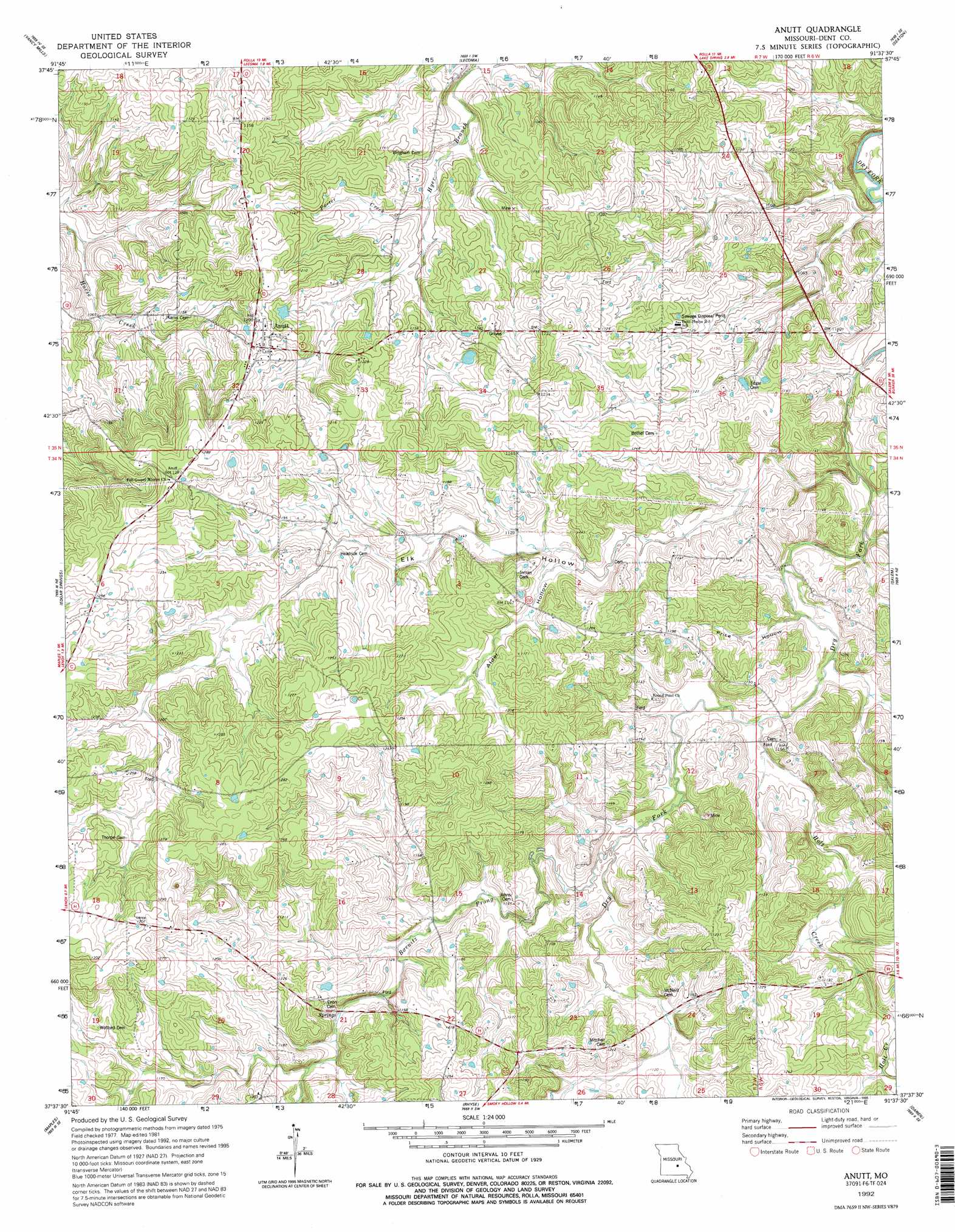
Anutt Topo Map Missouri
To zoom in, hover over the map of Anutt
USGS Topo Quad 37091f6 - 1:24,000 scale
| Topo Map Name: | Anutt |
| USGS Topo Quad ID: | 37091f6 |
| Print Size: | ca. 21 1/4" wide x 27" high |
| Southeast Coordinates: | 37.625° N latitude / 91.625° W longitude |
| Map Center Coordinates: | 37.6875° N latitude / 91.6875° W longitude |
| U.S. State: | MO |
| Filename: | o37091f6.jpg |
| Download Map JPG Image: | Anutt topo map 1:24,000 scale |
| Map Type: | Topographic |
| Topo Series: | 7.5´ |
| Map Scale: | 1:24,000 |
| Source of Map Images: | United States Geological Survey (USGS) |
| Alternate Map Versions: |
Anutt MO 1981, updated 1981 Download PDF Buy paper map Anutt MO 1992, updated 1995 Download PDF Buy paper map Anutt MO 2011 Download PDF Buy paper map Anutt MO 2015 Download PDF Buy paper map |
1:24,000 Topo Quads surrounding Anutt
Newburg |
Rolla |
Dillon |
Maramec Spring |
Indian Springs |
Kaintuck Hollow |
Yancy Mills |
Lecoma |
Seaton |
Cook Station |
Flat |
Edgar Springs |
Anutt |
Salem |
Short Bend |
Beulah |
Maples |
Rhyse |
Darien |
Doss |
Prescott |
Licking |
Montauk |
Cedar Grove |
Gladden |
> Back to 37091e1 at 1:100,000 scale
> Back to 37090a1 at 1:250,000 scale
> Back to U.S. Topo Maps home
Anutt topo map: Gazetteer
Anutt: Dams
Green Dam elevation 355m 1164′Anutt: Lakes
Round Pond elevation 356m 1167′Anutt: Mines
Clark Bank elevation 351m 1151′Anutt: Populated Places
Anutt elevation 368m 1207′Hedrick elevation 359m 1177′
Anutt: Streams
Barnitz Prong elevation 335m 1099′Holt Creek elevation 329m 1079′
Porter Creek elevation 332m 1089′
Anutt: Valleys
Alder Hollow elevation 341m 1118′Elk Hollow elevation 321m 1053′
Price Hollow elevation 324m 1062′
Rocky Pond Hollow elevation 330m 1082′
Anutt digital topo map on disk
Buy this Anutt topo map showing relief, roads, GPS coordinates and other geographical features, as a high-resolution digital map file on DVD: