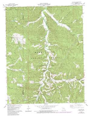
Courtois Topo Map Missouri
To zoom in, hover over the map of Courtois
USGS Topo Quad 37091g1 - 1:24,000 scale
| Topo Map Name: | Courtois |
| USGS Topo Quad ID: | 37091g1 |
| Print Size: | ca. 21 1/4" wide x 27" high |
| Southeast Coordinates: | 37.75° N latitude / 91° W longitude |
| Map Center Coordinates: | 37.8125° N latitude / 91.0625° W longitude |
| U.S. State: | MO |
| Filename: | o37091g1.jpg |
| Download Map JPG Image: | Courtois topo map 1:24,000 scale |
| Map Type: | Topographic |
| Topo Series: | 7.5´ |
| Map Scale: | 1:24,000 |
| Source of Map Images: | United States Geological Survey (USGS) |
| Alternate Map Versions: |
Courtois MO 1978, updated 1979 Download PDF Buy paper map Courtois MO 1978, updated 1985 Download PDF Buy paper map Courtois MO 1978, updated 1985 Download PDF Buy paper map Courtois MO 1999, updated 2002 Download PDF Buy paper map Courtois MO 2011 Download PDF Buy paper map Courtois MO 2015 Download PDF Buy paper map |
| FStopo: | US Forest Service topo Courtois is available: Download FStopo PDF Download FStopo TIF |
1:24,000 Topo Quads surrounding Courtois
> Back to 37091e1 at 1:100,000 scale
> Back to 37090a1 at 1:250,000 scale
> Back to U.S. Topo Maps home
Courtois topo map: Gazetteer
Courtois: Dams
Number 717 Dam elevation 282m 925′Number 718 Dam elevation 294m 964′
Courtois: Mines
Bluff Lead Diggings elevation 272m 892′Coffee-Pot Lead Diggings elevation 335m 1099′
Kellogg Shaft elevation 295m 967′
Polecat Lead Diggings elevation 319m 1046′
Water Hill Lead Diggings elevation 294m 964′
Courtois: Populated Places
Brazil elevation 273m 895′Courtois elevation 272m 892′
Czar elevation 353m 1158′
Ishmael elevation 259m 849′
Quaker elevation 295m 967′
Courtois: Ridges
Dawes Ridge elevation 350m 1148′Courtois: Springs
Iron Ore Spring elevation 273m 895′Courtois: Streams
Andys Branch elevation 278m 912′Bailey Branch elevation 264m 866′
Cub Creek elevation 258m 846′
Graves Branch elevation 277m 908′
Hazel Creek elevation 249m 816′
Indian Creek elevation 271m 889′
Johns Creek elevation 250m 820′
Loomis Branch elevation 256m 839′
Rocky Fork elevation 268m 879′
Scrap Branch elevation 260m 853′
Snapps Branch elevation 250m 820′
Town Branch elevation 260m 853′
Trace Creek elevation 280m 918′
Yount Branch elevation 284m 931′
Courtois: Summits
Murry Hill elevation 375m 1230′Courtois: Valleys
Boiling Springs Hollow elevation 248m 813′Kelly Hollow elevation 279m 915′
Mash Hollow elevation 286m 938′
Mason Hollow elevation 279m 915′
Walnut Hollow elevation 281m 921′
Courtois digital topo map on disk
Buy this Courtois topo map showing relief, roads, GPS coordinates and other geographical features, as a high-resolution digital map file on DVD:


