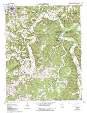
Maramec Spring Topo Map Missouri
To zoom in, hover over the map of Maramec Spring
USGS Topo Quad 37091h5 - 1:24,000 scale
| Topo Map Name: | Maramec Spring |
| USGS Topo Quad ID: | 37091h5 |
| Print Size: | ca. 21 1/4" wide x 27" high |
| Southeast Coordinates: | 37.875° N latitude / 91.5° W longitude |
| Map Center Coordinates: | 37.9375° N latitude / 91.5625° W longitude |
| U.S. State: | MO |
| Filename: | o37091h5.jpg |
| Download Map JPG Image: | Maramec Spring topo map 1:24,000 scale |
| Map Type: | Topographic |
| Topo Series: | 7.5´ |
| Map Scale: | 1:24,000 |
| Source of Map Images: | United States Geological Survey (USGS) |
| Alternate Map Versions: |
Meramec Spring MO 1963, updated 1964 Download PDF Buy paper map Maramec Spring MO 1963, updated 1964 Download PDF Buy paper map Maramec Spring MO 1963, updated 1971 Download PDF Buy paper map Maramec Spring MO 1963, updated 1985 Download PDF Buy paper map Maramec Spring MO 1980, updated 1981 Download PDF Buy paper map Maramec Spring MO 2012 Download PDF Buy paper map Maramec Spring MO 2015 Download PDF Buy paper map |
1:24,000 Topo Quads surrounding Maramec Spring
> Back to 37091e1 at 1:100,000 scale
> Back to 37090a1 at 1:250,000 scale
> Back to U.S. Topo Maps home
Maramec Spring topo map: Gazetteer
Maramec Spring: Bridges
Natural Bridge elevation 258m 846′Maramec Spring: Dams
Bedell Lake Dam elevation 290m 951′Lake Scioto Dam elevation 312m 1023′
Moty Lake Dam elevation 265m 869′
Tripoli Valley Dam elevation 271m 889′
Walnut Hill Lake Dam elevation 258m 846′
Wayman-Fuhring Lake Dam elevation 295m 967′
Maramec Spring: Mines
De Camp Mine elevation 306m 1003′James Mine elevation 289m 948′
Mosselle Mine elevation 292m 958′
Reed Bank Mine elevation 268m 879′
Maramec Spring: Parks
Asher State Wildlife Management Area elevation 358m 1174′Dry Fork State Wildlife Area elevation 275m 902′
Maramec Spring: Populated Places
Boys Town of Missouri elevation 263m 862′De Camp (historical) elevation 272m 892′
Meramec Springs (historical) elevation 246m 807′
Saint James elevation 333m 1092′
Maramec Spring: Reservoirs
Bedell Lake elevation 290m 951′Lake Scioto elevation 312m 1023′
Moty Lake elevation 265m 869′
Tripoli Valley Lake elevation 271m 889′
Walnut Hill Lake elevation 258m 846′
Maramec Spring: Springs
Maramec Spring elevation 244m 800′Maramec Spring: Streams
Benton Creek elevation 245m 803′Dry Fork elevation 232m 761′
Earle Branch elevation 275m 902′
Elliot Branch elevation 262m 859′
Luther Branch elevation 244m 800′
Norman Creek elevation 255m 836′
Maramec Spring: Valleys
Asher Hollow elevation 238m 780′Brown Hollow elevation 241m 790′
Normans Hollow elevation 255m 836′
Piney Hollow elevation 253m 830′
Maramec Spring digital topo map on disk
Buy this Maramec Spring topo map showing relief, roads, GPS coordinates and other geographical features, as a high-resolution digital map file on DVD:


