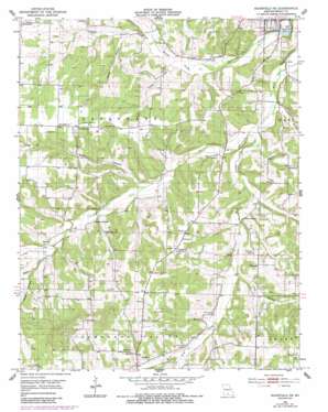
Mansfield Ne Topo Map Missouri
To zoom in, hover over the map of Mansfield Ne
USGS Topo Quad 37092b5 - 1:24,000 scale
| Topo Map Name: | Mansfield Ne |
| USGS Topo Quad ID: | 37092b5 |
| Print Size: | ca. 21 1/4" wide x 27" high |
| Southeast Coordinates: | 37.125° N latitude / 92.5° W longitude |
| Map Center Coordinates: | 37.1875° N latitude / 92.5625° W longitude |
| U.S. State: | MO |
| Filename: | o37092b5.jpg |
| Download Map JPG Image: | Mansfield Ne topo map 1:24,000 scale |
| Map Type: | Topographic |
| Topo Series: | 7.5´ |
| Map Scale: | 1:24,000 |
| Source of Map Images: | United States Geological Survey (USGS) |
| Alternate Map Versions: |
Mansfield NE MO 1951, updated 1953 Download PDF Buy paper map Mansfield NE MO 1951, updated 1985 Download PDF Buy paper map Mansfield NE MO 2011 Download PDF Buy paper map Mansfield NE MO 2015 Download PDF Buy paper map |
1:24,000 Topo Quads surrounding Mansfield Ne
> Back to 37092a1 at 1:100,000 scale
> Back to 37092a1 at 1:250,000 scale
> Back to U.S. Topo Maps home
Mansfield Ne topo map: Gazetteer
Mansfield Ne: Airports
Mansfield Municipal Airport elevation 453m 1486′Mansfield Ne: Dams
Casador Lake Dam elevation 348m 1141′Mansfield Ne: Populated Places
Rembert (historical) elevation 391m 1282′Umpire elevation 393m 1289′
Mansfield Ne: Post Offices
Rembert Post Office elevation 391m 1282′Umpire Post Office elevation 393m 1289′
Mansfield Ne: Reservoirs
Casador Lake elevation 348m 1141′Mansfield Ne: Streams
Baker Creek elevation 380m 1246′Campbell Branch elevation 351m 1151′
Fry Creek elevation 389m 1276′
Prairie Branch elevation 360m 1181′
Quillen Branch elevation 356m 1167′
Spence Creek elevation 380m 1246′
Wolf Creek elevation 354m 1161′
Mansfield Ne: Valleys
Alsop Hollow elevation 369m 1210′Buck Hollow elevation 370m 1213′
Dugger Hollow elevation 359m 1177′
Long Hollow elevation 372m 1220′
Possum Hollow elevation 384m 1259′
Mansfield Ne digital topo map on disk
Buy this Mansfield Ne topo map showing relief, roads, GPS coordinates and other geographical features, as a high-resolution digital map file on DVD:


