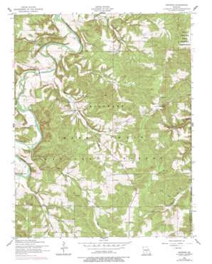
Winnipeg Topo Map Missouri
To zoom in, hover over the map of Winnipeg
USGS Topo Quad 37092e3 - 1:24,000 scale
| Topo Map Name: | Winnipeg |
| USGS Topo Quad ID: | 37092e3 |
| Print Size: | ca. 21 1/4" wide x 27" high |
| Southeast Coordinates: | 37.5° N latitude / 92.25° W longitude |
| Map Center Coordinates: | 37.5625° N latitude / 92.3125° W longitude |
| U.S. State: | MO |
| Filename: | o37092e3.jpg |
| Download Map JPG Image: | Winnipeg topo map 1:24,000 scale |
| Map Type: | Topographic |
| Topo Series: | 7.5´ |
| Map Scale: | 1:24,000 |
| Source of Map Images: | United States Geological Survey (USGS) |
| Alternate Map Versions: |
Winnipeg MO 1954, updated 1959 Download PDF Buy paper map Winnipeg MO 1954, updated 1977 Download PDF Buy paper map Winnipeg MO 2004, updated 2006 Download PDF Buy paper map Winnipeg MO 2012 Download PDF Buy paper map Winnipeg MO 2015 Download PDF Buy paper map |
| FStopo: | US Forest Service topo Winnipeg is available: Download FStopo PDF Download FStopo TIF |
1:24,000 Topo Quads surrounding Winnipeg
> Back to 37092e1 at 1:100,000 scale
> Back to 37092a1 at 1:250,000 scale
> Back to U.S. Topo Maps home
Winnipeg topo map: Gazetteer
Winnipeg: Areas
Osage Gasconade Hills elevation 346m 1135′Winnipeg: Bridges
Dougan Bridge elevation 295m 967′Winnipeg: Populated Places
Casey Ford elevation 312m 1023′Nebo elevation 315m 1033′
Saint Annie elevation 399m 1309′
Southard elevation 358m 1174′
Winnipeg elevation 323m 1059′
Winnipeg: Post Offices
Pine Creek Post Office elevation 351m 1151′Winnipeg: Springs
Big Spring elevation 299m 980′Winnipeg: Streams
Dry Branch elevation 292m 958′Kuhn Creek elevation 285m 935′
Mill Creek elevation 287m 941′
Norris Creek elevation 295m 967′
Pine Creek elevation 293m 961′
Winnipeg: Valleys
Tracy Hollow elevation 346m 1135′Winnipeg digital topo map on disk
Buy this Winnipeg topo map showing relief, roads, GPS coordinates and other geographical features, as a high-resolution digital map file on DVD:


