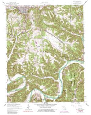
Dixon Topo Map Missouri
To zoom in, hover over the map of Dixon
USGS Topo Quad 37092h1 - 1:24,000 scale
| Topo Map Name: | Dixon |
| USGS Topo Quad ID: | 37092h1 |
| Print Size: | ca. 21 1/4" wide x 27" high |
| Southeast Coordinates: | 37.875° N latitude / 92° W longitude |
| Map Center Coordinates: | 37.9375° N latitude / 92.0625° W longitude |
| U.S. State: | MO |
| Filename: | o37092h1.jpg |
| Download Map JPG Image: | Dixon topo map 1:24,000 scale |
| Map Type: | Topographic |
| Topo Series: | 7.5´ |
| Map Scale: | 1:24,000 |
| Source of Map Images: | United States Geological Survey (USGS) |
| Alternate Map Versions: |
Dixon MO 1954, updated 1959 Download PDF Buy paper map Dixon MO 1954, updated 1974 Download PDF Buy paper map Dixon MO 1954, updated 1977 Download PDF Buy paper map Dixon MO 1954, updated 1991 Download PDF Buy paper map Dixon MO 2004, updated 2006 Download PDF Buy paper map Dixon MO 2012 Download PDF Buy paper map Dixon MO 2015 Download PDF Buy paper map |
| FStopo: | US Forest Service topo Dixon is available: Download FStopo PDF Download FStopo TIF |
1:24,000 Topo Quads surrounding Dixon
> Back to 37092e1 at 1:100,000 scale
> Back to 37092a1 at 1:250,000 scale
> Back to U.S. Topo Maps home
Dixon topo map: Gazetteer
Dixon: Basins
Conical Sink elevation 294m 964′Slaughter Sink elevation 251m 823′
Dixon: Capes
Portuguese Point elevation 220m 721′Dixon: Cliffs
Bryant Bluff elevation 256m 839′Dixon: Dams
Cardin Lake Dam elevation 303m 994′Dennis Lake Dam elevation 247m 810′
Dixon: Forests
Lone Star Tract State Forest elevation 238m 780′Dixon: Gaps
Low Gap elevation 267m 875′Dixon: Populated Places
Clementine elevation 318m 1043′Dixon elevation 356m 1167′
Franks elevation 297m 974′
Mazzaville Resort elevation 217m 711′
Piney End Resort elevation 213m 698′
Powellville elevation 308m 1010′
Three Island Resort elevation 210m 688′
Dixon: Reservoirs
Cardin Lake elevation 303m 994′Dennis Lake elevation 247m 810′
Emerald Lake elevation 217m 711′
Dixon: Ridges
Sheppard Ridge elevation 305m 1000′Dixon: Springs
Boiling Spring elevation 208m 682′Dixon: Streams
Big Piney River elevation 210m 688′Jones Creek elevation 214m 702′
McMakin Creek elevation 259m 849′
Mill Creek elevation 200m 656′
Dixon: Valleys
Buckhead Hollow elevation 242m 793′Hickory Hollow elevation 210m 688′
Mud Cave Hollow elevation 208m 682′
Prewett Hollow elevation 209m 685′
Dixon digital topo map on disk
Buy this Dixon topo map showing relief, roads, GPS coordinates and other geographical features, as a high-resolution digital map file on DVD:


