Billings Topo Map Missouri
To zoom in, hover over the map of Billings
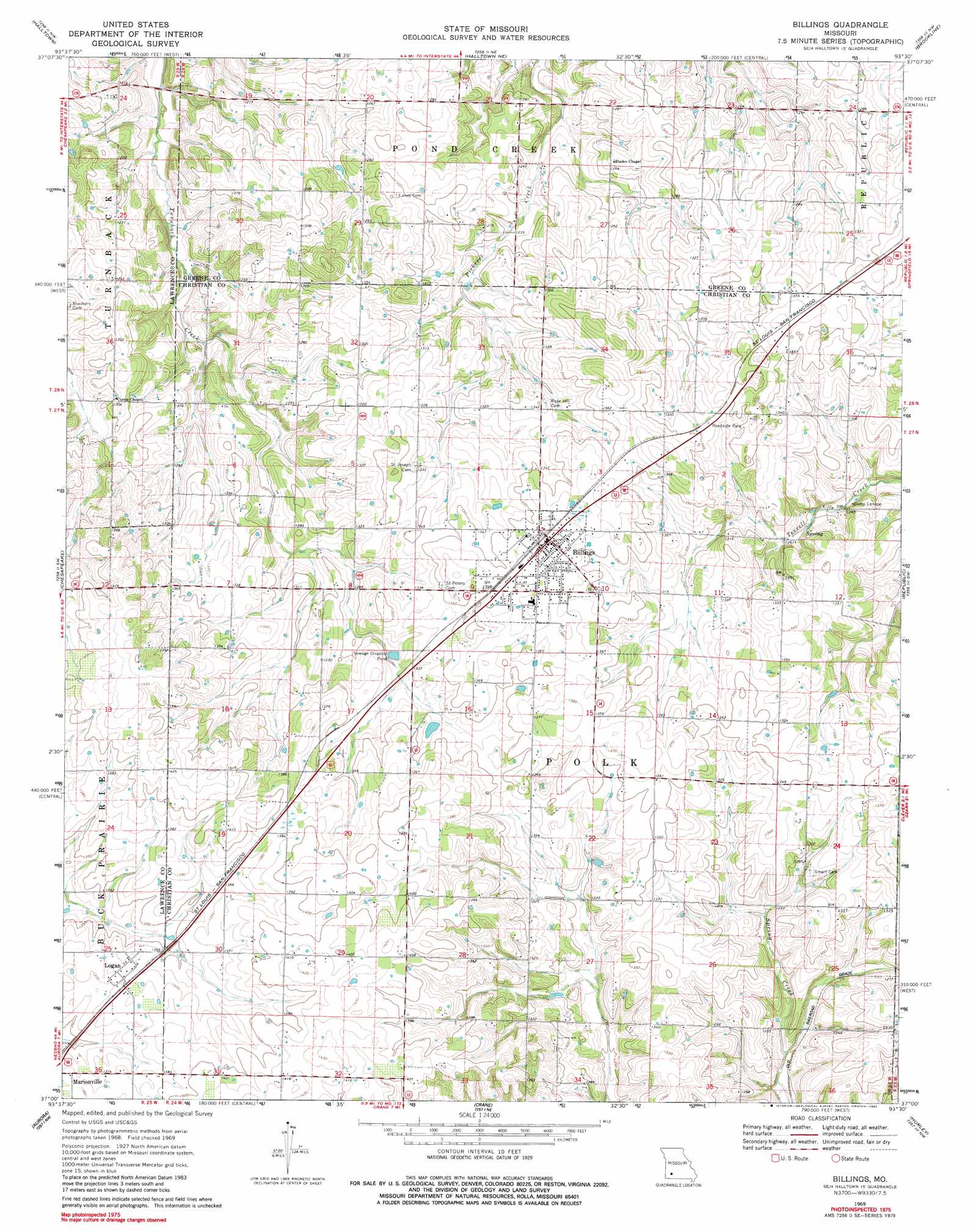
USGS Topo Quad 37093a5 - 1:24,000 scale
| Topo Map Name: | Billings |
| USGS Topo Quad ID: | 37093a5 |
| Print Size: | ca. 21 1/4" wide x 27" high |
| Southeast Coordinates: | 37° N latitude / 93.5° W longitude |
| Map Center Coordinates: | 37.0625° N latitude / 93.5625° W longitude |
| U.S. State: | MO |
| Filename: | o37093a5.jpg |
| Download Map JPG Image: | Billings topo map 1:24,000 scale |
| Map Type: | Topographic |
| Topo Series: | 7.5´ |
| Map Scale: | 1:24,000 |
| Source of Map Images: | United States Geological Survey (USGS) |
| Alternate Map Versions: |
Billings MO 1969, updated 1971 Download PDF Buy paper map Billings MO 1969, updated 1982 Download PDF Buy paper map Billings MO 2011 Download PDF Buy paper map Billings MO 2015 Download PDF Buy paper map |
1:24,000 Topo Quads surrounding Billings
South Greenfield |
Everton |
Ash Grove |
Willard |
Ebenezer |
Miller |
Halltown |
Halltown Ne |
Brookline |
Springfield |
Mount Vernon |
Chesapeake |
Billings |
Republic |
Nixa |
Verona |
Aurora |
Crane |
Hurley |
Highlandville |
Mcdowell |
Jenkins |
Elsey |
Galena |
Spokane |
> Back to 37093a1 at 1:100,000 scale
> Back to 37092a1 at 1:250,000 scale
> Back to U.S. Topo Maps home
Billings topo map: Gazetteer
Billings: Airports
Herndon Orchard Airport elevation 420m 1377′Billings: Dams
Hagewood Lake Dam elevation 396m 1299′Billings: Populated Places
Billings elevation 417m 1368′Logan elevation 418m 1371′
Billings: Reservoirs
Hagewood Lake elevation 396m 1299′Billings digital topo map on disk
Buy this Billings topo map showing relief, roads, GPS coordinates and other geographical features, as a high-resolution digital map file on DVD: