Mount Vernon Topo Map Missouri
To zoom in, hover over the map of Mount Vernon
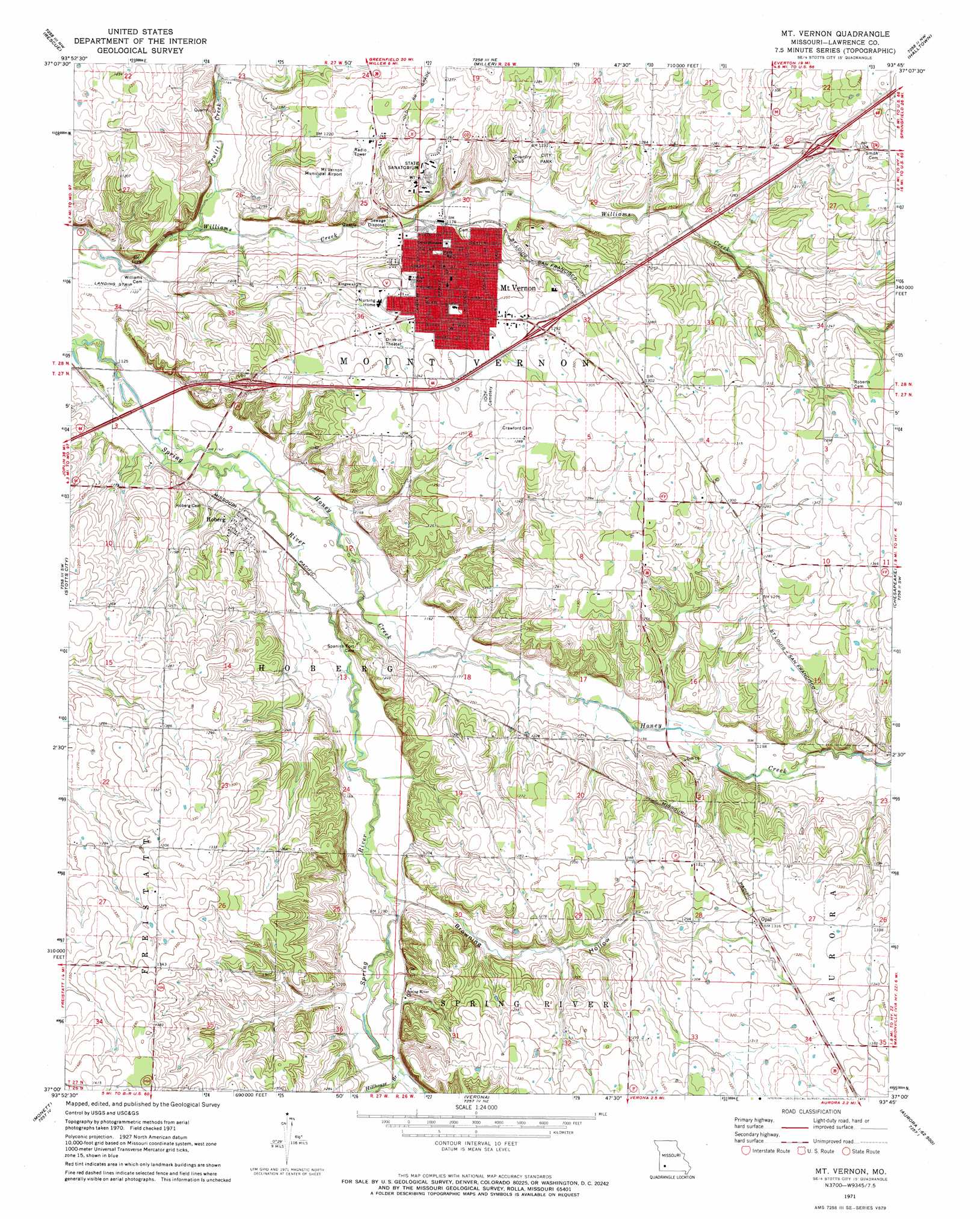
USGS Topo Quad 37093a7 - 1:24,000 scale
| Topo Map Name: | Mount Vernon |
| USGS Topo Quad ID: | 37093a7 |
| Print Size: | ca. 21 1/4" wide x 27" high |
| Southeast Coordinates: | 37° N latitude / 93.75° W longitude |
| Map Center Coordinates: | 37.0625° N latitude / 93.8125° W longitude |
| U.S. State: | MO |
| Filename: | o37093a7.jpg |
| Download Map JPG Image: | Mount Vernon topo map 1:24,000 scale |
| Map Type: | Topographic |
| Topo Series: | 7.5´ |
| Map Scale: | 1:24,000 |
| Source of Map Images: | United States Geological Survey (USGS) |
| Alternate Map Versions: |
Mount Vernon MO 1971, updated 1973 Download PDF Buy paper map Mount Vernon MO 2011 Download PDF Buy paper map Mount Vernon MO 2015 Download PDF Buy paper map |
1:24,000 Topo Quads surrounding Mount Vernon
Dudenville |
Kings Point |
South Greenfield |
Everton |
Ash Grove |
La Russell |
Rescue |
Miller |
Halltown |
Halltown Ne |
Sarcoxie |
Stotts City |
Mount Vernon |
Chesapeake |
Billings |
Pierce City |
Monett |
Verona |
Aurora |
Crane |
Wheaton |
Purdy |
Mcdowell |
Jenkins |
Elsey |
> Back to 37093a1 at 1:100,000 scale
> Back to 37092a1 at 1:250,000 scale
> Back to U.S. Topo Maps home
Mount Vernon topo map: Gazetteer
Mount Vernon: Dams
Faucetts Point Lake Dam elevation 363m 1190′Southwest Research Center Dam elevation 401m 1315′
Mount Vernon: Populated Places
Hoberg elevation 355m 1164′Mount Vernon elevation 369m 1210′
Opal elevation 399m 1309′
Mount Vernon: Reservoirs
Faucett Lake elevation 363m 1190′Southwest Research Center Lake elevation 401m 1315′
Mount Vernon: Streams
Hillhouse Branch elevation 368m 1207′Honey Creek elevation 342m 1122′
Truitt Creek elevation 341m 1118′
Mount Vernon: Valleys
Browning Hollow elevation 363m 1190′Mount Vernon digital topo map on disk
Buy this Mount Vernon topo map showing relief, roads, GPS coordinates and other geographical features, as a high-resolution digital map file on DVD: