Charity Topo Map Missouri
To zoom in, hover over the map of Charity
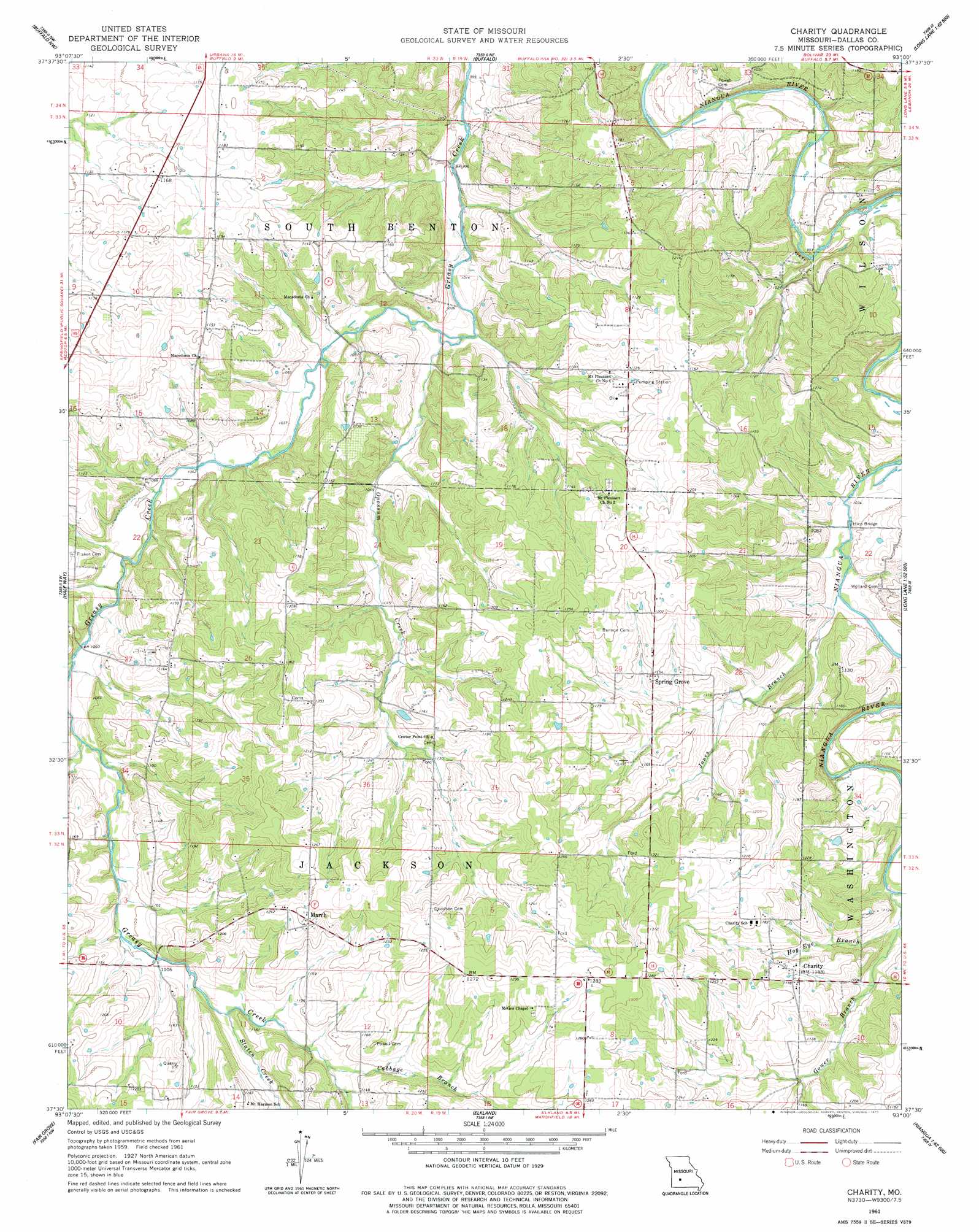
USGS Topo Quad 37093e1 - 1:24,000 scale
| Topo Map Name: | Charity |
| USGS Topo Quad ID: | 37093e1 |
| Print Size: | ca. 21 1/4" wide x 27" high |
| Southeast Coordinates: | 37.5° N latitude / 93° W longitude |
| Map Center Coordinates: | 37.5625° N latitude / 93.0625° W longitude |
| U.S. State: | MO |
| Filename: | o37093e1.jpg |
| Download Map JPG Image: | Charity topo map 1:24,000 scale |
| Map Type: | Topographic |
| Topo Series: | 7.5´ |
| Map Scale: | 1:24,000 |
| Source of Map Images: | United States Geological Survey (USGS) |
| Alternate Map Versions: |
Charity MO 1961, updated 1962 Download PDF Buy paper map Charity MO 1961, updated 1977 Download PDF Buy paper map Charity MO 2011 Download PDF Buy paper map Charity MO 2015 Download PDF Buy paper map |
1:24,000 Topo Quads surrounding Charity
Sentinel |
Urbana |
Tunas |
Leadmine |
Eldridge West |
Polk |
Buffalo Nw |
Buffalo |
Windyville |
Bennett Springs |
Cedar Vista |
Half Way |
Charity |
Long Lake |
Phillipsburg |
Pleasant Hope |
Fair Grove |
Elkland |
Beach |
Niangua |
Ebenezer |
Bassville |
Strafford |
Marshfield |
High Prarie |
> Back to 37093e1 at 1:100,000 scale
> Back to 37092a1 at 1:250,000 scale
> Back to U.S. Topo Maps home
Charity topo map: Gazetteer
Charity: Airports
Lauries Landing Airport elevation 369m 1210′Charity: Bridges
Hico Bridge elevation 313m 1026′Charity: Populated Places
Charity elevation 360m 1181′Hico (historical) elevation 323m 1059′
March elevation 382m 1253′
Spring Grove elevation 351m 1151′
Charity: Streams
Buffalo Branch elevation 322m 1056′Cabbage Branch elevation 369m 1210′
Gower Branch elevation 323m 1059′
Hankens Branch elevation 324m 1062′
Hog Eye Branch elevation 325m 1066′
Jones Branch elevation 314m 1030′
Opossum Creek elevation 307m 1007′
Staten Creek elevation 339m 1112′
Charity digital topo map on disk
Buy this Charity topo map showing relief, roads, GPS coordinates and other geographical features, as a high-resolution digital map file on DVD: