Branch Topo Map Missouri
To zoom in, hover over the map of Branch
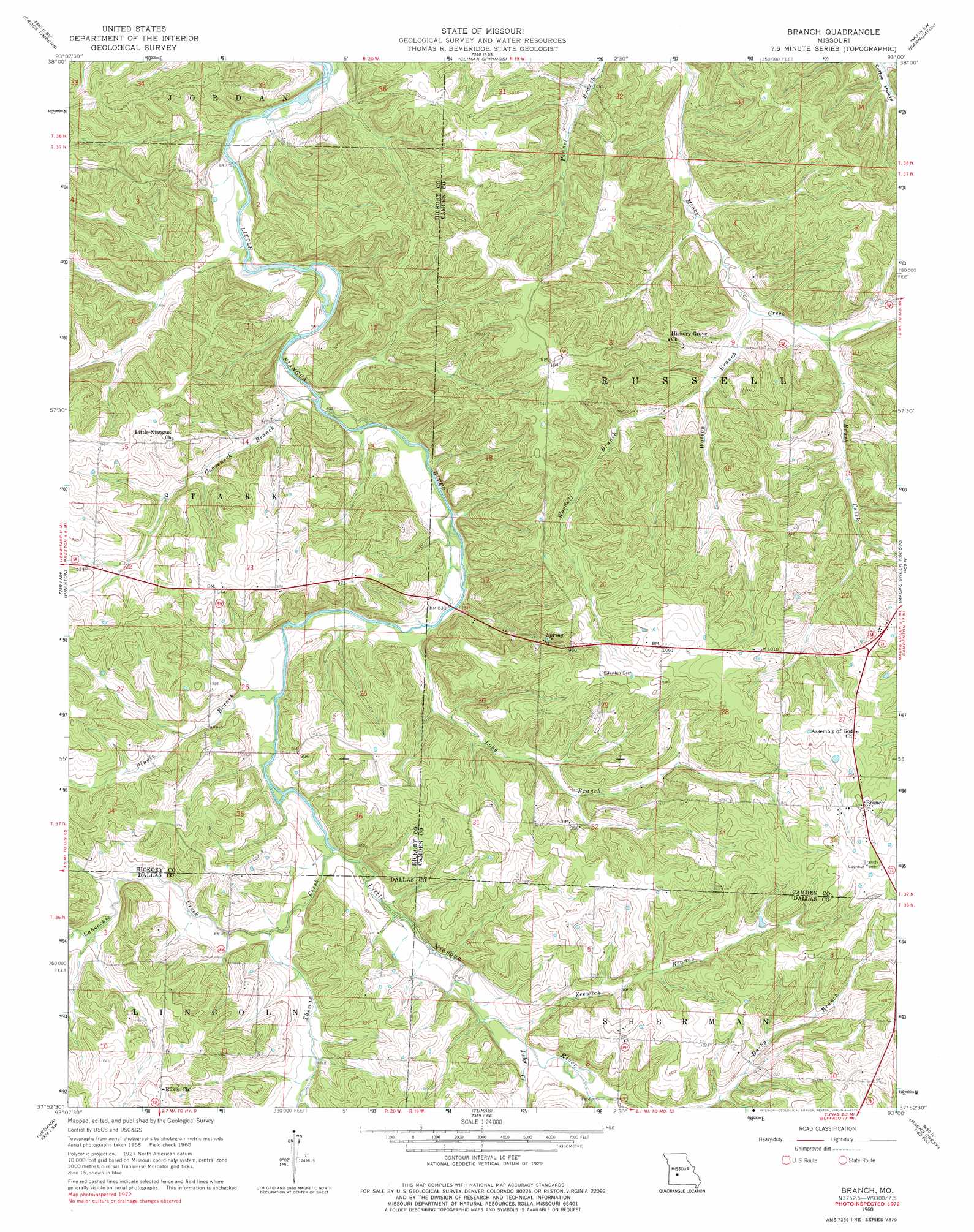
USGS Topo Quad 37093h1 - 1:24,000 scale
| Topo Map Name: | Branch |
| USGS Topo Quad ID: | 37093h1 |
| Print Size: | ca. 21 1/4" wide x 27" high |
| Southeast Coordinates: | 37.875° N latitude / 93° W longitude |
| Map Center Coordinates: | 37.9375° N latitude / 93.0625° W longitude |
| U.S. State: | MO |
| Filename: | o37093h1.jpg |
| Download Map JPG Image: | Branch topo map 1:24,000 scale |
| Map Type: | Topographic |
| Topo Series: | 7.5´ |
| Map Scale: | 1:24,000 |
| Source of Map Images: | United States Geological Survey (USGS) |
| Alternate Map Versions: |
Branch MO 1960, updated 1961 Download PDF Buy paper map Branch MO 1960, updated 1975 Download PDF Buy paper map Branch MO 2011 Download PDF Buy paper map Branch MO 2015 Download PDF Buy paper map |
1:24,000 Topo Quads surrounding Branch
Warsaw East |
Edwards |
Knobby |
Bollinger Creek |
Sunrise Beach |
Fristoe |
Cross Timbers |
Climax Springs |
Barnumton |
Green Bay Terrace |
Hermitage |
Preston |
Branch |
Macks Creek |
Hahatonka |
Sentinel |
Urbana |
Tunas |
Leadmine |
Eldridge West |
Polk |
Buffalo Nw |
Buffalo |
Windyville |
Bennett Springs |
> Back to 37093e1 at 1:100,000 scale
> Back to 37092a1 at 1:250,000 scale
> Back to U.S. Topo Maps home
Branch topo map: Gazetteer
Branch: Dams
Carpenter Lake Dam elevation 278m 912′Branch: Populated Places
Almon elevation 254m 833′Branch elevation 337m 1105′
Elixer elevation 290m 951′
Branch: Post Offices
Goose Neck Post Office (historical) elevation 248m 813′Branch: Streams
Brush Creek elevation 249m 816′Cahoochie Creek elevation 258m 846′
Darby Branch elevation 281m 921′
Gooseneck Branch elevation 242m 793′
Huffmans Creek elevation 238m 780′
Judge Creek elevation 262m 859′
Long Branch elevation 248m 813′
Pippin Branch elevation 250m 820′
Thomas Creek elevation 254m 833′
Watson Branch elevation 244m 800′
Woodall Branch elevation 252m 826′
Zeewick Branch elevation 261m 856′
Branch digital topo map on disk
Buy this Branch topo map showing relief, roads, GPS coordinates and other geographical features, as a high-resolution digital map file on DVD: