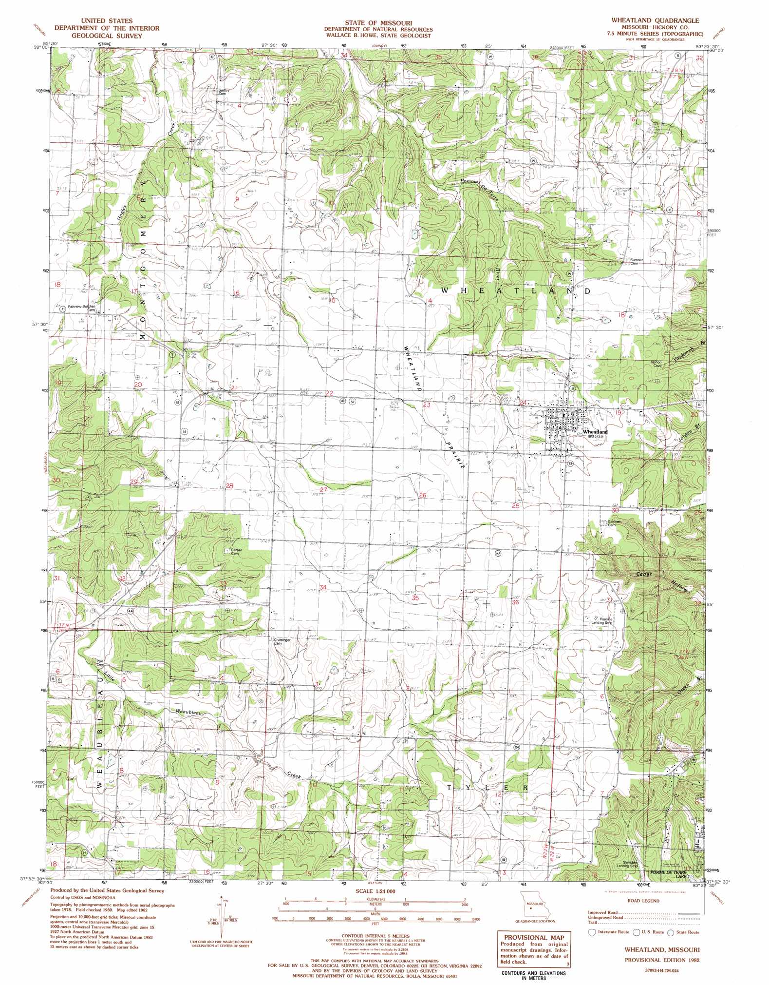
Wheatland Topo Map Missouri
To zoom in, hover over the map of Wheatland
USGS Topo Quad 37093h4 - 1:24,000 scale
| Topo Map Name: | Wheatland |
| USGS Topo Quad ID: | 37093h4 |
| Print Size: | ca. 21 1/4" wide x 27" high |
| Southeast Coordinates: | 37.875° N latitude / 93.375° W longitude |
| Map Center Coordinates: | 37.9375° N latitude / 93.4375° W longitude |
| U.S. State: | MO |
| Filename: | o37093h4.jpg |
| Download Map JPG Image: | Wheatland topo map 1:24,000 scale |
| Map Type: | Topographic |
| Topo Series: | 7.5´ |
| Map Scale: | 1:24,000 |
| Source of Map Images: | United States Geological Survey (USGS) |
| Alternate Map Versions: |
Wheatland MO 1980, updated 1982 Download PDF Buy paper map Wheatland MO 1982, updated 1982 Download PDF Buy paper map Wheatland MO 2011 Download PDF Buy paper map Wheatland MO 2015 Download PDF Buy paper map |
1:24,000 Topo Quads surrounding Wheatland
Lowry City |
Valhalla |
Warsaw West |
Warsaw East |
Edwards |
Osceola |
Iconium |
Quincy |
Fristoe |
Cross Timbers |
Vista |
Weaubleau |
Wheatland |
Hermitage |
Preston |
Arnica |
Humansville |
Elkton |
Sentinel |
Urbana |
Bearcreek |
Fair Play |
Cliquot |
Polk |
Buffalo Nw |
> Back to 37093e1 at 1:100,000 scale
> Back to 37092a1 at 1:250,000 scale
> Back to U.S. Topo Maps home
Wheatland topo map: Gazetteer
Wheatland: Airports
Pomme Aero Airport elevation 326m 1069′Wheatland: Areas
Wheatland Prairie elevation 315m 1033′Wheatland: Populated Places
Butcher elevation 307m 1007′Wheatland elevation 321m 1053′
Wheatland digital topo map on disk
Buy this Wheatland topo map showing relief, roads, GPS coordinates and other geographical features, as a high-resolution digital map file on DVD: