Vista Topo Map Missouri
To zoom in, hover over the map of Vista
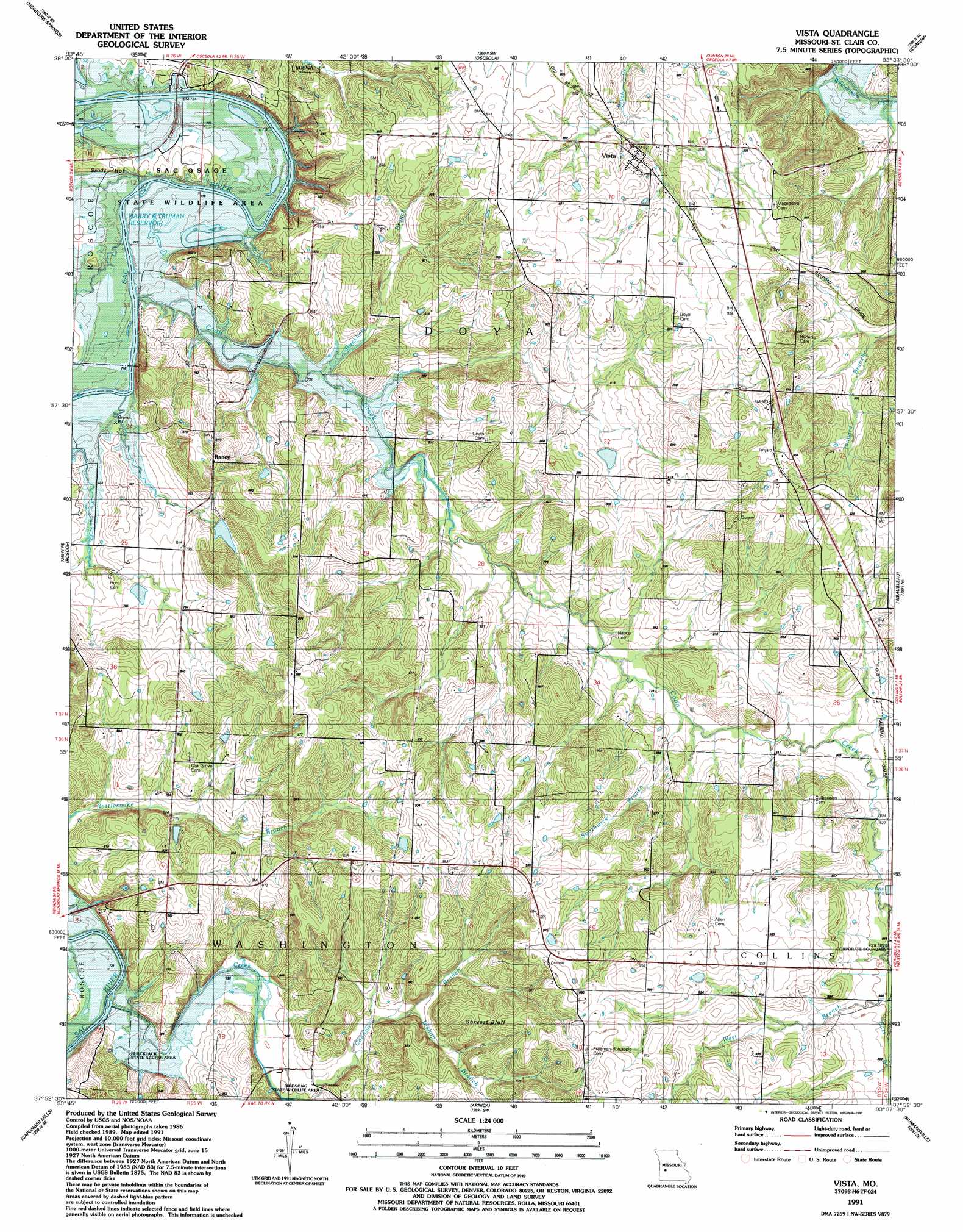
USGS Topo Quad 37093h6 - 1:24,000 scale
| Topo Map Name: | Vista |
| USGS Topo Quad ID: | 37093h6 |
| Print Size: | ca. 21 1/4" wide x 27" high |
| Southeast Coordinates: | 37.875° N latitude / 93.625° W longitude |
| Map Center Coordinates: | 37.9375° N latitude / 93.6875° W longitude |
| U.S. State: | MO |
| Filename: | o37093h6.jpg |
| Download Map JPG Image: | Vista topo map 1:24,000 scale |
| Map Type: | Topographic |
| Topo Series: | 7.5´ |
| Map Scale: | 1:24,000 |
| Source of Map Images: | United States Geological Survey (USGS) |
| Alternate Map Versions: |
Vista MO 1938, updated 1952 Download PDF Buy paper map Vista MO 1938, updated 1952 Download PDF Buy paper map Vista MO 1940 Download PDF Buy paper map Vista MO 1991, updated 1991 Download PDF Buy paper map Vista MO 2011 Download PDF Buy paper map Vista MO 2015 Download PDF Buy paper map |
1:24,000 Topo Quads surrounding Vista
Monegaw Springs Nw |
Ohio |
Lowry City |
Valhalla |
Warsaw West |
Taberville |
Monegaw Springs |
Osceola |
Iconium |
Quincy |
Tiffin |
Roscoe |
Vista |
Weaubleau |
Wheatland |
Filley |
Caplinger Mills |
Arnica |
Humansville |
Elkton |
Wagoner |
Stockton |
Bearcreek |
Fair Play |
Cliquot |
> Back to 37093e1 at 1:100,000 scale
> Back to 37092a1 at 1:250,000 scale
> Back to U.S. Topo Maps home
Vista topo map: Gazetteer
Vista: Airports
Peterman Airport elevation 256m 839′Vista: Cliffs
Shryers Bluff elevation 284m 931′Vista: Dams
Colemans Valley Lake Dam elevation 246m 807′Elliot Lake Dam elevation 274m 898′
Vista: Populated Places
Raney elevation 277m 908′Topper elevation 290m 951′
Tracy elevation 275m 902′
Vista elevation 266m 872′
Vista: Reservoirs
Coleman Lake elevation 246m 807′Vista: Streams
Bishop Branch elevation 241m 790′Brush Creek elevation 220m 721′
Buckhart Branch elevation 220m 721′
Cannon Branch elevation 228m 748′
Coon Creek elevation 217m 711′
East Branch Coon Creek elevation 257m 843′
Southwick Branch elevation 239m 784′
West Branch Coon Creek elevation 257m 843′
Vista: Valleys
Sandy Hollow elevation 221m 725′Vista digital topo map on disk
Buy this Vista topo map showing relief, roads, GPS coordinates and other geographical features, as a high-resolution digital map file on DVD: