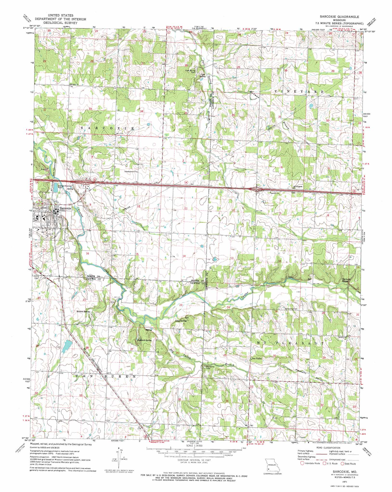
Sarcoxie Topo Map Missouri
To zoom in, hover over the map of Sarcoxie
USGS Topo Quad 37094a1 - 1:24,000 scale
| Topo Map Name: | Sarcoxie |
| USGS Topo Quad ID: | 37094a1 |
| Print Size: | ca. 21 1/4" wide x 27" high |
| Southeast Coordinates: | 37° N latitude / 94° W longitude |
| Map Center Coordinates: | 37.0625° N latitude / 94.0625° W longitude |
| U.S. State: | MO |
| Filename: | o37094a1.jpg |
| Download Map JPG Image: | Sarcoxie topo map 1:24,000 scale |
| Map Type: | Topographic |
| Topo Series: | 7.5´ |
| Map Scale: | 1:24,000 |
| Source of Map Images: | United States Geological Survey (USGS) |
| Alternate Map Versions: |
Sarcoxie MO 1971, updated 1973 Download PDF Buy paper map Sarcoxie MO 2011 Download PDF Buy paper map Sarcoxie MO 2015 Download PDF Buy paper map |
1:24,000 Topo Quads surrounding Sarcoxie
Jasper |
Maple Grove |
Dudenville |
Kings Point |
South Greenfield |
Carthage |
Avilla |
La Russell |
Rescue |
Miller |
Fidelity |
Reeds |
Sarcoxie |
Stotts City |
Mount Vernon |
Granby |
Newtonia |
Pierce City |
Monett |
Verona |
Neosho East |
Stella |
Wheaton |
Purdy |
Mcdowell |
> Back to 37094a1 at 1:100,000 scale
> Back to 37094a1 at 1:250,000 scale
> Back to U.S. Topo Maps home
Sarcoxie topo map: Gazetteer
Sarcoxie: Dams
Pepper Lake Dam elevation 356m 1167′Sarcoxie: Populated Places
Clarkson elevation 363m 1190′Dry Valley elevation 375m 1230′
Sarcoxie elevation 332m 1089′
Talmage City elevation 375m 1230′
Sarcoxie: Reservoirs
Bleuins Lake elevation 356m 1167′Sarcoxie: Springs
Button Spring elevation 348m 1141′Cave Spring elevation 328m 1076′
Clarkson Spring elevation 358m 1174′
Haddock Spring elevation 347m 1138′
Linn Spring elevation 341m 1118′
Sarcoxie: Streams
Dry Valley Branch elevation 339m 1112′Rickman Creek elevation 326m 1069′
Sarcoxie: Valleys
Pleasant Valley elevation 357m 1171′Sarcoxie digital topo map on disk
Buy this Sarcoxie topo map showing relief, roads, GPS coordinates and other geographical features, as a high-resolution digital map file on DVD: