Pittsburg Topo Map Kansas
To zoom in, hover over the map of Pittsburg
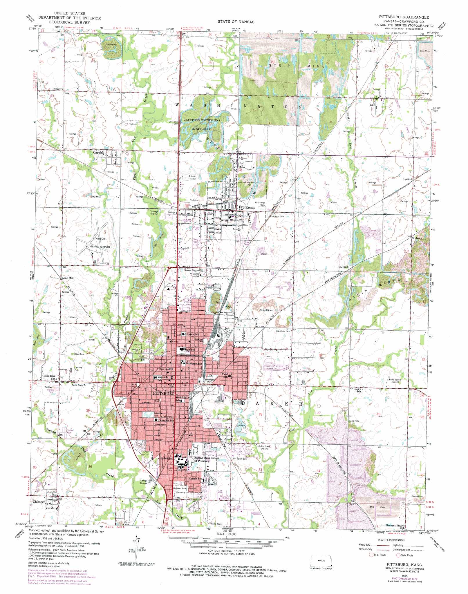
USGS Topo Quad 37094d6 - 1:24,000 scale
| Topo Map Name: | Pittsburg |
| USGS Topo Quad ID: | 37094d6 |
| Print Size: | ca. 21 1/4" wide x 27" high |
| Southeast Coordinates: | 37.375° N latitude / 94.625° W longitude |
| Map Center Coordinates: | 37.4375° N latitude / 94.6875° W longitude |
| U.S. State: | KS |
| Filename: | o37094d6.jpg |
| Download Map JPG Image: | Pittsburg topo map 1:24,000 scale |
| Map Type: | Topographic |
| Topo Series: | 7.5´ |
| Map Scale: | 1:24,000 |
| Source of Map Images: | United States Geological Survey (USGS) |
| Alternate Map Versions: |
Pittsburg KS 1959, updated 1960 Download PDF Buy paper map Pittsburg KS 1959, updated 1975 Download PDF Buy paper map Pittsburg KS 1959, updated 1978 Download PDF Buy paper map Pittsburg KS 2010 Download PDF Buy paper map Pittsburg KS 2012 Download PDF Buy paper map Pittsburg KS 2015 Download PDF Buy paper map |
1:24,000 Topo Quads surrounding Pittsburg
Hepler |
Hiattville |
Cato |
Garland |
Bronaugh |
Brazilton |
Girard |
Arma |
Liberal |
Iantha |
Grindstone Creek |
Radley |
Pittsburg |
Mindenmines |
Nashville |
West Mineral |
Cherokee |
Kirkwood |
Asbury |
Neck City |
Hallowell |
Columbus |
Crestline |
Carl Junction |
Webb City |
> Back to 37094a1 at 1:100,000 scale
> Back to 37094a1 at 1:250,000 scale
> Back to U.S. Topo Maps home
Pittsburg topo map: Gazetteer
Pittsburg: Airports
Atkinson Municipal Airport elevation 287m 941′Pittsburg: Parks
Crawford County State Park Number One elevation 290m 951′Crawford State Fishing Lake Number One elevation 290m 951′
Deramus Park elevation 284m 931′
Lakeside Park elevation 282m 925′
Lincoln Park elevation 275m 902′
Schlanger Park elevation 281m 921′
Pittsburg: Populated Places
Capaldo elevation 290m 951′Chicopee elevation 281m 921′
Cornell elevation 290m 951′
Dunkirk elevation 293m 961′
Frontenac elevation 291m 954′
Litchfield elevation 278m 912′
Lone Oak elevation 290m 951′
Midway elevation 284m 931′
Pittsburg elevation 287m 941′
Yale elevation 292m 958′
Pittsburg: Streams
First Cow Creek elevation 266m 872′Second Cow Creek elevation 266m 872′
Pittsburg digital topo map on disk
Buy this Pittsburg topo map showing relief, roads, GPS coordinates and other geographical features, as a high-resolution digital map file on DVD: