Lamar North Topo Map Missouri
To zoom in, hover over the map of Lamar North
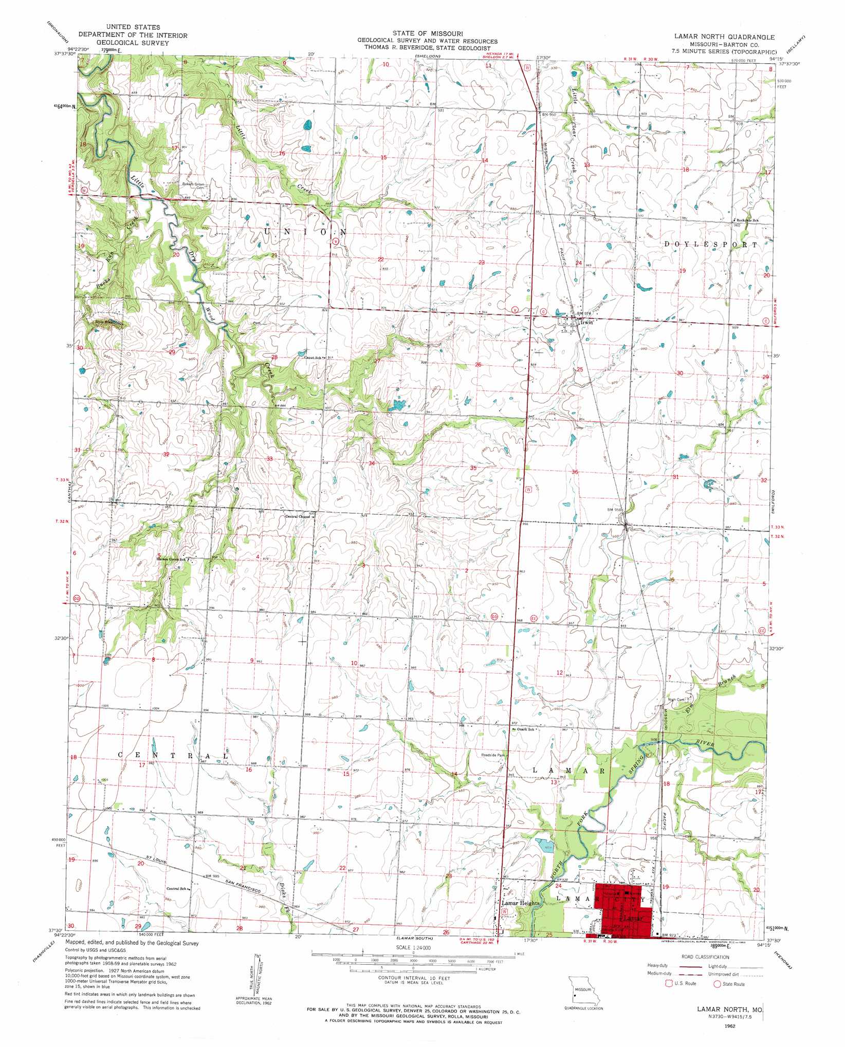
USGS Topo Quad 37094e3 - 1:24,000 scale
| Topo Map Name: | Lamar North |
| USGS Topo Quad ID: | 37094e3 |
| Print Size: | ca. 21 1/4" wide x 27" high |
| Southeast Coordinates: | 37.5° N latitude / 94.25° W longitude |
| Map Center Coordinates: | 37.5625° N latitude / 94.3125° W longitude |
| U.S. State: | MO |
| Filename: | o37094e3.jpg |
| Download Map JPG Image: | Lamar North topo map 1:24,000 scale |
| Map Type: | Topographic |
| Topo Series: | 7.5´ |
| Map Scale: | 1:24,000 |
| Source of Map Images: | United States Geological Survey (USGS) |
| Alternate Map Versions: |
Lamar North MO 1962, updated 1963 Download PDF Buy paper map Lamar North MO 2011 Download PDF Buy paper map Lamar North MO 2015 Download PDF Buy paper map |
1:24,000 Topo Quads surrounding Lamar North
Deerfield |
Moundville |
Nevada |
Dederick |
Eldorado Springs South |
Garland |
Bronaugh |
Sheldon |
Bellamy |
Montevallo |
Liberal |
Iantha |
Lamar North |
Milford |
Jerico Springs |
Mindenmines |
Nashville |
Lamar South |
Kenoma |
Golden City |
Asbury |
Neck City |
Jasper |
Maple Grove |
Dudenville |
> Back to 37094e1 at 1:100,000 scale
> Back to 37094a1 at 1:250,000 scale
> Back to U.S. Topo Maps home
Lamar North topo map: Gazetteer
Lamar North: Dams
Curless Lake Dam elevation 285m 935′Don Bunton Dam elevation 295m 967′
Earl Dumm Dam elevation 298m 977′
Lamar North: Populated Places
Irwin elevation 296m 971′Lamar North: Post Offices
Fairbanks Post Office (historical) elevation 271m 889′Lamar North: Streams
Bucks Run Creek elevation 251m 823′Elm Branch elevation 284m 931′
Lamar North digital topo map on disk
Buy this Lamar North topo map showing relief, roads, GPS coordinates and other geographical features, as a high-resolution digital map file on DVD: