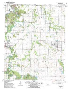
Liberal Topo Map Missouri
To zoom in, hover over the map of Liberal
USGS Topo Quad 37094e5 - 1:24,000 scale
| Topo Map Name: | Liberal |
| USGS Topo Quad ID: | 37094e5 |
| Print Size: | ca. 21 1/4" wide x 27" high |
| Southeast Coordinates: | 37.5° N latitude / 94.5° W longitude |
| Map Center Coordinates: | 37.5625° N latitude / 94.5625° W longitude |
| U.S. States: | MO, KS |
| Filename: | o37094e5.jpg |
| Download Map JPG Image: | Liberal topo map 1:24,000 scale |
| Map Type: | Topographic |
| Topo Series: | 7.5´ |
| Map Scale: | 1:24,000 |
| Source of Map Images: | United States Geological Survey (USGS) |
| Alternate Map Versions: |
Liberal MO 1948, updated 1954 Download PDF Buy paper map Liberal MO 1950 Download PDF Buy paper map Liberal MO 1950, updated 1985 Download PDF Buy paper map Liberal MO 1991, updated 1991 Download PDF Buy paper map Liberal MO 2009 Download PDF Buy paper map Liberal MO 2011 Download PDF Buy paper map Liberal MO 2015 Download PDF Buy paper map |
1:24,000 Topo Quads surrounding Liberal
> Back to 37094e1 at 1:100,000 scale
> Back to 37094a1 at 1:250,000 scale
> Back to U.S. Topo Maps home
Liberal topo map: Gazetteer
Liberal: Dams
Rose Lake Dam elevation 288m 944′Liberal: Forests
Lester R Davis Memorial State Forest elevation 293m 961′Liberal: Parks
Hunkah Prairie State Wildlife Area elevation 290m 951′Liberal City Park elevation 271m 889′
Mulberry City Park elevation 274m 898′
Liberal: Populated Places
Ardath elevation 267m 875′Burgess elevation 272m 892′
Fuller elevation 277m 908′
Liberal elevation 275m 902′
Miller Brothers (historical) elevation 273m 895′
Mulberry elevation 277m 908′
Liberal: Reservoirs
Roses Lake elevation 288m 944′Liberal: Streams
Bitter Creek elevation 250m 820′East Drywood Creek elevation 253m 830′
Fleck Creek elevation 258m 846′
Second Nicolson Creek elevation 253m 830′
West Elm Branch elevation 248m 813′
Liberal: Summits
Haake Mound elevation 274m 898′Liberal digital topo map on disk
Buy this Liberal topo map showing relief, roads, GPS coordinates and other geographical features, as a high-resolution digital map file on DVD:


