Bellamy Topo Map Missouri
To zoom in, hover over the map of Bellamy
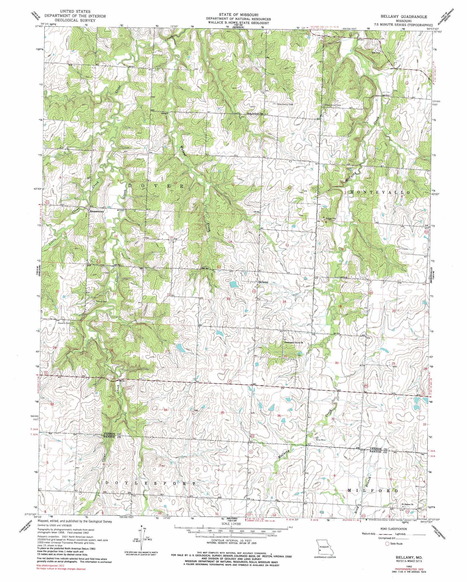
USGS Topo Quad 37094f2 - 1:24,000 scale
| Topo Map Name: | Bellamy |
| USGS Topo Quad ID: | 37094f2 |
| Print Size: | ca. 21 1/4" wide x 27" high |
| Southeast Coordinates: | 37.625° N latitude / 94.125° W longitude |
| Map Center Coordinates: | 37.6875° N latitude / 94.1875° W longitude |
| U.S. State: | MO |
| Filename: | o37094f2.jpg |
| Download Map JPG Image: | Bellamy topo map 1:24,000 scale |
| Map Type: | Topographic |
| Topo Series: | 7.5´ |
| Map Scale: | 1:24,000 |
| Source of Map Images: | United States Geological Survey (USGS) |
| Alternate Map Versions: |
Bellamy MO 1962, updated 1963 Download PDF Buy paper map Bellamy MO 1962, updated 1983 Download PDF Buy paper map Bellamy MO 2011 Download PDF Buy paper map Bellamy MO 2015 Download PDF Buy paper map |
1:24,000 Topo Quads surrounding Bellamy
Metz |
Horton |
Harwood |
Eldorado Springs North |
Tiffin |
Moundville |
Nevada |
Dederick |
Eldorado Springs South |
Filley |
Bronaugh |
Sheldon |
Bellamy |
Montevallo |
Wagoner |
Iantha |
Lamar North |
Milford |
Jerico Springs |
Cedarville |
Nashville |
Lamar South |
Kenoma |
Golden City |
Lockwood |
> Back to 37094e1 at 1:100,000 scale
> Back to 37094a1 at 1:250,000 scale
> Back to U.S. Topo Maps home
Bellamy topo map: Gazetteer
Bellamy: Dams
Claflin Lake Dam elevation 280m 918′Number 658 Dam elevation 290m 951′
Pottorf Lake Dam elevation 287m 941′
Bellamy: Populated Places
Bellamy elevation 291m 954′Rousertown elevation 260m 853′
Bellamy: Reservoirs
Blanchards Lake elevation 280m 918′Bellamy: Streams
Little Clear Creek elevation 249m 816′Walnut Creek elevation 247m 810′
Bellamy digital topo map on disk
Buy this Bellamy topo map showing relief, roads, GPS coordinates and other geographical features, as a high-resolution digital map file on DVD: