Cato Topo Map Kansas
To zoom in, hover over the map of Cato
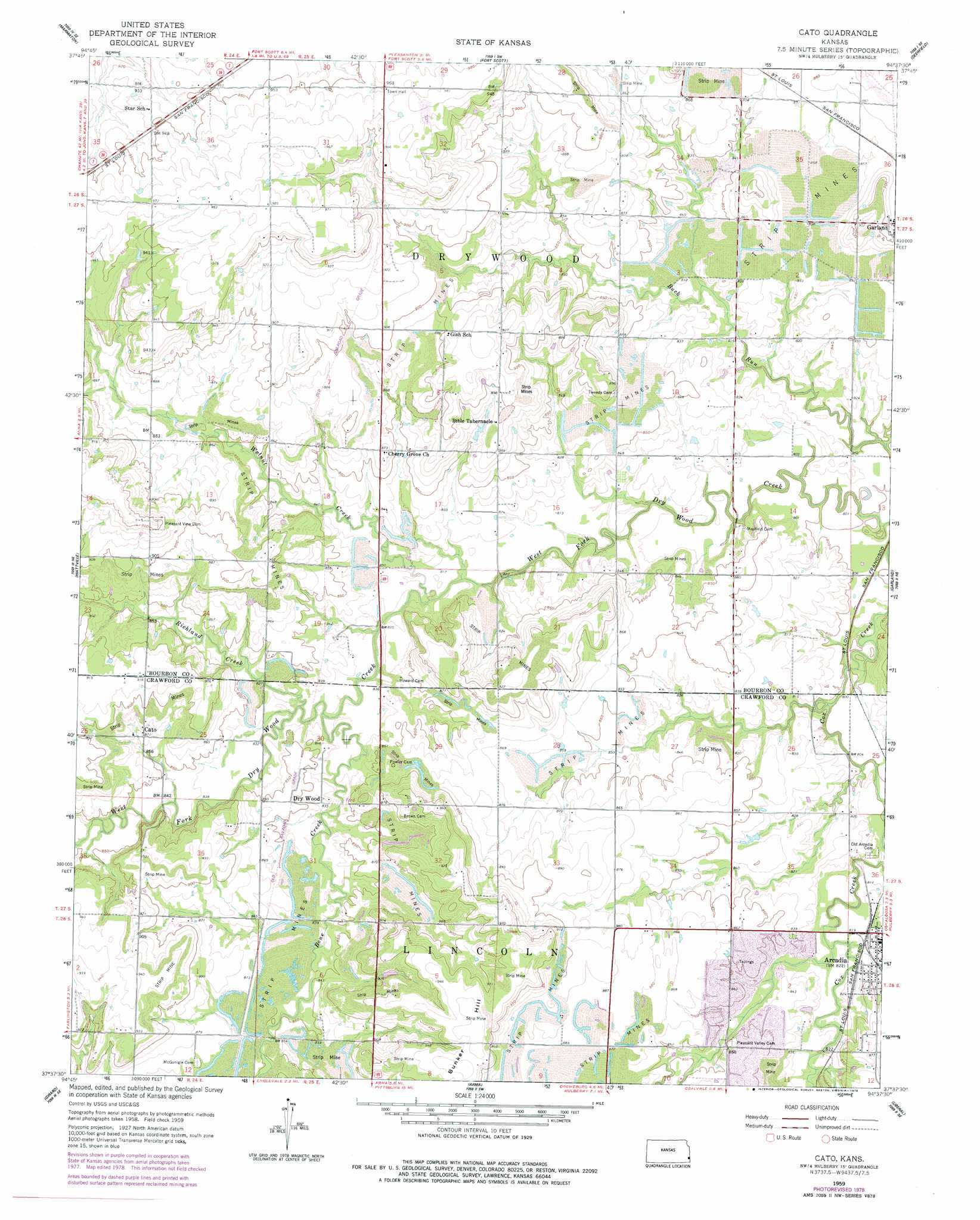
USGS Topo Quad 37094f6 - 1:24,000 scale
| Topo Map Name: | Cato |
| USGS Topo Quad ID: | 37094f6 |
| Print Size: | ca. 21 1/4" wide x 27" high |
| Southeast Coordinates: | 37.625° N latitude / 94.625° W longitude |
| Map Center Coordinates: | 37.6875° N latitude / 94.6875° W longitude |
| U.S. State: | KS |
| Filename: | o37094f6.jpg |
| Download Map JPG Image: | Cato topo map 1:24,000 scale |
| Map Type: | Topographic |
| Topo Series: | 7.5´ |
| Map Scale: | 1:24,000 |
| Source of Map Images: | United States Geological Survey (USGS) |
| Alternate Map Versions: |
Cato KS 1959, updated 1960 Download PDF Buy paper map Cato KS 1959, updated 1978 Download PDF Buy paper map Cato KS 2009 Download PDF Buy paper map Cato KS 2012 Download PDF Buy paper map Cato KS 2015 Download PDF Buy paper map |
1:24,000 Topo Quads surrounding Cato
Xenia |
Devon |
Hammond |
Richards |
Metz |
Uniontown |
Marmaton |
Fort Scott |
Deerfield |
Moundville |
Hepler |
Hiattville |
Cato |
Garland |
Bronaugh |
Brazilton |
Girard |
Arma |
Liberal |
Iantha |
Grindstone Creek |
Radley |
Pittsburg |
Mindenmines |
Nashville |
> Back to 37094e1 at 1:100,000 scale
> Back to 37094a1 at 1:250,000 scale
> Back to U.S. Topo Maps home
Cato topo map: Gazetteer
Cato: Populated Places
Cato elevation 269m 882′Dry Wood elevation 256m 839′
Cato: Streams
Bone Creek elevation 247m 810′Richland Creek elevation 249m 816′
Walnut Creek elevation 248m 813′
Cato digital topo map on disk
Buy this Cato topo map showing relief, roads, GPS coordinates and other geographical features, as a high-resolution digital map file on DVD: