Richards Topo Map Missouri
To zoom in, hover over the map of Richards
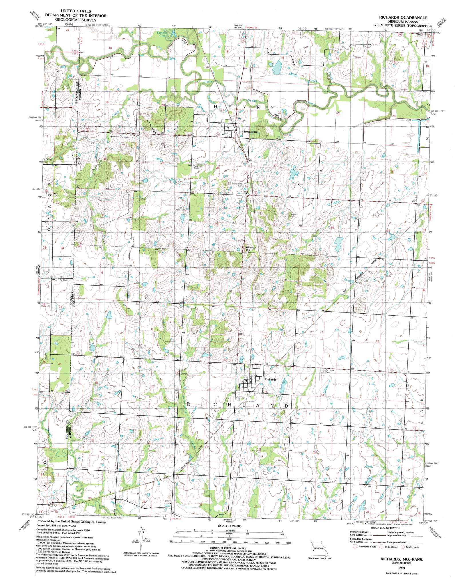
USGS Topo Quad 37094h5 - 1:24,000 scale
| Topo Map Name: | Richards |
| USGS Topo Quad ID: | 37094h5 |
| Print Size: | ca. 21 1/4" wide x 27" high |
| Southeast Coordinates: | 37.875° N latitude / 94.5° W longitude |
| Map Center Coordinates: | 37.9375° N latitude / 94.5625° W longitude |
| U.S. States: | MO, KS |
| Filename: | o37094h5.jpg |
| Download Map JPG Image: | Richards topo map 1:24,000 scale |
| Map Type: | Topographic |
| Topo Series: | 7.5´ |
| Map Scale: | 1:24,000 |
| Source of Map Images: | United States Geological Survey (USGS) |
| Alternate Map Versions: |
Richards MO 1942 Download PDF Buy paper map Richards MO 1942 Download PDF Buy paper map Richards MO 1942, updated 1949 Download PDF Buy paper map Richards MO 1991, updated 1991 Download PDF Buy paper map Richards MO 2009 Download PDF Buy paper map Richards MO 2011 Download PDF Buy paper map Richards MO 2015 Download PDF Buy paper map |
1:24,000 Topo Quads surrounding Richards
Mound City |
Pleasanton |
Worland |
New Home |
Butler & Vic |
Mantey |
Prescott |
Hume |
Sprague |
Rich Hill |
Devon |
Hammond |
Richards |
Metz |
Horton |
Marmaton |
Fort Scott |
Deerfield |
Moundville |
Nevada |
Hiattville |
Cato |
Garland |
Bronaugh |
Sheldon |
> Back to 37094e1 at 1:100,000 scale
> Back to 37094a1 at 1:250,000 scale
> Back to U.S. Topo Maps home
Richards topo map: Gazetteer
Richards: Areas
Osage Plains elevation 239m 784′Richards: Dams
Fred Wilmot Dam elevation 241m 790′Jantz Dam elevation 260m 853′
Mononame 308 Dam elevation 270m 885′
Wilmot and Steele Incorporated Lake Dam elevation 245m 803′
Richards: Populated Places
Richards elevation 254m 833′Stotesbury elevation 238m 780′
Richards: Ranges
Rombaugh Hills elevation 269m 882′Richards: Reservoirs
Fred Wilmot Reservoir elevation 241m 790′Jantz Reservoir elevation 260m 853′
Richards: Streams
Bitterroot Creek elevation 231m 757′Duncan Creek elevation 231m 757′
Pecan Creek elevation 230m 754′
Wolf Creek elevation 230m 754′
Richards: Summits
Hickman Hill elevation 276m 905′Richards digital topo map on disk
Buy this Richards topo map showing relief, roads, GPS coordinates and other geographical features, as a high-resolution digital map file on DVD: