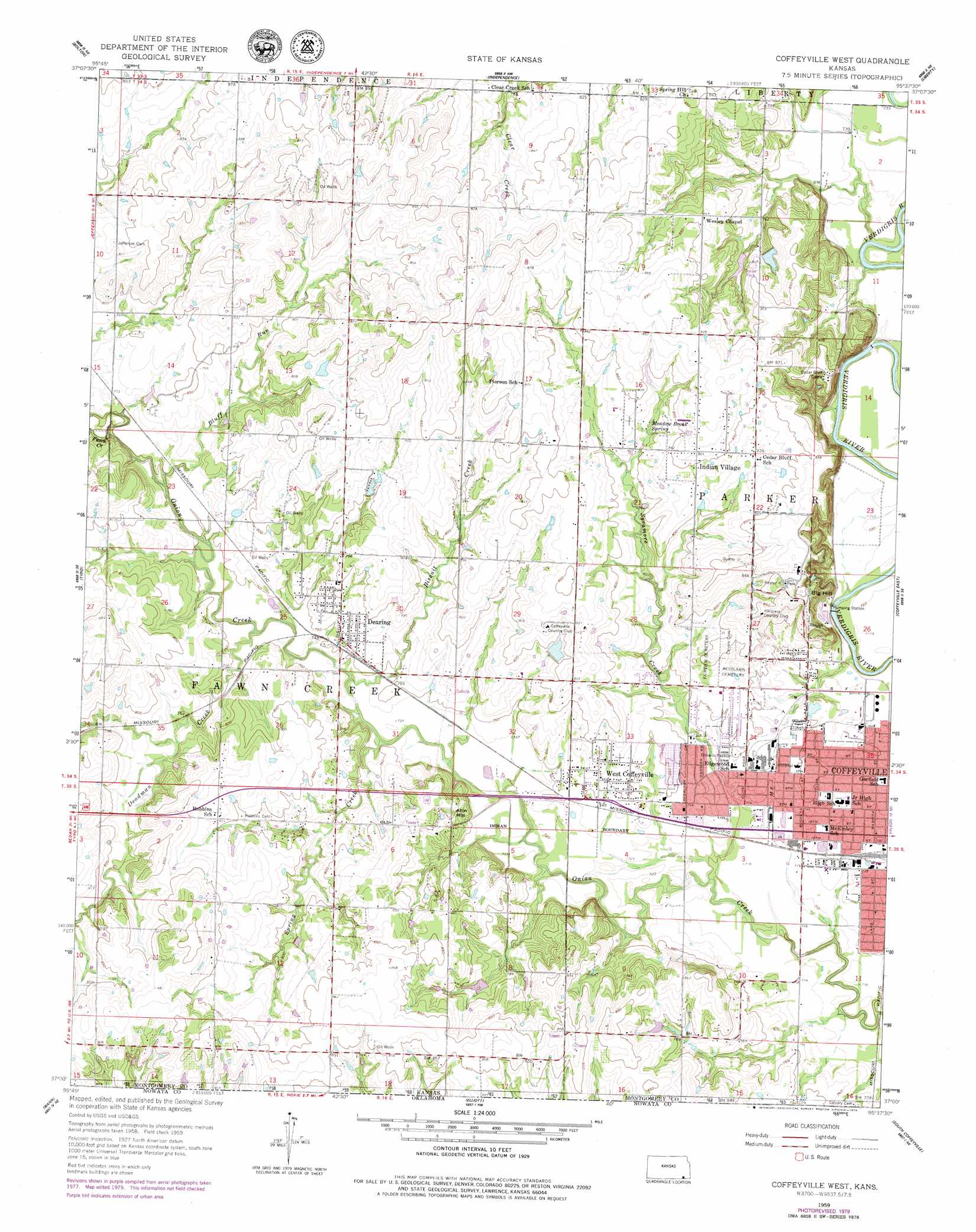
Coffeyville West Topo Map Kansas
To zoom in, hover over the map of Coffeyville West
USGS Topo Quad 37095a6 - 1:24,000 scale
| Topo Map Name: | Coffeyville West |
| USGS Topo Quad ID: | 37095a6 |
| Print Size: | ca. 21 1/4" wide x 27" high |
| Southeast Coordinates: | 37° N latitude / 95.625° W longitude |
| Map Center Coordinates: | 37.0625° N latitude / 95.6875° W longitude |
| U.S. State: | KS |
| Filename: | o37095a6.jpg |
| Download Map JPG Image: | Coffeyville West topo map 1:24,000 scale |
| Map Type: | Topographic |
| Topo Series: | 7.5´ |
| Map Scale: | 1:24,000 |
| Source of Map Images: | United States Geological Survey (USGS) |
| Alternate Map Versions: |
Coffeyville West KS 1959, updated 1960 Download PDF Buy paper map Coffeyville West KS 1959, updated 1979 Download PDF Buy paper map Coffeyville West KS 2010 Download PDF Buy paper map Coffeyville West KS 2012 Download PDF Buy paper map Coffeyville West KS 2016 Download PDF Buy paper map |
1:24,000 Topo Quads surrounding Coffeyville West
Elk City |
Table Mound |
Sycamore |
Cherryvale |
Dennis |
Caney Nw |
Bolton |
Independence |
Liberty |
Mound Valley |
Caney |
Tyro |
Coffeyville West |
Coffeyville East |
Valeda |
Copan |
Wann |
Elliott |
South Coffeyville |
Hayrick Mound |
Bartlesville North |
Blue Mound |
Delaware |
Childers |
Sanders |
> Back to 37095a1 at 1:100,000 scale
> Back to 37094a1 at 1:250,000 scale
> Back to U.S. Topo Maps home
Coffeyville West topo map: Gazetteer
Coffeyville West: Airports
Coffeyville Memorial Hospital Airport elevation 229m 751′Coffeyville West: Parks
Pfister Park elevation 270m 885′Coffeyville West: Populated Places
Dearing elevation 235m 770′West Coffeyville elevation 232m 761′
Coffeyville West: Springs
Meadow Brook Spring elevation 248m 813′Coffeyville West: Streams
Biscuit Creek elevation 223m 731′Bluff Run elevation 226m 741′
Deadman Creek elevation 223m 731′
Fawn Creek elevation 226m 741′
Spring Creek elevation 223m 731′
Sycamore Creek elevation 217m 711′
Coffeyville West: Summits
Allin Hill elevation 263m 862′Coffeyville West digital topo map on disk
Buy this Coffeyville West topo map showing relief, roads, GPS coordinates and other geographical features, as a high-resolution digital map file on DVD: