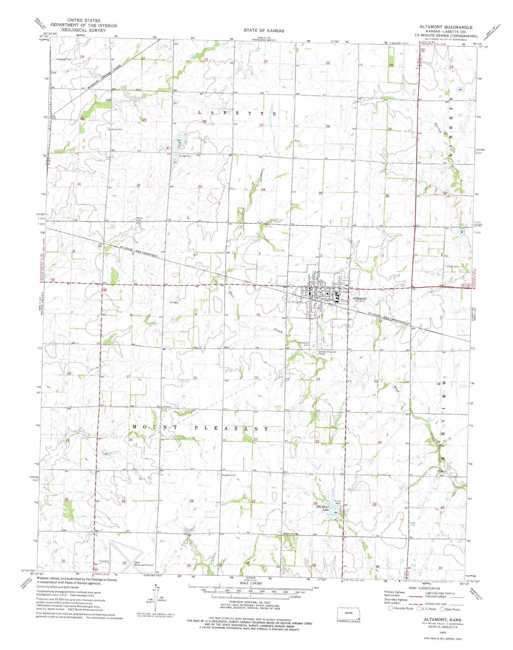
Altamont Topo Map Kansas
To zoom in, hover over the map of Altamont
USGS Topo Quad 37095b3 - 1:24,000 scale
| Topo Map Name: | Altamont |
| USGS Topo Quad ID: | 37095b3 |
| Print Size: | ca. 21 1/4" wide x 27" high |
| Southeast Coordinates: | 37.125° N latitude / 95.25° W longitude |
| Map Center Coordinates: | 37.1875° N latitude / 95.3125° W longitude |
| U.S. State: | KS |
| Filename: | o37095b3.jpg |
| Download Map JPG Image: | Altamont topo map 1:24,000 scale |
| Map Type: | Topographic |
| Topo Series: | 7.5´ |
| Map Scale: | 1:24,000 |
| Source of Map Images: | United States Geological Survey (USGS) |
| Alternate Map Versions: |
Altamont KS 1974, updated 1975 Download PDF Buy paper map Altamont KS 2010 Download PDF Buy paper map Altamont KS 2012 Download PDF Buy paper map Altamont KS 2015 Download PDF Buy paper map |
1:24,000 Topo Quads surrounding Altamont
Morehead |
Thayer |
Galesburg |
South Mound |
Mccune Ne |
Cherryvale |
Dennis |
Parsons West |
Parsons East |
Mccune |
Liberty |
Mound Valley |
Altamont |
Labette |
Oswego |
Coffeyville East |
Valeda |
Edna |
Bartlett |
Chetopa |
South Coffeyville |
Hayrick Mound |
Hollow |
Welch Nw |
Welch North |
> Back to 37095a1 at 1:100,000 scale
> Back to 37094a1 at 1:250,000 scale
> Back to U.S. Topo Maps home
Altamont topo map: Gazetteer
Altamont: Airports
Edna Municipal Airport elevation 283m 928′Altamont: Dams
Altamont Dam elevation 275m 902′Altamont: Lakes
Idle Hour Lake elevation 275m 902′Altamont: Populated Places
Altamont elevation 278m 912′Altamont: Reservoirs
Altamont Idle Hour Lake elevation 275m 902′Altamont digital topo map on disk
Buy this Altamont topo map showing relief, roads, GPS coordinates and other geographical features, as a high-resolution digital map file on DVD: