Liberty Topo Map Kansas
To zoom in, hover over the map of Liberty
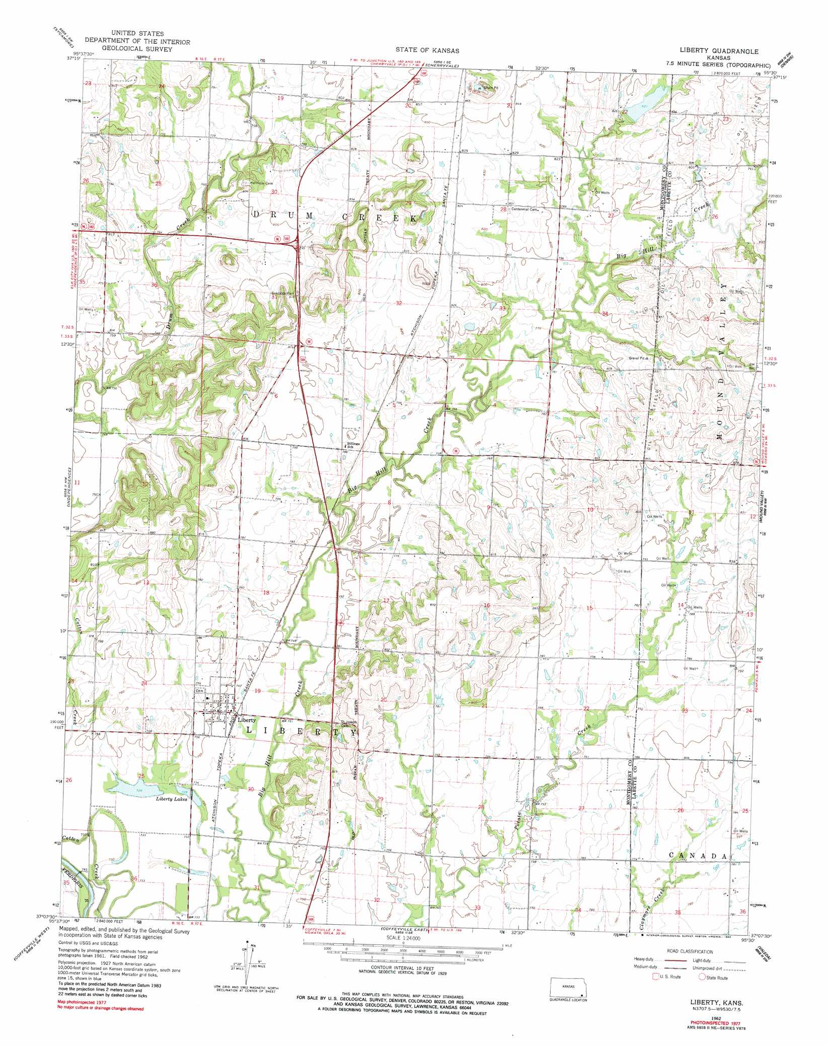
USGS Topo Quad 37095b5 - 1:24,000 scale
| Topo Map Name: | Liberty |
| USGS Topo Quad ID: | 37095b5 |
| Print Size: | ca. 21 1/4" wide x 27" high |
| Southeast Coordinates: | 37.125° N latitude / 95.5° W longitude |
| Map Center Coordinates: | 37.1875° N latitude / 95.5625° W longitude |
| U.S. State: | KS |
| Filename: | o37095b5.jpg |
| Download Map JPG Image: | Liberty topo map 1:24,000 scale |
| Map Type: | Topographic |
| Topo Series: | 7.5´ |
| Map Scale: | 1:24,000 |
| Source of Map Images: | United States Geological Survey (USGS) |
| Alternate Map Versions: |
Liberty KS 1962, updated 1964 Download PDF Buy paper map Liberty KS 1962, updated 1983 Download PDF Buy paper map Liberty KS 2010 Download PDF Buy paper map Liberty KS 2012 Download PDF Buy paper map Liberty KS 2016 Download PDF Buy paper map |
1:24,000 Topo Quads surrounding Liberty
Lafontaine |
Neodesha |
Morehead |
Thayer |
Galesburg |
Table Mound |
Sycamore |
Cherryvale |
Dennis |
Parsons West |
Bolton |
Independence |
Liberty |
Mound Valley |
Altamont |
Tyro |
Coffeyville West |
Coffeyville East |
Valeda |
Edna |
Wann |
Elliott |
South Coffeyville |
Hayrick Mound |
Hollow |
> Back to 37095a1 at 1:100,000 scale
> Back to 37094a1 at 1:250,000 scale
> Back to U.S. Topo Maps home
Liberty topo map: Gazetteer
Liberty: Lakes
Liberty Lakes elevation 223m 731′Liberty: Populated Places
Liberty elevation 226m 741′Liberty digital topo map on disk
Buy this Liberty topo map showing relief, roads, GPS coordinates and other geographical features, as a high-resolution digital map file on DVD: