Bolton Topo Map Kansas
To zoom in, hover over the map of Bolton
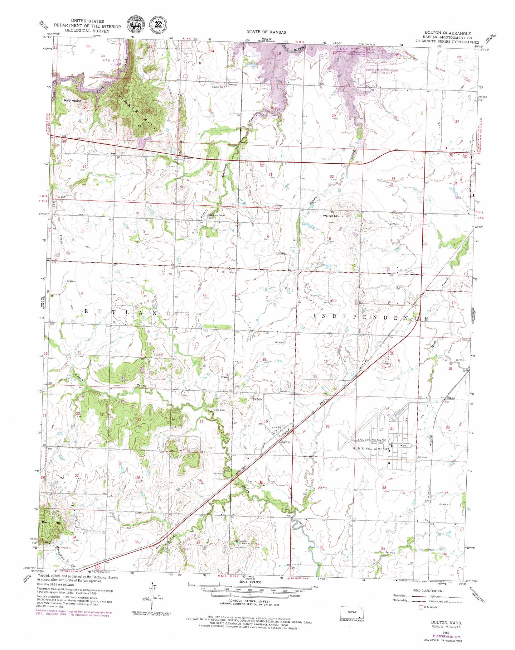
USGS Topo Quad 37095b7 - 1:24,000 scale
| Topo Map Name: | Bolton |
| USGS Topo Quad ID: | 37095b7 |
| Print Size: | ca. 21 1/4" wide x 27" high |
| Southeast Coordinates: | 37.125° N latitude / 95.75° W longitude |
| Map Center Coordinates: | 37.1875° N latitude / 95.8125° W longitude |
| U.S. State: | KS |
| Filename: | o37095b7.jpg |
| Download Map JPG Image: | Bolton topo map 1:24,000 scale |
| Map Type: | Topographic |
| Topo Series: | 7.5´ |
| Map Scale: | 1:24,000 |
| Source of Map Images: | United States Geological Survey (USGS) |
| Alternate Map Versions: |
Bolton KS 1959, updated 1959 Download PDF Buy paper map Bolton KS 1959, updated 1979 Download PDF Buy paper map Bolton KS 2010 Download PDF Buy paper map Bolton KS 2012 Download PDF Buy paper map Bolton KS 2015 Download PDF Buy paper map |
1:24,000 Topo Quads surrounding Bolton
Longton |
Buxton |
Lafontaine |
Neodesha |
Morehead |
Oak Valley |
Elk City |
Table Mound |
Sycamore |
Cherryvale |
Hale |
Caney Nw |
Bolton |
Independence |
Liberty |
Peru |
Caney |
Tyro |
Coffeyville West |
Coffeyville East |
Bowring |
Copan |
Wann |
Elliott |
South Coffeyville |
> Back to 37095a1 at 1:100,000 scale
> Back to 37094a1 at 1:250,000 scale
> Back to U.S. Topo Maps home
Bolton topo map: Gazetteer
Bolton: Airports
Independence Municipal Airport elevation 250m 820′Bolton: Parks
Squaw Creek Cove South Public Use Area elevation 246m 807′Bolton: Populated Places
Blake elevation 247m 810′Bolton elevation 251m 823′
Bolton: Streams
Chetopa Creek elevation 243m 797′Coon Creek elevation 243m 797′
Bolton: Summits
Bald Mound elevation 296m 971′Walker Mound elevation 291m 954′
Bolton digital topo map on disk
Buy this Bolton topo map showing relief, roads, GPS coordinates and other geographical features, as a high-resolution digital map file on DVD: