Mccune Topo Map Kansas
To zoom in, hover over the map of Mccune
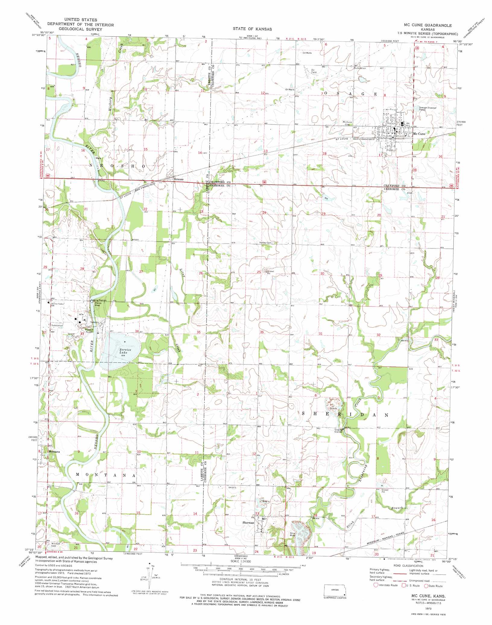
USGS Topo Quad 37095c1 - 1:24,000 scale
| Topo Map Name: | Mccune |
| USGS Topo Quad ID: | 37095c1 |
| Print Size: | ca. 21 1/4" wide x 27" high |
| Southeast Coordinates: | 37.25° N latitude / 95° W longitude |
| Map Center Coordinates: | 37.3125° N latitude / 95.0625° W longitude |
| U.S. State: | KS |
| Filename: | o37095c1.jpg |
| Download Map JPG Image: | Mccune topo map 1:24,000 scale |
| Map Type: | Topographic |
| Topo Series: | 7.5´ |
| Map Scale: | 1:24,000 |
| Source of Map Images: | United States Geological Survey (USGS) |
| Alternate Map Versions: |
Mc Cune KS 1973, updated 1975 Download PDF Buy paper map McCune KS 2010 Download PDF Buy paper map McCune KS 2012 Download PDF Buy paper map McCune KS 2016 Download PDF Buy paper map |
1:24,000 Topo Quads surrounding Mccune
Shaw |
Erie |
Walnut |
Brazilton |
Girard |
Galesburg |
South Mound |
Mccune Ne |
Grindstone Creek |
Radley |
Parsons West |
Parsons East |
Mccune |
West Mineral |
Cherokee |
Altamont |
Labette |
Oswego |
Hallowell |
Columbus |
Edna |
Bartlett |
Chetopa |
Melrose |
Neutral |
> Back to 37095a1 at 1:100,000 scale
> Back to 37094a1 at 1:250,000 scale
> Back to U.S. Topo Maps home
Mccune topo map: Gazetteer
Mccune: Populated Places
McCune elevation 278m 912′Montana elevation 261m 856′
Sherman elevation 274m 898′
Strauss elevation 259m 849′
Mccune: Reservoirs
Service Lake elevation 254m 833′Mccune: Streams
Hickory Creek elevation 251m 823′Litup Creek elevation 253m 830′
Stink Branch elevation 250m 820′
Mccune digital topo map on disk
Buy this Mccune topo map showing relief, roads, GPS coordinates and other geographical features, as a high-resolution digital map file on DVD: