Cherryvale Topo Map Kansas
To zoom in, hover over the map of Cherryvale
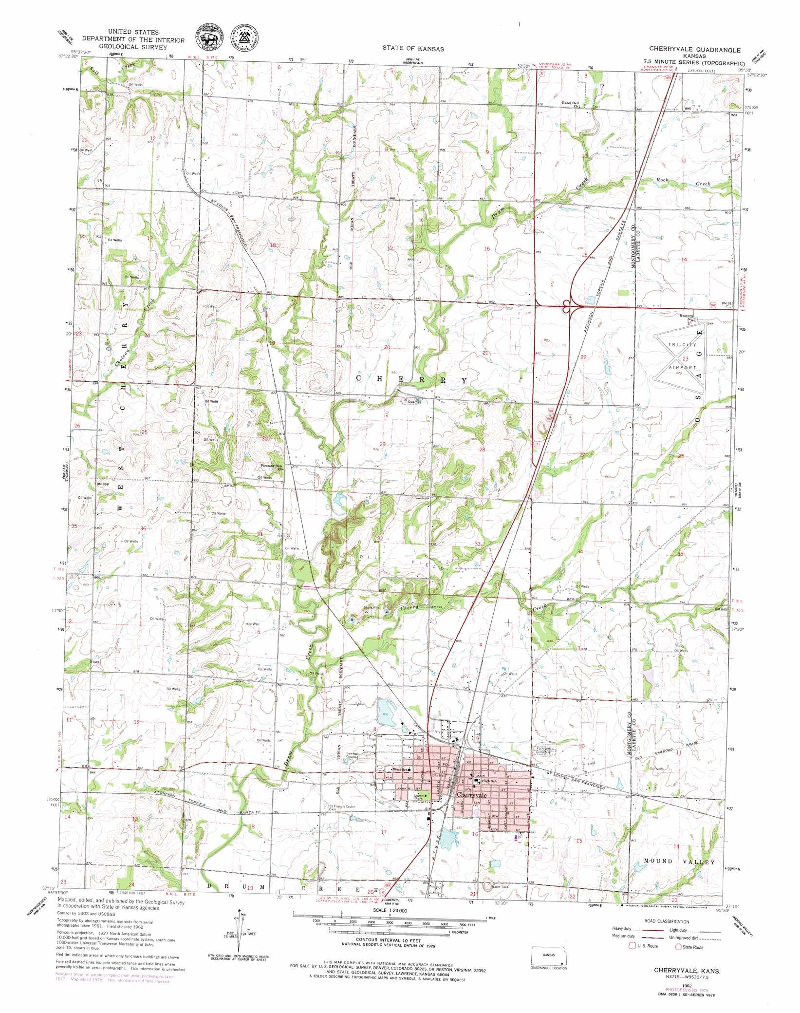
USGS Topo Quad 37095c5 - 1:24,000 scale
| Topo Map Name: | Cherryvale |
| USGS Topo Quad ID: | 37095c5 |
| Print Size: | ca. 21 1/4" wide x 27" high |
| Southeast Coordinates: | 37.25° N latitude / 95.5° W longitude |
| Map Center Coordinates: | 37.3125° N latitude / 95.5625° W longitude |
| U.S. State: | KS |
| Filename: | o37095c5.jpg |
| Download Map JPG Image: | Cherryvale topo map 1:24,000 scale |
| Map Type: | Topographic |
| Topo Series: | 7.5´ |
| Map Scale: | 1:24,000 |
| Source of Map Images: | United States Geological Survey (USGS) |
| Alternate Map Versions: |
Cherryvale KS 1962, updated 1964 Download PDF Buy paper map Cherryvale KS 1962, updated 1979 Download PDF Buy paper map Cherryvale KS 2009 Download PDF Buy paper map Cherryvale KS 2012 Download PDF Buy paper map Cherryvale KS 2016 Download PDF Buy paper map |
1:24,000 Topo Quads surrounding Cherryvale
Fredonia |
Altoona |
Five Mounds |
Earlton |
Shaw |
Lafontaine |
Neodesha |
Morehead |
Thayer |
Galesburg |
Table Mound |
Sycamore |
Cherryvale |
Dennis |
Parsons West |
Bolton |
Independence |
Liberty |
Mound Valley |
Altamont |
Tyro |
Coffeyville West |
Coffeyville East |
Valeda |
Edna |
> Back to 37095a1 at 1:100,000 scale
> Back to 37094a1 at 1:250,000 scale
> Back to U.S. Topo Maps home
Cherryvale topo map: Gazetteer
Cherryvale: Airports
Tri-City Airport elevation 274m 898′Cherryvale: Dams
Cherryvale City Lake Dam elevation 252m 826′Cherryvale: Parks
Logan Park elevation 251m 823′Cherryvale: Populated Places
Cherryvale elevation 255m 836′Corbin (historical) elevation 259m 849′
Cherryvale: Streams
Cherry Creek elevation 235m 770′Rock Creek elevation 259m 849′
Cherryvale digital topo map on disk
Buy this Cherryvale topo map showing relief, roads, GPS coordinates and other geographical features, as a high-resolution digital map file on DVD: