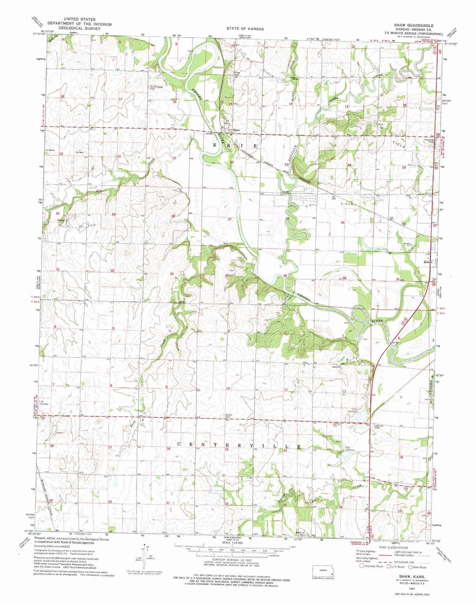
Shaw Topo Map Kansas
To zoom in, hover over the map of Shaw
USGS Topo Quad 37095e3 - 1:24,000 scale
| Topo Map Name: | Shaw |
| USGS Topo Quad ID: | 37095e3 |
| Print Size: | ca. 21 1/4" wide x 27" high |
| Southeast Coordinates: | 37.5° N latitude / 95.25° W longitude |
| Map Center Coordinates: | 37.5625° N latitude / 95.3125° W longitude |
| U.S. State: | KS |
| Filename: | o37095e3.jpg |
| Download Map JPG Image: | Shaw topo map 1:24,000 scale |
| Map Type: | Topographic |
| Topo Series: | 7.5´ |
| Map Scale: | 1:24,000 |
| Source of Map Images: | United States Geological Survey (USGS) |
| Alternate Map Versions: |
Shaw KS 1973, updated 1975 Download PDF Buy paper map Shaw KS 2010 Download PDF Buy paper map Shaw KS 2012 Download PDF Buy paper map Shaw KS 2015 Download PDF Buy paper map |
1:24,000 Topo Quads surrounding Shaw
Yates Center Se |
Humboldt |
Iola Se |
Elsmore |
Moran Se |
Vilas |
Chanute |
Rollin |
Stark |
Porterville |
Five Mounds |
Earlton |
Shaw |
Erie |
Walnut |
Morehead |
Thayer |
Galesburg |
South Mound |
Mccune Ne |
Cherryvale |
Dennis |
Parsons West |
Parsons East |
Mccune |
> Back to 37095e1 at 1:100,000 scale
> Back to 37094a1 at 1:250,000 scale
> Back to U.S. Topo Maps home
Shaw topo map: Gazetteer
Shaw: Populated Places
Shaw elevation 279m 915′Shaw: Streams
Canville Creek elevation 268m 879′Elk River elevation 268m 879′
Pecan Creek elevation 269m 882′
Rock Creek elevation 268m 879′
Shaw digital topo map on disk
Buy this Shaw topo map showing relief, roads, GPS coordinates and other geographical features, as a high-resolution digital map file on DVD: