Fredonia Topo Map Kansas
To zoom in, hover over the map of Fredonia
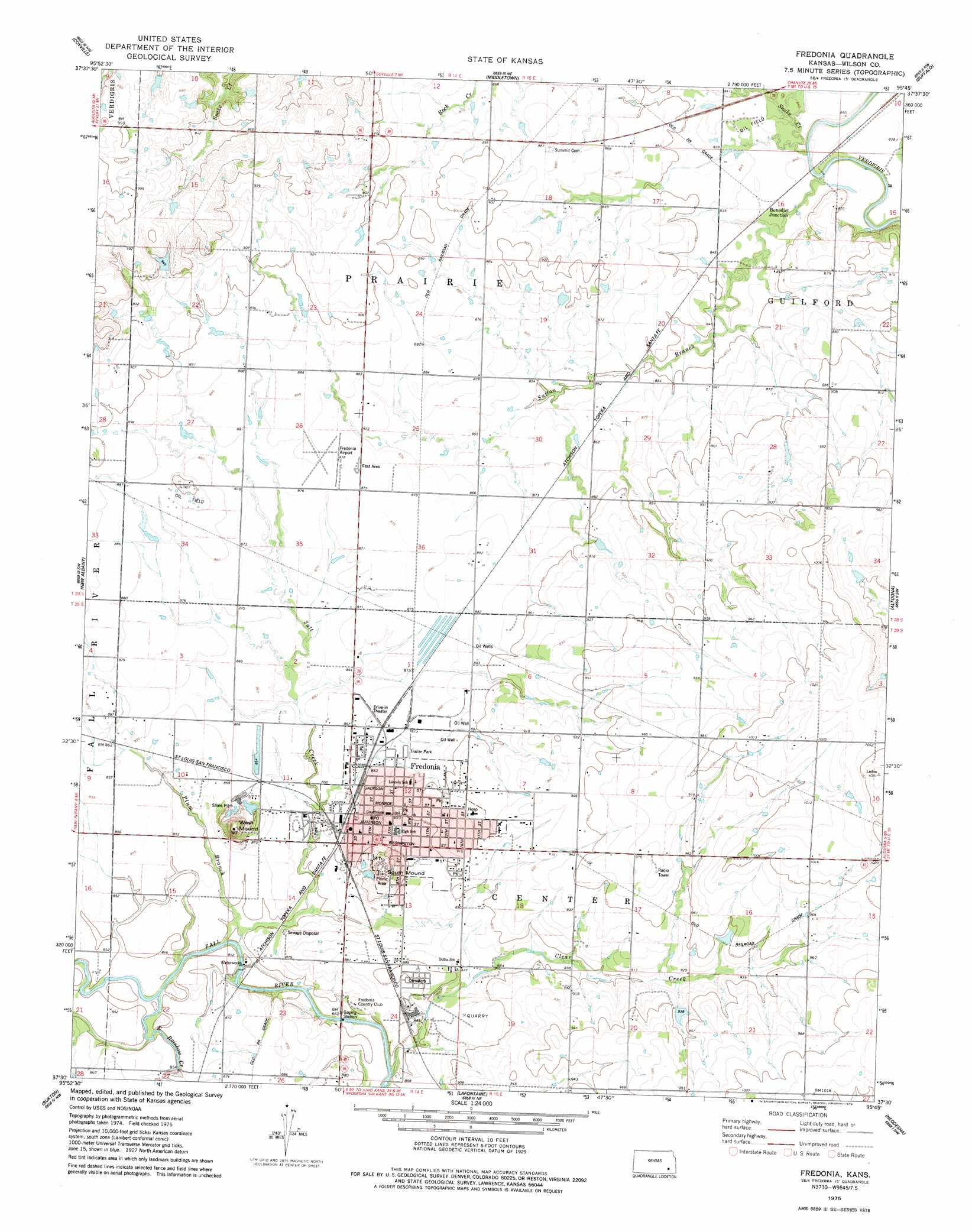
USGS Topo Quad 37095e7 - 1:24,000 scale
| Topo Map Name: | Fredonia |
| USGS Topo Quad ID: | 37095e7 |
| Print Size: | ca. 21 1/4" wide x 27" high |
| Southeast Coordinates: | 37.5° N latitude / 95.75° W longitude |
| Map Center Coordinates: | 37.5625° N latitude / 95.8125° W longitude |
| U.S. State: | KS |
| Filename: | o37095e7.jpg |
| Download Map JPG Image: | Fredonia topo map 1:24,000 scale |
| Map Type: | Topographic |
| Topo Series: | 7.5´ |
| Map Scale: | 1:24,000 |
| Source of Map Images: | United States Geological Survey (USGS) |
| Alternate Map Versions: |
Fredonia KS 1975, updated 1978 Download PDF Buy paper map Fredonia KS 2010 Download PDF Buy paper map Fredonia KS 2012 Download PDF Buy paper map Fredonia KS 2016 Download PDF Buy paper map |
1:24,000 Topo Quads surrounding Fredonia
Neal |
Toronto |
Toronto Se |
Rose |
Yates Center Se |
Fall River Lake |
Coyville |
Middletown |
Buffalo |
Vilas |
Fall River |
New Albany |
Fredonia |
Altoona |
Five Mounds |
Longton |
Buxton |
Lafontaine |
Neodesha |
Morehead |
Oak Valley |
Elk City |
Table Mound |
Sycamore |
Cherryvale |
> Back to 37095e1 at 1:100,000 scale
> Back to 37094a1 at 1:250,000 scale
> Back to U.S. Topo Maps home
Fredonia topo map: Gazetteer
Fredonia: Airports
Fredonia Airport elevation 268m 879′Fredonia: Populated Places
Benedict Junction elevation 256m 839′Fredonia elevation 273m 895′
Fredonia: Streams
Clear Creek elevation 252m 826′East Rainbow Creek elevation 255m 836′
Plum Branch Fall River elevation 252m 826′
Salt Creek elevation 257m 843′
Snake Creek elevation 249m 816′
Sutton Branch elevation 249m 816′
Fredonia: Summits
South Mound elevation 319m 1046′West Mound elevation 316m 1036′
Fredonia digital topo map on disk
Buy this Fredonia topo map showing relief, roads, GPS coordinates and other geographical features, as a high-resolution digital map file on DVD: