Buffalo Topo Map Kansas
To zoom in, hover over the map of Buffalo
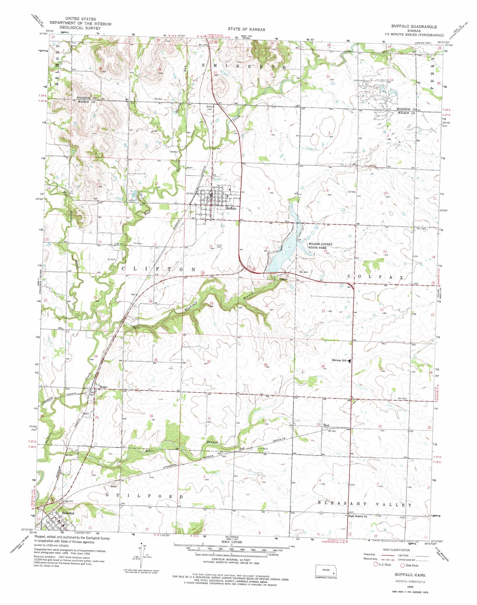
USGS Topo Quad 37095f6 - 1:24,000 scale
| Topo Map Name: | Buffalo |
| USGS Topo Quad ID: | 37095f6 |
| Print Size: | ca. 21 1/4" wide x 27" high |
| Southeast Coordinates: | 37.625° N latitude / 95.625° W longitude |
| Map Center Coordinates: | 37.6875° N latitude / 95.6875° W longitude |
| U.S. State: | KS |
| Filename: | o37095f6.jpg |
| Download Map JPG Image: | Buffalo topo map 1:24,000 scale |
| Map Type: | Topographic |
| Topo Series: | 7.5´ |
| Map Scale: | 1:24,000 |
| Source of Map Images: | United States Geological Survey (USGS) |
| Alternate Map Versions: |
Buffalo KS 1959, updated 1960 Download PDF Buy paper map Buffalo KS 1959, updated 1976 Download PDF Buy paper map Buffalo KS 2009 Download PDF Buy paper map Buffalo KS 2012 Download PDF Buy paper map Buffalo KS 2015 Download PDF Buy paper map |
1:24,000 Topo Quads surrounding Buffalo
Quincy |
Toronto Ne |
Yates Center |
Piqua |
Iola |
Toronto |
Toronto Se |
Rose |
Yates Center Se |
Humboldt |
Coyville |
Middletown |
Buffalo |
Vilas |
Chanute |
New Albany |
Fredonia |
Altoona |
Five Mounds |
Earlton |
Buxton |
Lafontaine |
Neodesha |
Morehead |
Thayer |
> Back to 37095e1 at 1:100,000 scale
> Back to 37094a1 at 1:250,000 scale
> Back to U.S. Topo Maps home
Buffalo topo map: Gazetteer
Buffalo: Dams
Wilson County State Lake Dam elevation 283m 928′Buffalo: Parks
Wilson County State Park elevation 281m 921′Wilson State Fishing Lake elevation 281m 921′
Buffalo: Populated Places
Buffalo elevation 285m 935′Rest elevation 297m 974′
Roper elevation 264m 866′
Buffalo: Reservoirs
Wilson County State Lake elevation 283m 928′Buffalo: Streams
Bloody Run elevation 264m 866′East Buffalo Creek elevation 256m 839′
Elder Branch elevation 253m 830′
West Buffalo Creek elevation 261m 856′
Woodruff Branch elevation 256m 839′
Buffalo digital topo map on disk
Buy this Buffalo topo map showing relief, roads, GPS coordinates and other geographical features, as a high-resolution digital map file on DVD: