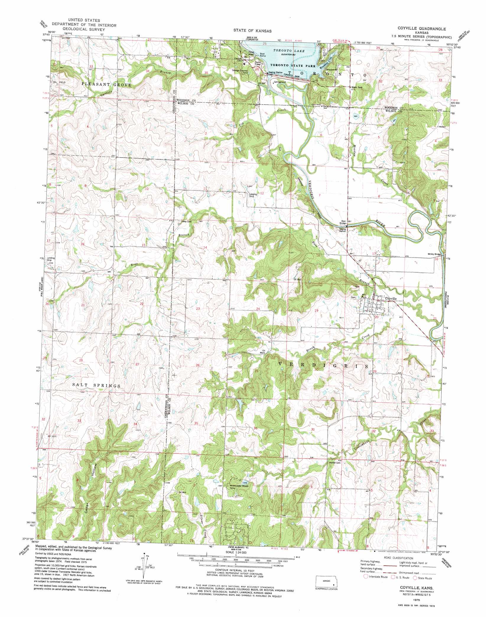
Coyville Topo Map Kansas
To zoom in, hover over the map of Coyville
USGS Topo Quad 37095f8 - 1:24,000 scale
| Topo Map Name: | Coyville |
| USGS Topo Quad ID: | 37095f8 |
| Print Size: | ca. 21 1/4" wide x 27" high |
| Southeast Coordinates: | 37.625° N latitude / 95.875° W longitude |
| Map Center Coordinates: | 37.6875° N latitude / 95.9375° W longitude |
| U.S. State: | KS |
| Filename: | o37095f8.jpg |
| Download Map JPG Image: | Coyville topo map 1:24,000 scale |
| Map Type: | Topographic |
| Topo Series: | 7.5´ |
| Map Scale: | 1:24,000 |
| Source of Map Images: | United States Geological Survey (USGS) |
| Alternate Map Versions: |
Coyville KS 1975, updated 1978 Download PDF Buy paper map Coyville KS 2009 Download PDF Buy paper map Coyville KS 2012 Download PDF Buy paper map Coyville KS 2015 Download PDF Buy paper map |
1:24,000 Topo Quads surrounding Coyville
Hamilton |
Virgil |
Quincy |
Toronto Ne |
Yates Center |
Tonovay |
Neal |
Toronto |
Toronto Se |
Rose |
Severy North |
Fall River Lake |
Coyville |
Middletown |
Buffalo |
Severy South |
Fall River |
New Albany |
Fredonia |
Altoona |
Longton Nw |
Longton |
Buxton |
Lafontaine |
Neodesha |
> Back to 37095e1 at 1:100,000 scale
> Back to 37094a1 at 1:250,000 scale
> Back to U.S. Topo Maps home
Coyville topo map: Gazetteer
Coyville: Bays
Woodson Cove elevation 275m 902′Coyville: Bridges
Marr Bridge elevation 259m 849′McVey Bridge elevation 261m 856′
Coyville: Dams
Toronto Dam elevation 292m 958′Coyville: Populated Places
Coyville elevation 269m 882′Coyville: Reservoirs
Toronto Lake elevation 292m 958′Coyville: Streams
Brush Creek elevation 262m 859′Carlisle Branch elevation 264m 866′
Greathouse Creek elevation 259m 849′
Meadow Creek elevation 259m 849′
Pig Creek elevation 264m 866′
Ross Branch elevation 260m 853′
Coyville digital topo map on disk
Buy this Coyville topo map showing relief, roads, GPS coordinates and other geographical features, as a high-resolution digital map file on DVD: