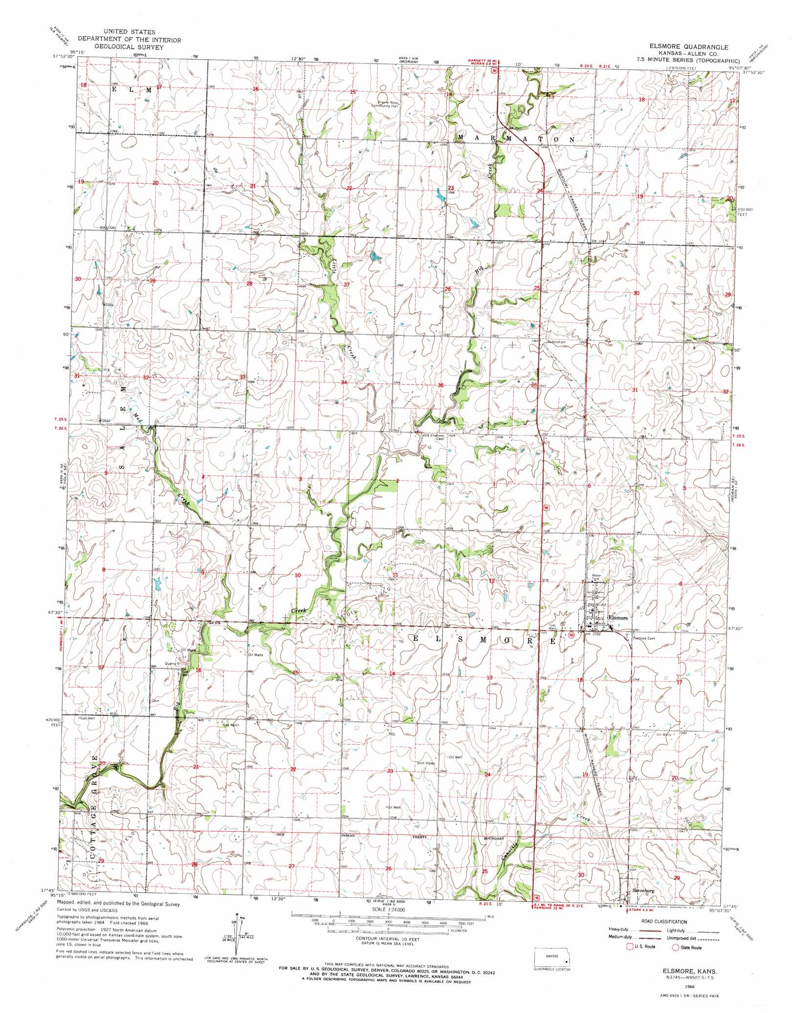
Elsmore Topo Map Kansas
To zoom in, hover over the map of Elsmore
USGS Topo Quad 37095g2 - 1:24,000 scale
| Topo Map Name: | Elsmore |
| USGS Topo Quad ID: | 37095g2 |
| Print Size: | ca. 21 1/4" wide x 27" high |
| Southeast Coordinates: | 37.75° N latitude / 95.125° W longitude |
| Map Center Coordinates: | 37.8125° N latitude / 95.1875° W longitude |
| U.S. State: | KS |
| Filename: | o37095g2.jpg |
| Download Map JPG Image: | Elsmore topo map 1:24,000 scale |
| Map Type: | Topographic |
| Topo Series: | 7.5´ |
| Map Scale: | 1:24,000 |
| Source of Map Images: | United States Geological Survey (USGS) |
| Alternate Map Versions: |
Elsmore KS 1966, updated 1967 Download PDF Buy paper map Elsmore KS 2009 Download PDF Buy paper map Elsmore KS 2012 Download PDF Buy paper map Elsmore KS 2015 Download PDF Buy paper map |
1:24,000 Topo Quads surrounding Elsmore
Geneva |
Colony |
Kincaid |
Blue Mound |
Mapleton |
Iola |
La Harpe |
Moran |
Bronson |
Xenia |
Humboldt |
Iola Se |
Elsmore |
Moran Se |
Uniontown |
Chanute |
Rollin |
Stark |
Porterville |
Hepler |
Earlton |
Shaw |
Erie |
Walnut |
Brazilton |
> Back to 37095e1 at 1:100,000 scale
> Back to 37094a1 at 1:250,000 scale
> Back to U.S. Topo Maps home
Elsmore topo map: Gazetteer
Elsmore: Populated Places
Elsmore elevation 321m 1053′Elsmore: Streams
Little Creek elevation 310m 1017′Mud Creek elevation 297m 974′
Elsmore digital topo map on disk
Buy this Elsmore topo map showing relief, roads, GPS coordinates and other geographical features, as a high-resolution digital map file on DVD: