La Harpe Topo Map Kansas
To zoom in, hover over the map of La Harpe
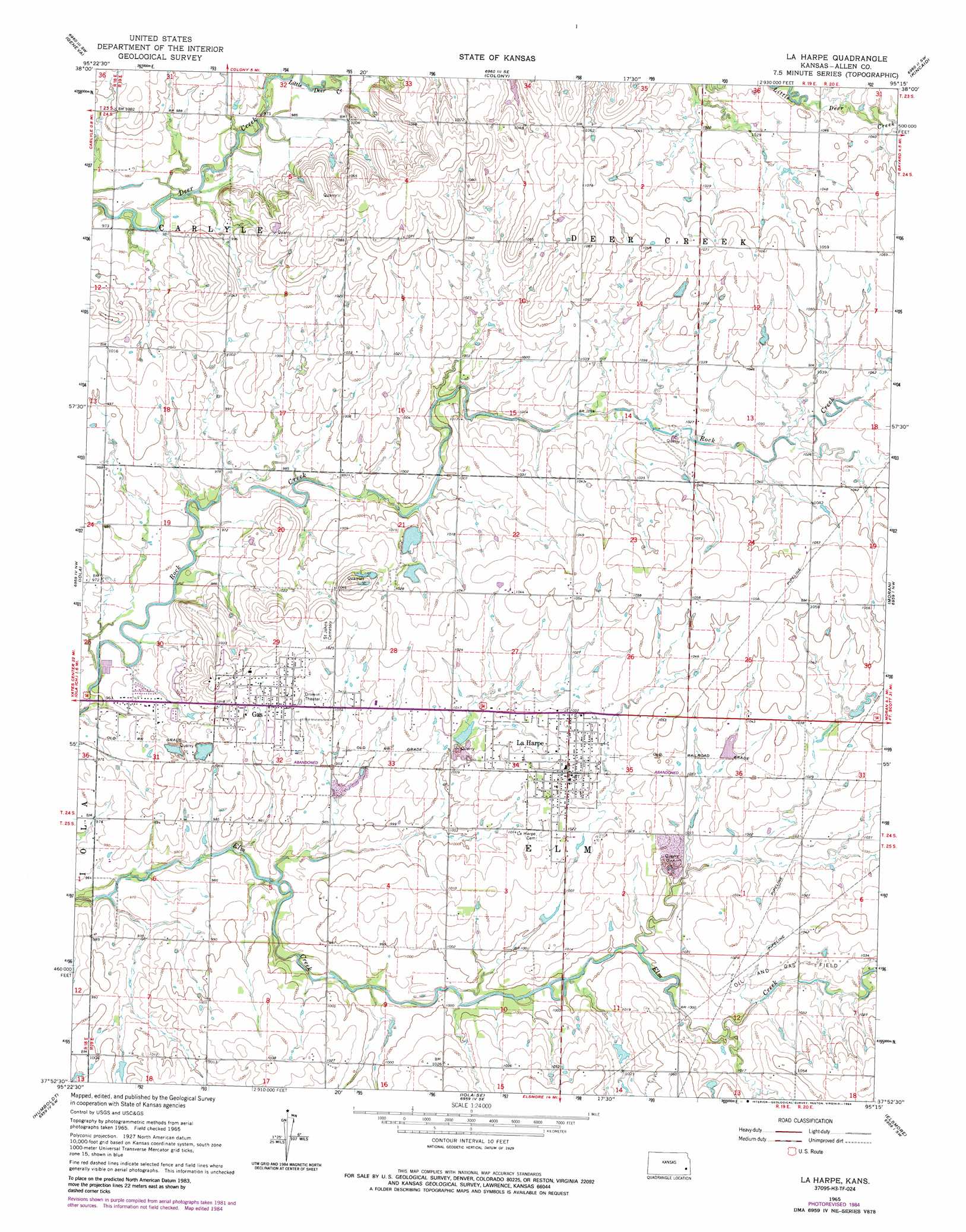
USGS Topo Quad 37095h3 - 1:24,000 scale
| Topo Map Name: | La Harpe |
| USGS Topo Quad ID: | 37095h3 |
| Print Size: | ca. 21 1/4" wide x 27" high |
| Southeast Coordinates: | 37.875° N latitude / 95.25° W longitude |
| Map Center Coordinates: | 37.9375° N latitude / 95.3125° W longitude |
| U.S. State: | KS |
| Filename: | o37095h3.jpg |
| Download Map JPG Image: | La Harpe topo map 1:24,000 scale |
| Map Type: | Topographic |
| Topo Series: | 7.5´ |
| Map Scale: | 1:24,000 |
| Source of Map Images: | United States Geological Survey (USGS) |
| Alternate Map Versions: |
La Harpe KS 1965, updated 1967 Download PDF Buy paper map La Harpe KS 1965, updated 1984 Download PDF Buy paper map La Harpe KS 2009 Download PDF Buy paper map La Harpe KS 2012 Download PDF Buy paper map La Harpe KS 2015 Download PDF Buy paper map |
1:24,000 Topo Quads surrounding La Harpe
Aliceville |
Westphalia |
Welda |
Bush City |
Centerville |
Neosho Falls |
Geneva |
Colony |
Kincaid |
Blue Mound |
Piqua |
Iola |
La Harpe |
Moran |
Bronson |
Yates Center Se |
Humboldt |
Iola Se |
Elsmore |
Moran Se |
Vilas |
Chanute |
Rollin |
Stark |
Porterville |
> Back to 37095e1 at 1:100,000 scale
> Back to 37094a1 at 1:250,000 scale
> Back to U.S. Topo Maps home
La Harpe topo map: Gazetteer
La Harpe: Airports
Midway Air Park elevation 317m 1040′National Airport elevation 306m 1003′
La Harpe: Populated Places
Gas elevation 312m 1023′La Harpe elevation 315m 1033′
La Harpe: Streams
Little Deer Creek elevation 299m 980′La Harpe digital topo map on disk
Buy this La Harpe topo map showing relief, roads, GPS coordinates and other geographical features, as a high-resolution digital map file on DVD: