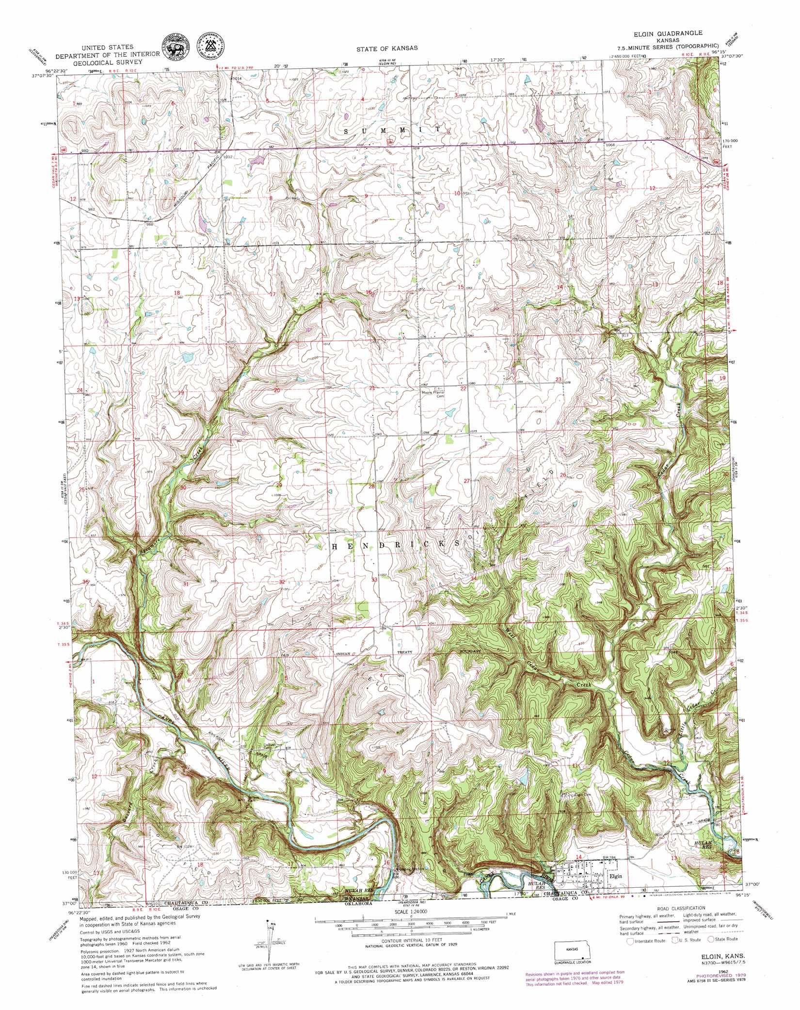
Elgin Topo Map Kansas
To zoom in, hover over the map of Elgin
USGS Topo Quad 37096a3 - 1:24,000 scale
| Topo Map Name: | Elgin |
| USGS Topo Quad ID: | 37096a3 |
| Print Size: | ca. 21 1/4" wide x 27" high |
| Southeast Coordinates: | 37° N latitude / 96.25° W longitude |
| Map Center Coordinates: | 37.0625° N latitude / 96.3125° W longitude |
| U.S. State: | KS |
| Filename: | o37096a3.jpg |
| Download Map JPG Image: | Elgin topo map 1:24,000 scale |
| Map Type: | Topographic |
| Topo Series: | 7.5´ |
| Map Scale: | 1:24,000 |
| Source of Map Images: | United States Geological Survey (USGS) |
| Alternate Map Versions: |
Elgin KS 1962, updated 1963 Download PDF Buy paper map Elgin KS 1962, updated 1968 Download PDF Buy paper map Elgin KS 1962, updated 1979 Download PDF Buy paper map Elgin KS 2010 Download PDF Buy paper map Elgin KS 2012 Download PDF Buy paper map Elgin KS 2015 Download PDF Buy paper map |
1:24,000 Topo Quads surrounding Elgin
Grand Summit |
Grenola |
Moline |
Elk Falls |
Oak Valley |
Dexter Ne |
Cloverdale |
Elgin Ne |
Sedan |
Hale |
Cedar Vale West |
Cedar Vale East |
Elgin |
Chautauqua |
Peru |
Foraker North |
Pearsonia Nw |
Pearsonia Ne |
Whippoorwill |
Bowring |
Foraker South |
Pearsonia |
Nanos |
Herd |
Bowring Se |
> Back to 37096a1 at 1:100,000 scale
> Back to 37096a1 at 1:250,000 scale
> Back to U.S. Topo Maps home
Elgin topo map: Gazetteer
Elgin: Parks
Hulah Wildlife Area elevation 239m 784′Elgin: Populated Places
Elgin elevation 239m 784′Elgin: Streams
Buzzard Creek elevation 240m 787′Grant Creek elevation 241m 790′
Little Cedar Creek elevation 235m 770′
Sycamore Creek elevation 237m 777′
West Cedar Creek elevation 238m 780′
Elgin digital topo map on disk
Buy this Elgin topo map showing relief, roads, GPS coordinates and other geographical features, as a high-resolution digital map file on DVD: