Cedar Vale West Topo Map Kansas
To zoom in, hover over the map of Cedar Vale West
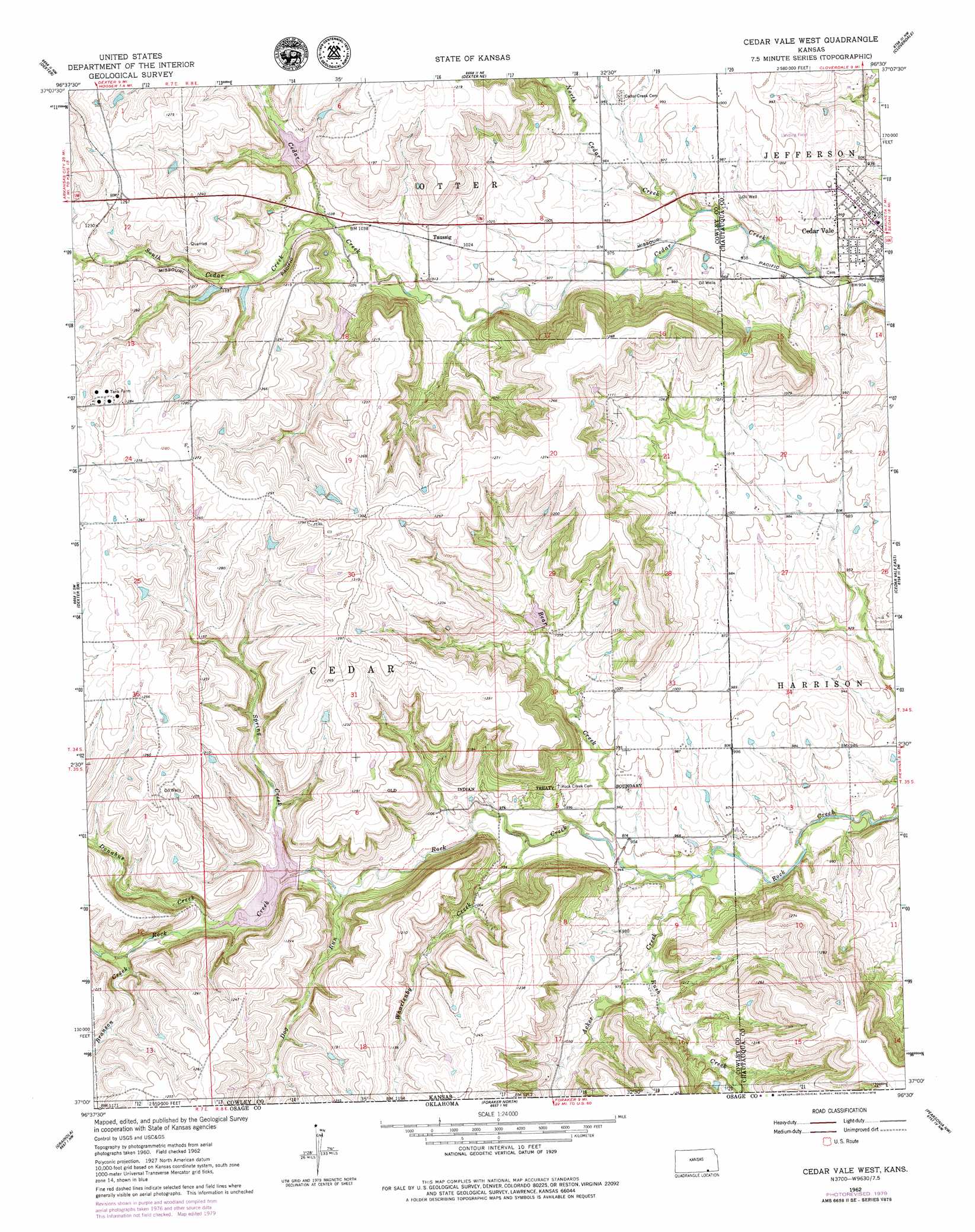
USGS Topo Quad 37096a5 - 1:24,000 scale
| Topo Map Name: | Cedar Vale West |
| USGS Topo Quad ID: | 37096a5 |
| Print Size: | ca. 21 1/4" wide x 27" high |
| Southeast Coordinates: | 37° N latitude / 96.5° W longitude |
| Map Center Coordinates: | 37.0625° N latitude / 96.5625° W longitude |
| U.S. State: | KS |
| Filename: | o37096a5.jpg |
| Download Map JPG Image: | Cedar Vale West topo map 1:24,000 scale |
| Map Type: | Topographic |
| Topo Series: | 7.5´ |
| Map Scale: | 1:24,000 |
| Source of Map Images: | United States Geological Survey (USGS) |
| Alternate Map Versions: |
Cedar Vale West KS 1962, updated 1963 Download PDF Buy paper map Cedar Vale West KS 1962, updated 1979 Download PDF Buy paper map Cedar Vale West KS 2010 Download PDF Buy paper map Cedar Vale West KS 2012 Download PDF Buy paper map Cedar Vale West KS 2015 Download PDF Buy paper map |
1:24,000 Topo Quads surrounding Cedar Vale West
Burden |
Cambridge |
Grand Summit |
Grenola |
Moline |
Eaton |
Dexter |
Dexter Ne |
Cloverdale |
Elgin Ne |
Maple City |
Dexter Sw |
Cedar Vale West |
Cedar Vale East |
Elgin |
Hardy |
Grainola |
Foraker North |
Pearsonia Nw |
Pearsonia Ne |
Kaw City |
Shidler |
Foraker South |
Pearsonia |
Nanos |
> Back to 37096a1 at 1:100,000 scale
> Back to 37096a1 at 1:250,000 scale
> Back to U.S. Topo Maps home
Cedar Vale West topo map: Gazetteer
Cedar Vale West: Airports
Mills Ranch Airport elevation 301m 987′Cedar Vale West: Populated Places
Cedar Vale elevation 289m 948′Taussig elevation 318m 1043′
Cedar Vale West: Streams
Acker Creek elevation 283m 928′Acker Creek elevation 283m 928′
Bear Creek elevation 285m 935′
Branson Creek elevation 323m 1059′
Dog Run elevation 301m 987′
Donahue Creek elevation 314m 1030′
North Cedar Creek elevation 281m 921′
Rush Creek elevation 292m 958′
Rush Creek elevation 292m 958′
South Cedar Creek elevation 313m 1026′
Spring Creek elevation 312m 1023′
Whartenby Creek elevation 291m 954′
Whartenby Creek elevation 291m 954′
Cedar Vale West digital topo map on disk
Buy this Cedar Vale West topo map showing relief, roads, GPS coordinates and other geographical features, as a high-resolution digital map file on DVD: