Cloverdale Topo Map Kansas
To zoom in, hover over the map of Cloverdale
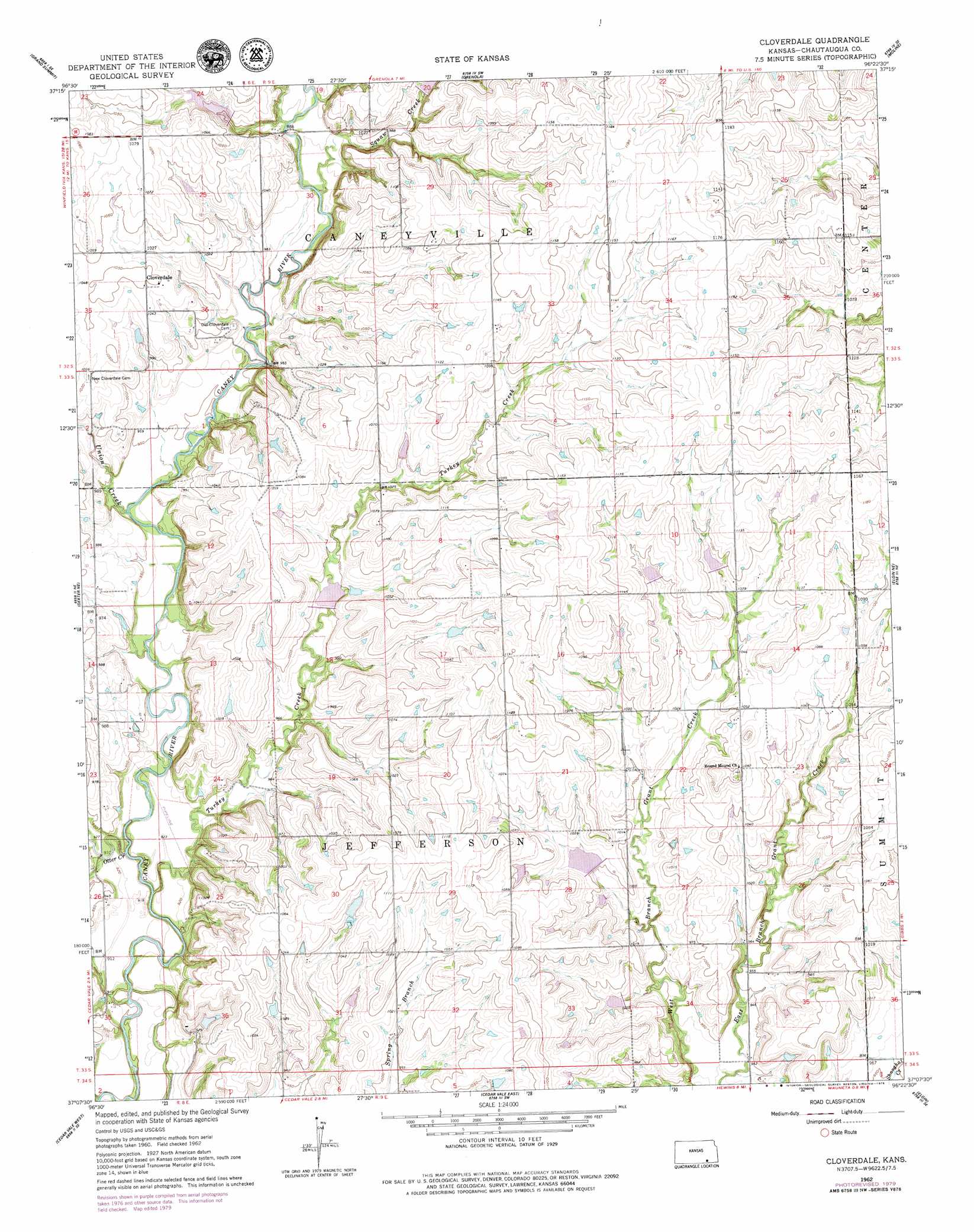
USGS Topo Quad 37096b4 - 1:24,000 scale
| Topo Map Name: | Cloverdale |
| USGS Topo Quad ID: | 37096b4 |
| Print Size: | ca. 21 1/4" wide x 27" high |
| Southeast Coordinates: | 37.125° N latitude / 96.375° W longitude |
| Map Center Coordinates: | 37.1875° N latitude / 96.4375° W longitude |
| U.S. State: | KS |
| Filename: | o37096b4.jpg |
| Download Map JPG Image: | Cloverdale topo map 1:24,000 scale |
| Map Type: | Topographic |
| Topo Series: | 7.5´ |
| Map Scale: | 1:24,000 |
| Source of Map Images: | United States Geological Survey (USGS) |
| Alternate Map Versions: |
Cloverdale KS 1962, updated 1963 Download PDF Buy paper map Cloverdale KS 1962, updated 1979 Download PDF Buy paper map Cloverdale KS 2010 Download PDF Buy paper map Cloverdale KS 2012 Download PDF Buy paper map Cloverdale KS 2015 Download PDF Buy paper map |
1:24,000 Topo Quads surrounding Cloverdale
Cambridge Nw |
Cambridge Ne |
Howard Nw |
Howard |
Longton Nw |
Cambridge |
Grand Summit |
Grenola |
Moline |
Elk Falls |
Dexter |
Dexter Ne |
Cloverdale |
Elgin Ne |
Sedan |
Dexter Sw |
Cedar Vale West |
Cedar Vale East |
Elgin |
Chautauqua |
Grainola |
Foraker North |
Pearsonia Nw |
Pearsonia Ne |
Whippoorwill |
> Back to 37096a1 at 1:100,000 scale
> Back to 37096a1 at 1:250,000 scale
> Back to U.S. Topo Maps home
Cloverdale topo map: Gazetteer
Cloverdale: Populated Places
Cloverdale elevation 321m 1053′Cloverdale: Streams
Otter Creek elevation 274m 898′Squaw Creek elevation 295m 967′
Turkey Creek elevation 274m 898′
Union Creek elevation 284m 931′
Cloverdale digital topo map on disk
Buy this Cloverdale topo map showing relief, roads, GPS coordinates and other geographical features, as a high-resolution digital map file on DVD: