Cambridge Nw Topo Map Kansas
To zoom in, hover over the map of Cambridge Nw
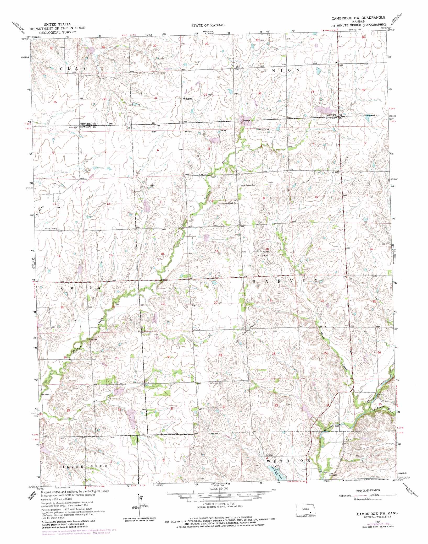
USGS Topo Quad 37096d6 - 1:24,000 scale
| Topo Map Name: | Cambridge Nw |
| USGS Topo Quad ID: | 37096d6 |
| Print Size: | ca. 21 1/4" wide x 27" high |
| Southeast Coordinates: | 37.375° N latitude / 96.625° W longitude |
| Map Center Coordinates: | 37.4375° N latitude / 96.6875° W longitude |
| U.S. State: | KS |
| Filename: | o37096d6.jpg |
| Download Map JPG Image: | Cambridge Nw topo map 1:24,000 scale |
| Map Type: | Topographic |
| Topo Series: | 7.5´ |
| Map Scale: | 1:24,000 |
| Source of Map Images: | United States Geological Survey (USGS) |
| Alternate Map Versions: |
Cambridge NW KS 1964, updated 1965 Download PDF Buy paper map Cambridge NW KS 1964, updated 1983 Download PDF Buy paper map Cambridge NW KS 2010 Download PDF Buy paper map Cambridge NW KS 2012 Download PDF Buy paper map Cambridge NW KS 2015 Download PDF Buy paper map |
1:24,000 Topo Quads surrounding Cambridge Nw
Augusta |
Leon |
Keighley |
Beaumont |
Piedmont Nw |
Gordon |
Augusta Se |
Latham |
Latham Se |
Piedmont Sw |
Wilmot |
Atlanta |
Cambridge Nw |
Cambridge Ne |
Howard Nw |
New Salem |
Burden |
Cambridge |
Grand Summit |
Grenola |
Winfield |
Eaton |
Dexter |
Dexter Ne |
Cloverdale |
> Back to 37096a1 at 1:100,000 scale
> Back to 37096a1 at 1:250,000 scale
> Back to U.S. Topo Maps home
Cambridge Nw topo map: Gazetteer
Cambridge Nw: Oilfields
Box Oil Field elevation 449m 1473′Grouse Creek Oil Field elevation 448m 1469′
Cambridge Nw: Populated Places
Wingate elevation 457m 1499′Cambridge Nw: Streams
Gardners Branch elevation 390m 1279′Goose Creek elevation 391m 1282′
Cambridge Nw digital topo map on disk
Buy this Cambridge Nw topo map showing relief, roads, GPS coordinates and other geographical features, as a high-resolution digital map file on DVD: