Fall River Lake Topo Map Kansas
To zoom in, hover over the map of Fall River Lake
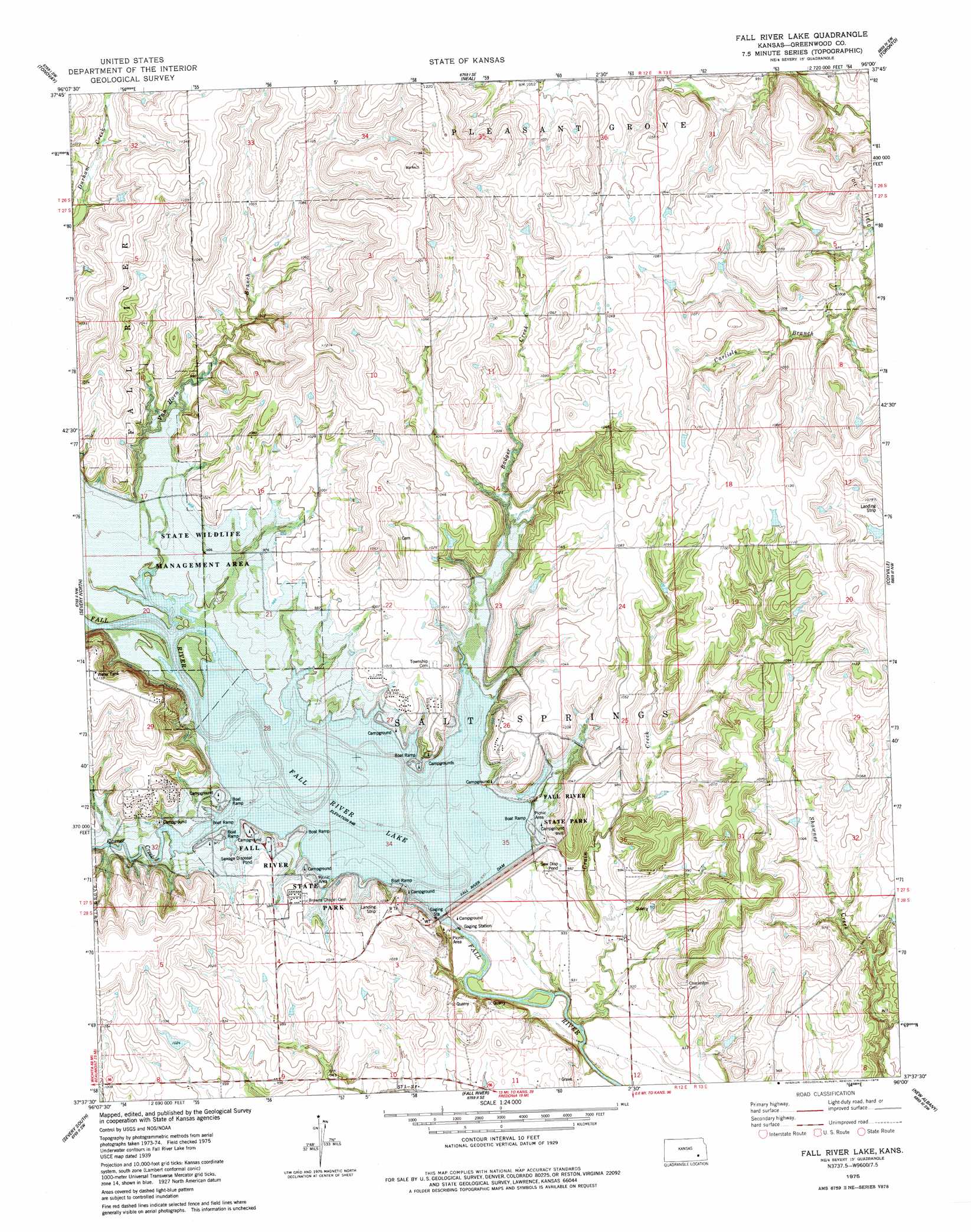
USGS Topo Quad 37096f1 - 1:24,000 scale
| Topo Map Name: | Fall River Lake |
| USGS Topo Quad ID: | 37096f1 |
| Print Size: | ca. 21 1/4" wide x 27" high |
| Southeast Coordinates: | 37.625° N latitude / 96° W longitude |
| Map Center Coordinates: | 37.6875° N latitude / 96.0625° W longitude |
| U.S. State: | KS |
| Filename: | o37096f1.jpg |
| Download Map JPG Image: | Fall River Lake topo map 1:24,000 scale |
| Map Type: | Topographic |
| Topo Series: | 7.5´ |
| Map Scale: | 1:24,000 |
| Source of Map Images: | United States Geological Survey (USGS) |
| Alternate Map Versions: |
Fall River Lake KS 1975, updated 1978 Download PDF Buy paper map Fall River Lake KS 2010 Download PDF Buy paper map Fall River Lake KS 2012 Download PDF Buy paper map Fall River Lake KS 2015 Download PDF Buy paper map |
1:24,000 Topo Quads surrounding Fall River Lake
Eureka Ne |
Hamilton |
Virgil |
Quincy |
Toronto Ne |
Eureka |
Tonovay |
Neal |
Toronto |
Toronto Se |
Piedmont Ne |
Severy North |
Fall River Lake |
Coyville |
Middletown |
Piedmont |
Severy South |
Fall River |
New Albany |
Fredonia |
Howard |
Longton Nw |
Longton |
Buxton |
Lafontaine |
> Back to 37096e1 at 1:100,000 scale
> Back to 37096a1 at 1:250,000 scale
> Back to U.S. Topo Maps home
Fall River Lake topo map: Gazetteer
Fall River Lake: Airports
Heir Airport elevation 325m 1066′Fall River Lake: Dams
Fall River Dam elevation 303m 994′Fall River Lake: Parks
Fall River State Park elevation 291m 954′Fall River Wildlife Area elevation 288m 944′
Fall River Lake: Reservoirs
Fall River Lake elevation 303m 994′Fall River Lake: Streams
Badger Creek elevation 295m 967′Casner Creek elevation 288m 944′
Crain Creek elevation 274m 898′
Van Horn Branch elevation 288m 944′
Fall River Lake digital topo map on disk
Buy this Fall River Lake topo map showing relief, roads, GPS coordinates and other geographical features, as a high-resolution digital map file on DVD: